Southwest Monsoon Arrives in Uttarakhand with Ten Day Delay
Source:indiatimes ↗
Why It Matters
The onset, delay, and distribution of the Southwest Monsoon directly influence the agrarian economy, water resource management, and natural disaster preparedness (such as landslide and flash flood mitigation) in the ecologically fragile Himalayan state of Uttarakhand. Understanding regional meteorology, physical geography of districts, and climate vulnerability is a core component of the UKPSC Geography syllabus.
Summary
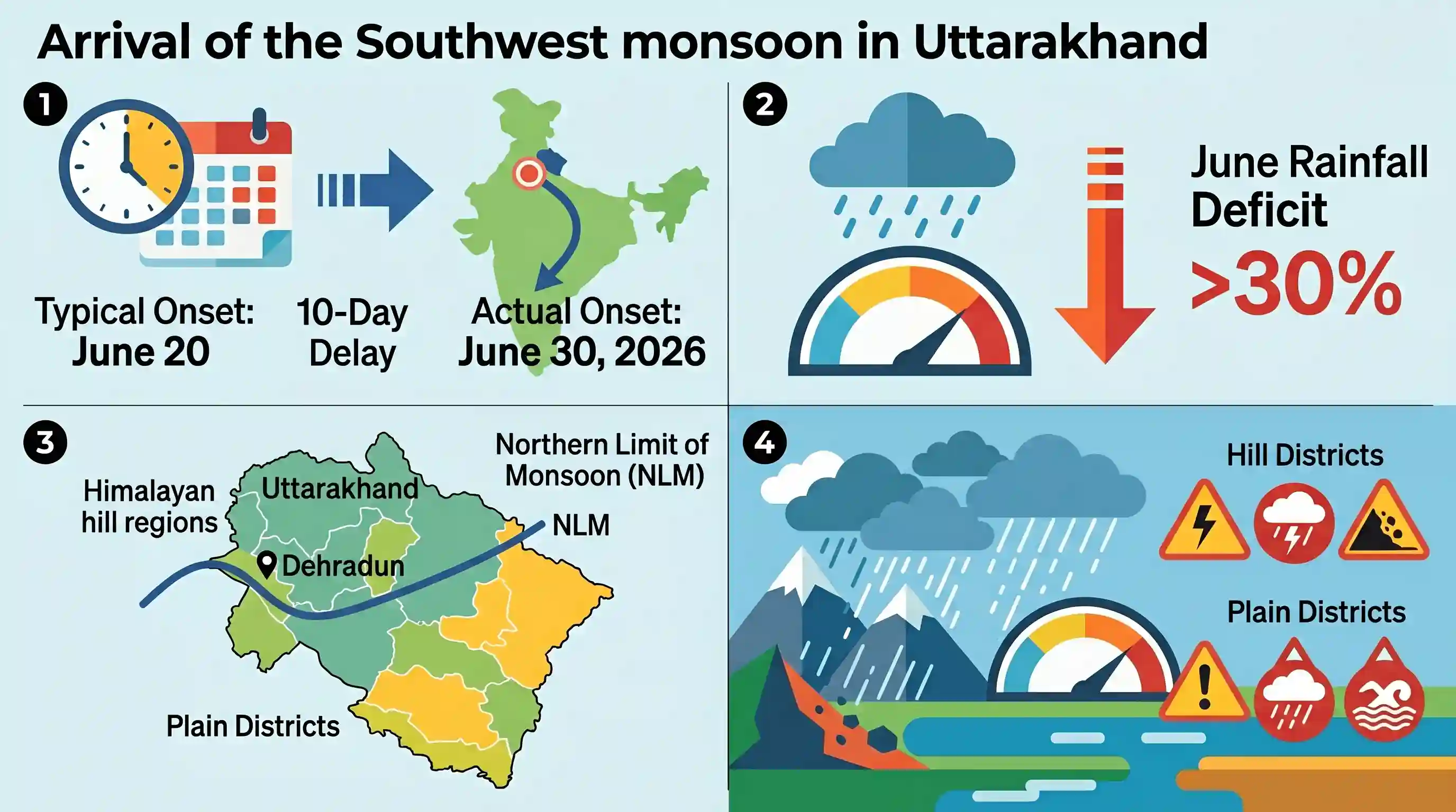
The Southwest monsoon officially arrived in Uttarakhand on June 30, 2026, registering a 10-day delay from its typical onset date of June 20. Stalling over north India after a timely arrival in Kerala, the delay caused a rainfall deficit exceeding 30% in June. With the Northern Limit of Monsoon (NLM) passing through Dehradun, the India Meteorological Department (IMD) expects widespread, intense rain to reduce this deficit, issuing heavy precipitation alerts for several hill and plain districts.
Key Points
- The Southwest monsoon officially arrived in Uttarakhand on June 30, 2026, approximately 10 days later than its normal onset date of June 20.
- The sluggish advance of the monsoon over north India occurred despite a timely initial onset over Kerala, leading to a state-wide June rainfall deficit of over 30%.
- The Northern Limit of Monsoon (NLM) was reported to pass through Dehradun, indicating the system's advance into the state.
- CS Tomar, director of the regional meteorological centre in Dehradun, stated that the active monsoon system will bring widespread and intense rainfall across the state.
- Heavy rainfall warnings have been issued for isolated places in hill districts including Pauri, Pithoragarh, Nainital, and Bageshwar, as well as thunderstorms and gusty winds in the plains of Haridwar and Udham Singh Nagar.
Important Terms
India Meteorological Department (IMD)

Established in 1875, the India Meteorological Department is the principal government agency under the Ministry of Earth Sciences responsible for meteorological observations, weather forecasting, and early warnings for natural disasters.
UPSC context
GS Paper 1 (Geography) and GS Paper 3 (Disaster Management); tests administrative machinery for early warning and climate mitigation.
Northern Limit of Monsoon (NLM)
The northernmost boundary line across the Indian subcontinent up to which Southwest monsoon rains have advanced on any given day, mapped systematically by the India Meteorological Department to track progress.
UPSC context
GS Paper 1 (Indian Geography); tests climatological parameters, spatial progression of monsoon systems, and seasonal rainfall distribution.
Southwest Monsoon
A massive seasonal wind system blowing from the southwest (June to September) carrying moisture from the Indian Ocean, responsible for generating more than 75% of India's annual precipitation.
UPSC context
GS Paper 1 (Physical Geography); tests atmospheric circulation, ITCZ shifts, and its critical socio-economic and agricultural impact.
Meteorological Centre, Dehradun
A state-level observation and forecasting unit of the IMD, established in 2002 to provide localized weather monitoring, forecasting, and disaster warnings specifically for Uttarakhand.
UPSC context
GS Paper 3 (Disaster Management); tests state-level meteorological systems, warning dissemination, and Himalayan landslide/cloudburst mitigation.
Prelims Trap
The swampy Tarai region lies immediately north of the porous Bhabar belt when moving from south to north.
This is physically reversed. Bhabar is the porous pebble belt directly at the foot of the Shiwaliks (further north), whereas the swampy Tarai belt lies immediately south of the Bhabar zone.
Static Concepts Connected
What is the Northern Limit of Monsoon (NLM) and how is it monitored?
- Dynamic boundary: It is the northernmost boundary up to which the Southwest monsoon has advanced on any given day across the subcontinent.
- IMD monitoring: Determined daily by the India Meteorological Department based on spatial rainfall distribution, wind transition, and lower-tropospheric moisture levels.
How do Bhabar and Tarai tracts differ in physical geography?
- Bhabar tract: A porous, pebble-dominated belt at Shiwalik foothills where streams sink and flow underground; generally unsuitable for agriculture.
- Tarai tract: A swampy, water-logged zone south of Bhabar where underground streams re-emerge, creating highly fertile soil reclaimed for intensive cultivation.
Cross-Topic Patterns
Himalayan orogeny and hydro-disasters
Delayed, high-intensity monsoonal rain on fragile Himalayan slopes triggers frequent landslides, highlighting the gap between static hazard mapping and dynamic climate realities.
Monsoon anomalies and Kharif security
A sluggish regional monsoon onset disrupts crop sowing schedules, forcing dependency on groundwater and directly impacting India's climate-resilient agriculture goals.

Himalayan foothill physiography (Bhabar-Tarai sequence) and dynamic monsoon concepts like NLM are highly likely to feature in Prelims.
Linked PYQs · 3
Linked PYQs · 3
- 2007UKPSC_PRELIMSGS1
In India, the normal direction of Monsoon flow during summer is?
- 2025UKPSC_PRELIMSGS1
Consider the following statements and select the correct answer from the options given below : Statement 1 : Uttarakhand is highly vulnerable to climate change. Statement 2 : Climate change is causing water stress and depleting biodiversity in Uttarakhand.
- 2025UKPSC_PRELIMSGS1
Which of the following is the correct order of the following physiographic regions of Uttarakhand from south to north direction?
