Chenab Rail Bridge Engineering Feats and Border Infrastructure
Source:The Hindu ↗
Why It Matters
The inauguration of the Chenab and Anji bridges is a watershed moment for Indian engineering and strategic infrastructure. For UPSC aspirants, this touches upon physical geography (Himalayan geomorphology, seismic zones, and the Indus river system), disaster management in fragile terrains, and GS3 topics concerning infrastructure development and internal security/border management in Jammu and Kashmir.
Summary
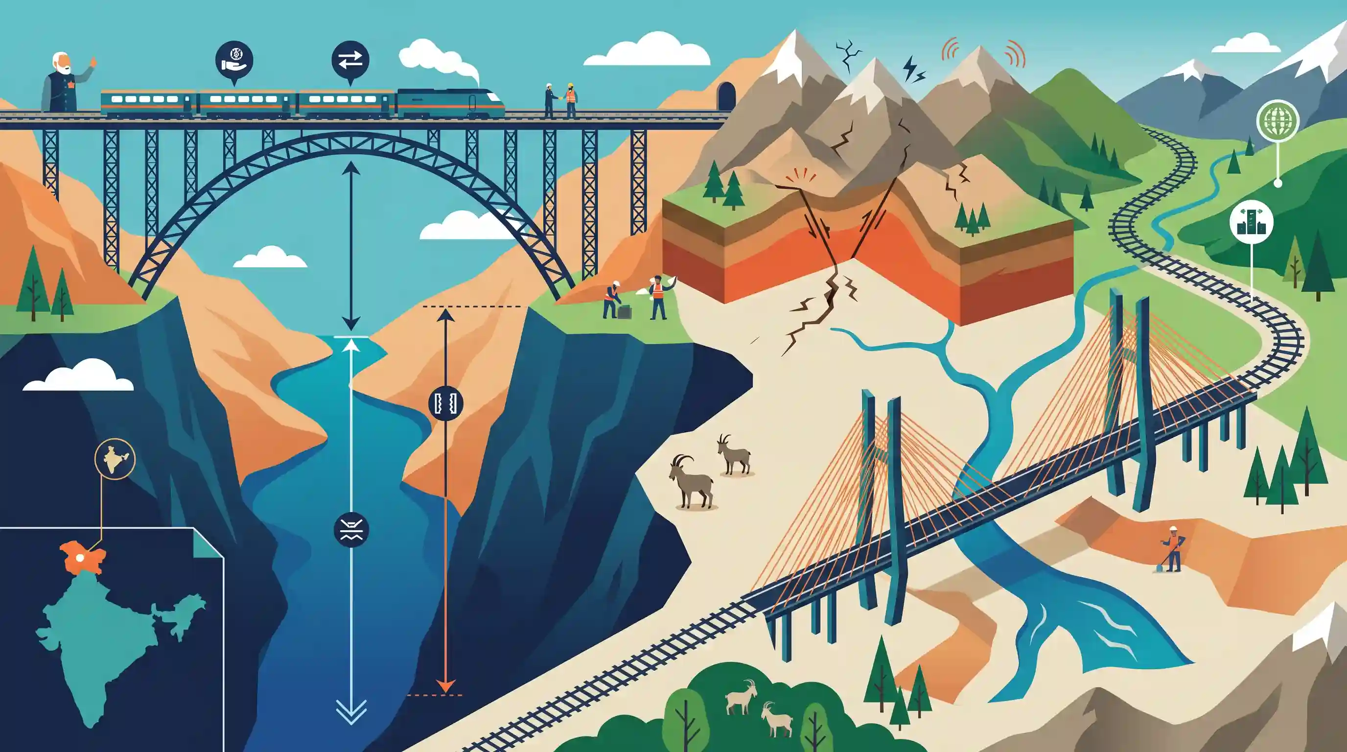
Prime Minister Narendra Modi inaugurated the Chenab Rail Bridge in Jammu and Kashmir, which holds the title of the world's highest railway bridge, standing 359 meters above the Chenab River. The monumental steel arch bridge forms a critical segment of the Udhampur-Srinagar-Baramulla Rail Link Project, aimed at integrating the Kashmir Valley with the rest of India's railway network. In addition, PM Modi inaugurated the Anji bridge, India's first cable-stayed rail bridge, constructed over a tributary of the Chenab. The Anji bridge adopted a cable-stayed design instead of an arch due to the complex geological and seismic vulnerabilities of the young fold Himalayan mountains. Both bridges represent significant engineering marvels that overcome daunting geographical hurdles to bolster border infrastructure and regional connectivity.
Key Points
- PM Modi inaugurated the world's highest railway bridge over the Chenab river, soaring 359 meters above the riverbed, as part of the Udhampur-Srinagar-Baramulla Rail Link Project.
- The 1,315-meter-long steel arch bridge connects Katra to Banihal and is engineered to withstand severe seismic and wind conditions.
- India's first cable-stayed railway bridge over the Anji River (a tributary of the Chenab) was also inaugurated.
- The Anji bridge's cable-stayed design was chosen over an arch design due to the extreme geological fragility and seismic vulnerability of the Himalayan young fold mountains.
Important Terms
Udhampur-Srinagar-Baramulla Rail Link (USBRL) Project

A 272-km national railway project connecting the Kashmir Valley with the rest of India. It features extensive tunneling and mega-bridges to navigate the rugged Himalayan terrain.
UPSC context
GS Paper 3: Infrastructure (Railways); vital for regional connectivity, national integration, and strategic border logistics.
Chenab Rail Bridge
The world's highest railway arch bridge, standing 359 meters above the Chenab River. Designed to be blast-proof, it can withstand extreme wind speeds and high-intensity earthquakes.
UPSC context
GS Paper 3: Science & Tech (Engineering); demonstrates high-altitude infrastructure capabilities in hostile geographical conditions.
Anji Khad Bridge
India’s first cable-stayed railway bridge, featuring a single central pylon and 96 high-tensile cables. It was specifically chosen for its stability in the complex geological conditions of the Himalayas.
UPSC context
GS Paper 3: Infrastructure; highlights technical adaptations to overcome 'Young Fold Mountain' geological challenges.
National Project Status
A status given to strategically significant infrastructure projects of high cost and national importance, ensuring prioritized funding and faster inter-ministerial clearances.
UPSC context
GS Paper 2: Governance; pertains to policy mechanisms for accelerating critical infrastructure in remote/sensitive areas.
Young Fold Mountains
Geologically recent mountains formed by the collision of tectonic plates. In the Himalayas, this results in unstable slopes, fragile rock, and high tectonic activity.
UPSC context
GS Paper 1: Geography; explains the geomorphological constraints and natural hazards inherent to Himalayan development.
Seismic Vulnerability
The susceptibility of an area to earthquake damage. The USBRL project lies in high-risk zones (Zone IV and V), requiring specialized seismic-resilient engineering designs.
UPSC context
GS Paper 3: Disaster Management; critical for understanding safety standards in high-risk infrastructure projects.
Prelims Trap
"The Chenab river originates in the Kashmir Valley and flows entirely within Jammu & Kashmir before entering Pakistan."
Chenab originates in the Lahaul-Spiti district of Himachal Pradesh (as the Chandra and Bhaga rivers) before flowing into Jammu and Kashmir.
Static Concepts Connected
What is the origin and course of the Chenab river?
- Origin: Formed by the confluence of the Chandra and Bhaga rivers at Tandi in the Lahaul-Spiti region of Himachal Pradesh.
- Course: Flows through Himachal Pradesh and the Jammu region of J&K before entering the Punjab plains of Pakistan.
- Indus Waters Treaty: Under the 1960 Treaty, its waters are allocated primarily to Pakistan, but India retains specific non-consumptive and agricultural usage rights.
Why are Himalayan infrastructure projects highly vulnerable to geologic hazards?
- Tectonic activity: The Himalayas are formed by the ongoing collision of the Indian and Eurasian plates, placing them in highly active seismic zones (Zones IV & V).
- Lithology: Composed of young, highly jointed, and fractured sedimentary/metamorphic rocks that are structurally fragile and prone to failure.
- Steep gradients: Deep gorges and steep gradients exacerbate mass wasting, landslides, and slope failures during heavy rainfall or construction blasting.
Cross-Topic Patterns
Himalayan geology dictating engineering norms
The shift from an arch design (Chenab) to a cable-stayed design (Anji) demonstrates how localized lithology and seismic fragility override standard engineering templates in young fold mountains.
Border Infra vs. Indus Waters Treaty
Mega-infrastructure and run-of-the-river hydro projects (like Ratle and Pakal Dul) on the Chenab routinely intersect with strategic border deployments and diplomatic scrutiny under the Indus Waters Treaty.

Expect a prelims pairing question matching strategic bridges/tunnels (Chenab, Anji, Sela, Zoji La) to their rivers, ranges, or states.
Linked PYQs · 5
Linked PYQs · 5
- 2021PrelimsGS1
With reference to the Indus river system, of the following four rivers, three of them pour into one of them which joins the Indus direct. Among the following, which one is such river that joins the Indus direct?
- 2016MainsGS1
The Himalayas are highly prone to landslides. Discuss the causes and suggest suitable measures of mitigation.
- 2021MainsGS1
Differentiate the causes of landslides in the Himalayan region and Western Ghats.
- 2013MainsGS1
Bring out the causes for more frequent occurrence of landslides in the Himalayas than in the Western Ghats.
- 2024MainsGS3
India has a long and troubled border with China and Pakistan fraught with contentious issues. Examine the conflicting issues and security challenges along the border. Also give out the development being undertaken in these areas under the Border Area Development Programme (BADP) and Border Infrastructure and Management (BIM) Scheme.
