Mithapur Chiraiyatar Flyover Project Impact and Patna Traffic Route
Source:patnapress ↗
Why It Matters
BPSC Prelims frequently tests facts regarding major infrastructure initiatives, road lengths, costs, and project completion targets in Bihar. Knowledge of the key corridors in Patna, connectivity to NH-30, and relevant administrative figures is highly relevant for state-specific current affairs.
Summary
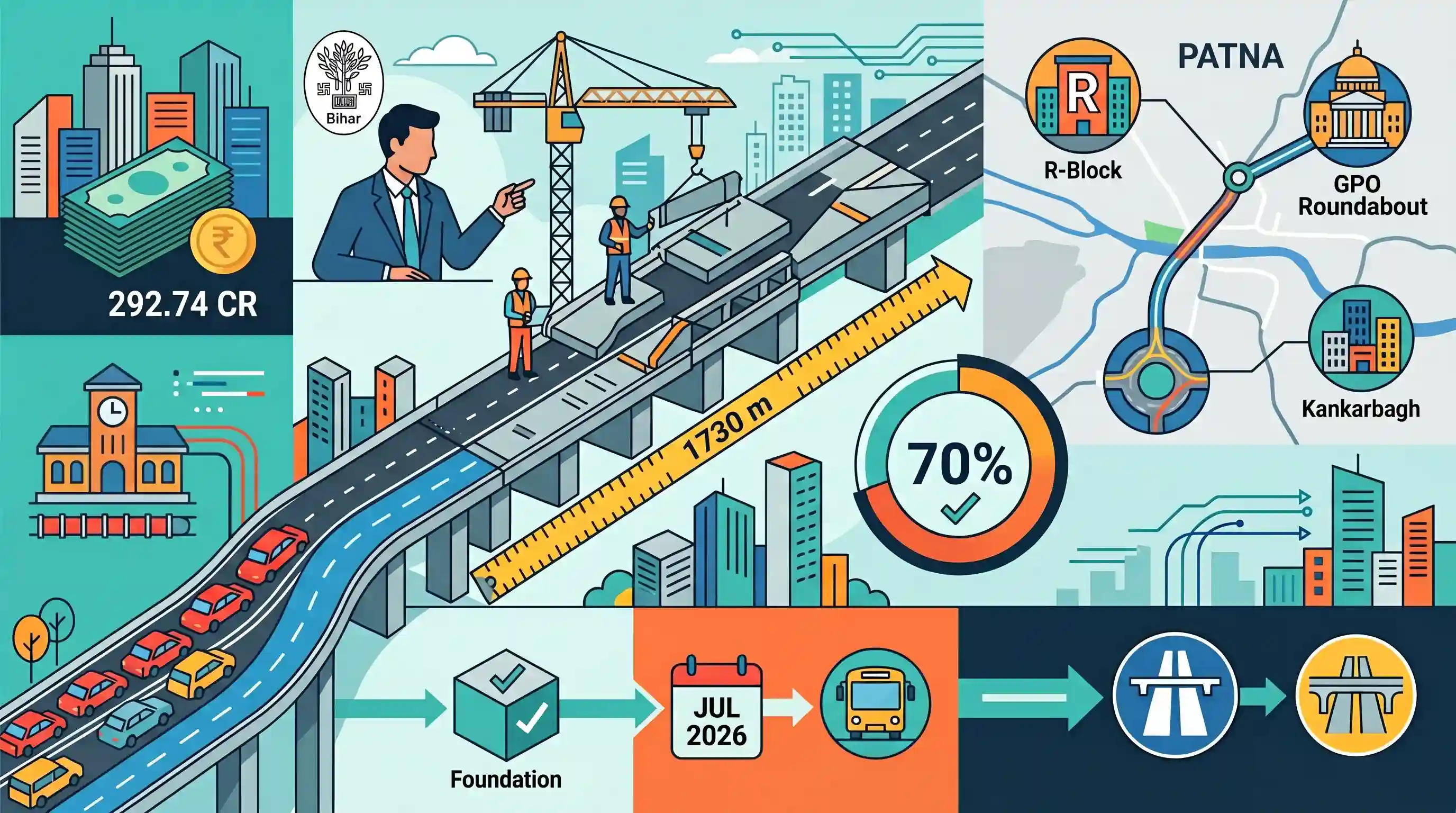
Bihar's Road Construction Department Secretary Pankaj Kumar Pal reviewed the Rs 292.74 crore, 1,730-metre Mithapur-Chiraiyatar flyover project in Patna. The project is designed to improve urban traffic movement, ease bottleneck congestion near Karbigahiya Station, and link Patna's key transport nodes including R-Block, GPO Roundabout, and Kankarbagh. Currently 70% complete with foundation work fully finished, the first phase (GPO to Old Bus Stand) is set for completion by July 2026, and the entire corridor is slated for opening by December 2026, offering seamless connectivity to the NH-30 bypass and the Mithapur-Mahuli flyover.
Key Points
- The Road Construction Department of Bihar, led by Secretary Pankaj Kumar Pal, reviewed the Mithapur-Chiraiyatar flyover project in Patna, which is targeted for full completion by December 2026.
- The project's estimated cost is Rs 292.74 crore, and it has a total length of 1,730 metres (1.73 km).
- The corridor spans from the R-Block Roundabout through GPO Roundabout, Mithapur Roundabout, and Karbigahiya Station to Kankarbagh.
- It aims to ease traffic congestion around Karbigahiya Station, strengthen connectivity to the newly built Mithapur-Mahuli flyover, and provide direct access from Mithapur Golambar to the NH-30 bypass.
- Currently, the foundation work is complete, and about 70% of the sub-structure, super-structure, and approach roads are ready.
- The first phase, linking GPO Roundabout to the Old Bus Stand, is targeted to open by July 2026.
Important Terms
Road Construction Department, Government of Bihar

The nodal department of the Bihar state government responsible for the planning, designing, construction, and long-term maintenance of roadways, state highways, and major bridges across Bihar.
UPSC context
GS Paper II/III: State Administration and Infrastructure, testing state-level execution frameworks and public works management.
Bihar Rajya Pul Nirman Nigam Limited (BRPNNL)
A state-owned public sector undertaking (PSU) under the Road Construction Department of Bihar, specialized in executing flyovers, bridges, and major transit corridor structures.
UPSC context
GS Paper III: Infrastructure Development, testing the capacity and role of state-level PSUs in executing regional connectivity.
Urban Infrastructure
The fundamental physical systems and public facilities, such as roads, transit networks, and utilities, necessary for the economic and social functioning of urban areas.
UPSC context
GS Paper I/III: Urbanization and Infrastructure, testing policies regarding sustainable cities, congestion reduction, and economic development.
Urban Traffic Management
The planning, regulation, and logistical coordination of vehicular and pedestrian flows to optimize road capacity, minimize travel times, and reduce congestion in metropolitan regions.
UPSC context
GS Paper I/III: Urbanization and Transport Infrastructure, testing strategies to alleviate traffic bottlenecks and improve city livability.
Prelims Trap
Highly industrialized states like Maharashtra and Gujarat lead India in road network density due to their vast economic output.
Road density is road length per unit land area. Compact, densely populated states like Kerala, West Bengal, and Bihar rank higher than massive, industrialized states.
Static Concepts Connected
What is Road Density and how is it distributed across Indian states?
- Definition: It measures the ratio of a territory's total road network length to its land area, usually expressed per 100 square kilometers.
- State Rankings: Kerala ranks first, followed by West Bengal and Bihar, demonstrating that high population density often correlates with higher road network density.
- Traffic Distribution: National Highways constitute only about 2% of India's total road length but carry over 40% of the country's total vehicular traffic.
What are the strategic objectives of the Bharatmala Pariyojana?
- Corridor-Based Development: Improving connectivity to economic corridors, border areas, and backward regions to optimize resource movement.
- Congestion Mitigation: Developing bypasses, ring roads, and elevated corridors to remove logistical choke points near urban centers.
- Greenfield Alignments: Constructing state-of-the-art Greenfield Expressways to minimize transit times and reduce overall fuel consumption.
Cross-Topic Patterns
Urban Flyovers vs Sustainable Transport Paradigms
While flyovers ease localized congestion, modern urban planning prioritizes Transit-Oriented Development (TOD) and non-motorized public transit to curb private vehicle dependency and long-term carbon emissions.
Federalism in National Logistics Infrastructure
Coordinated execution between State Road Departments and NHAI for corridors like the Varanasi-Ranchi-Kolkata Expressway highlights the fiscal federalism driving India's logistic network integration.

Prelims 2026 may test comparative state-wise road density statistics alongside specific alignments of major Greenfield Expressways.
Linked PYQs · 3
Linked PYQs · 3
- 2016BPSC_PRELIMSGS1
Total length of National Highways in Bihar is:
- 2017BPSC_PRELIMSGS1
The road length per lakh of population in Bihar is
- 2020BPSC_PRELIMSGS1
Which of the following infrastructure sectors of India is related with Bharatmala Project?
