Odisha launches marine spatial planning for sustainable blue economy
Source:Indian Express ↗
Why It Matters
Marine Spatial Planning (MSP) is critical for sustainable coastal management, a major theme in GS3 (Environment/Economy) and GS1 (Geography). It highlights India's steps towards institutionalizing the blue economy and addressing climate resilience through international partnerships.
Summary
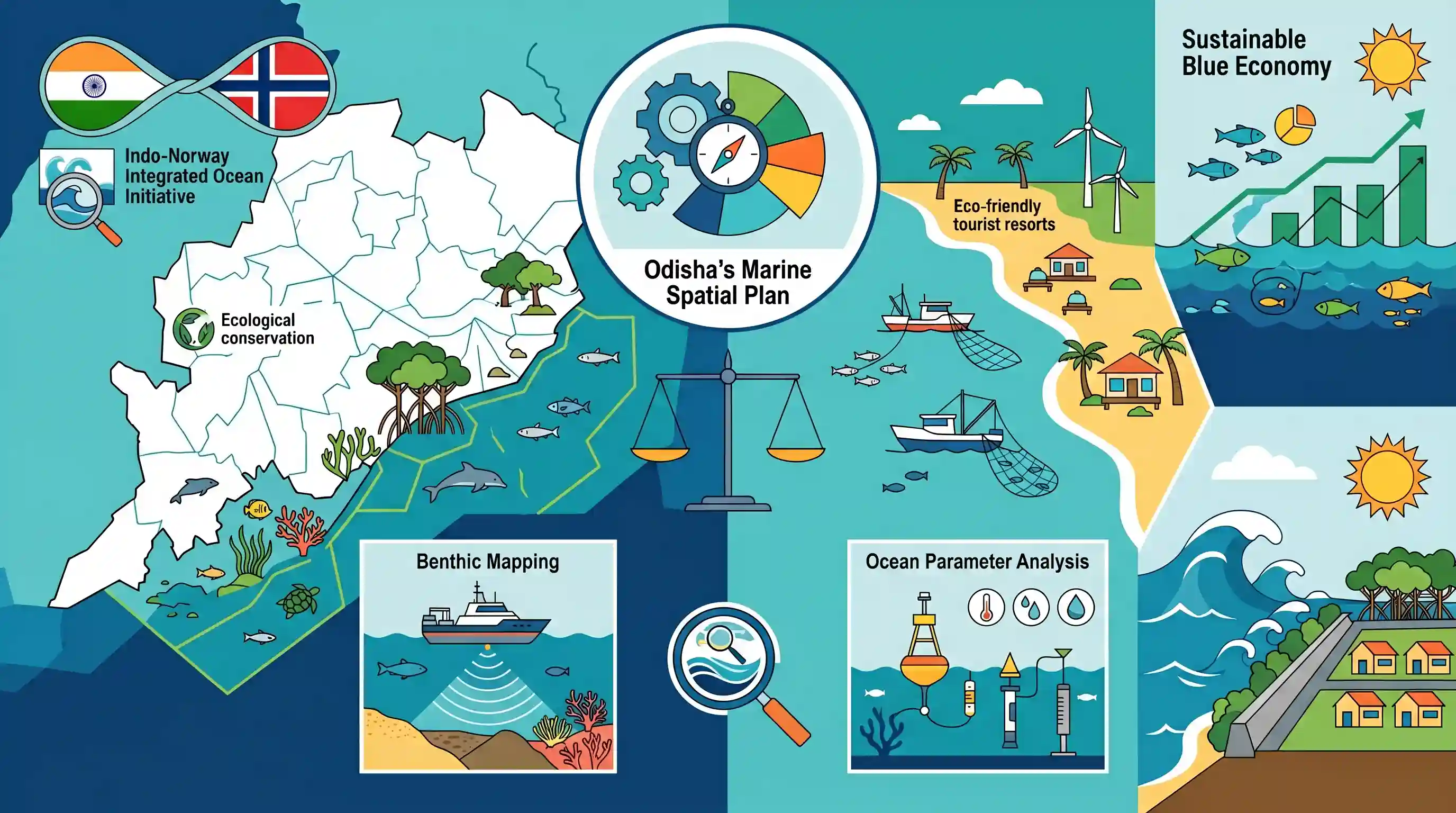
Odisha has launched India's first Marine Spatial Plan (MSP) at the state level under Phase II of the Indo-Norway Integrated Ocean Initiative. In partnership with the National Centre for Coastal Research (NCCR), the initiative aims to balance economic activities such as tourism and fisheries with ecological conservation across its 550 km coastline. Through activities like benthic mapping and ocean parameter analysis, the MSP seeks to promote sustainable blue economy practices and build coastal climate resilience.
Key Points
- Odisha is the first Indian state to launch a Marine Spatial Plan (MSP) under the second phase of the Indo-Norway Integrated Ocean Initiative.
- The state government signed an MoU with the National Centre for Coastal Research (NCCR) to develop the MSP.
- The MSP focuses on the sustainable utilization of Odisha's marine resources, bolstering the blue economy, and improving climate resilience along its 550+ km coastline.
- Key operations under the MSP include benthic mapping, studying ocean parameters like salinity and temperature, and earmarking zones for tourism, fisheries, and seagrass conservation.
- The initiative builds upon the previously launched Odisha Marine Biotechnology Research and Innovation Corridor (OMBRIC), aimed at fostering marine biotechnology startups.
Important Terms
Marine Spatial Plan (MSP)

A scientific, data-driven framework that maps and allocates marine zones for activities like fishing, tourism, and energy while ensuring ecological conservation and reducing sectoral conflicts.
UPSC context
GS Paper III (Environment/Economy): Key for sustainable ocean governance, Blue Economy, and integrated coastal zone management.
Indo-Norway Integrated Ocean Initiative
A 2019 bilateral agreement between India and Norway to promote sustainable ocean management and the Blue Economy through joint research and spatial planning.
UPSC context
GS Paper II (International Relations): Bilateral environmental cooperation and technology transfer for marine resource management.
Odisha Marine Biotechnology Research and Innovation Corridor (OMBRIC)
A state-led initiative launched to harness marine bio-resources through biotechnology research, supporting startups, coastal livelihoods, and scientific marine conservation.
UPSC context
GS Paper III (Science & Technology): Regional innovation in biotechnology and its role in strengthening the Blue Economy.
National Centre for Coastal Research (NCCR)
A premier scientific laboratory under the Union Ministry of Earth Sciences responsible for monitoring coastal processes, benthic mapping, and technical implementation of marine spatial plans.
UPSC context
GS Paper III (Science/Environment): Important institution for coastal hazard mitigation and evidence-based marine resource management.
Blue Economy
The sustainable use of ocean resources for economic growth, improved livelihoods, and jobs while preserving the health of the marine ecosystem.
UPSC context
GS Paper III (Economy/Geography): Focuses on maritime trade, deep-sea mining, and sustainable fisheries as growth drivers.
Benthic Mapping
The process of mapping the ocean floor to study its topography, biological habitats (like seagrass), and physical parameters to guide marine zoning.
UPSC context
GS Paper I/III (Geography/Science): Technical tool for marine spatial planning and biodiversity conservation.
Prelims Trap
Odisha is the first territory in India to implement Marine Spatial Planning.
While Odisha is the first state under Phase II, Puducherry and Lakshadweep were the initial pilot territories for Marine Spatial Planning under Phase I of the Indo-Norway initiative.
Static Concepts Connected
What is the mandate of the National Centre for Coastal Research (NCCR)?
- Nodal agency: Operates under the Ministry of Earth Sciences (MoES), focusing on coastal ecosystem health, shoreline management, and hazard mitigation.
- Coastal zoning & quality: Provides scientific inputs for Coastal Regulation Zones (CRZ) and implements the Coastal Ocean Monitoring and Prediction System (COMAPS).
What comprises the Benthic Zone and why is it mapped?
- Ecological definition: It is the ecological region at the lowest level of a marine or freshwater body, including the sediment surface and sub-surface layers.
- Benthic mapping: Mapping identifies seabed features, underwater vegetation like seagrass, and sediment types to allocate specific zones for conservation and economic use.
Cross-Topic Patterns
Indo-Nordic Blue Economy Synergy
The Indo-Norway Ocean Initiative reflects India's broader strategic tilt towards Nordic countries for clean technologies, sustainable shipping, and advanced ocean governance frameworks.
Marine Biotechnology & Coastal Zoning
Linking the OMBRIC initiative with MSP highlights a national shift from traditional fisheries to high-value marine biotech startups, intersecting with Coastal Regulation Zone (CRZ) compliance.

Expect a multi-statement Prelims question comparing the mandate of NCCR vs INCOIS, woven with the Indo-Norway Ocean Initiative.
Linked PYQs · 3
Linked PYQs · 3
- 2014MainsGS1
Critically evaluate the various resources of the oceans which can be harnessed to meet the resource crisis in the world.
- 2018MainsGS1
Defining blue revolution, explain the problems and strategies for pisciculture development in India.
- 2022MainsGS3
Explain the causes and effects of coastal erosion in India. What are the available coastal management techniques for combating the hazard?
