Maharashtra Monsoon Rainfall Distribution And Spatial Variation
Source:newsonair ↗
Why It Matters
Understanding the spatial distribution of monsoon rainfall is crucial for agriculture, water resource management, and economic planning in Maharashtra. MPSC Combined Prelims regularly tests the characteristics of the South-west monsoon and its varying impact across regions like Konkan and the rain-shadow areas of western Maharashtra.
Summary
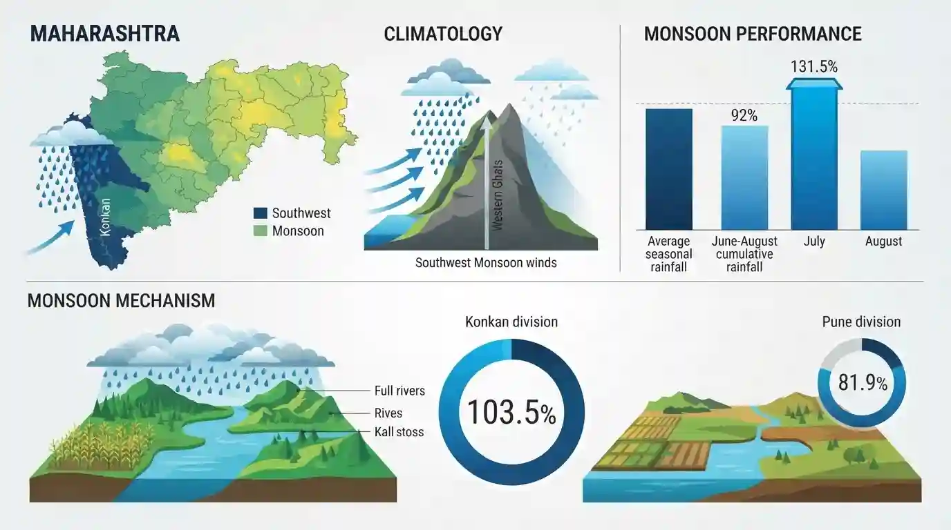
Between June 1 and August 20, Maharashtra recorded 92% of its average seasonal rainfall, ensuring a satisfactory overall monsoon performance. While July witnessed surplus rains (131.5% of average), the intensity decreased in August. The coastal Konkan division led with the highest rainfall at 103.5% of normal, whereas the Pune division recorded 81.9%. This variation highlights the spatial distribution of the southwest monsoon, which causes heavy orographic rainfall on the windward side (Konkan) while areas further inland often face relative deficits.
Key Points
- Maharashtra recorded 92% of its average monsoon rainfall between June 1 and August 20.
- The state experienced heavy downpours in July (131.5% of average), followed by a decline in August.
- Konkan division received the highest rainfall, recording 103.5% of its long-term average.
- Pune division recorded 561.4 mm of rainfall against an average of 685.5 mm, which is 81.9%.
Prelims Trap
The entire Pune division lies on the windward side of the Sahyadris, receiving uniform orographic rainfall.
Only the western rim of Pune division near the Ghats receives heavy rain; its eastern districts (Solapur, Sangli) lie deep in the rain-shadow zone and face dry spells.
Static Concepts Connected
How does the Sahyadri Range affect Maharashtra's rainfall distribution?
- Orographic barrier: The Western Ghats act as a barrier to moisture-laden Southwest monsoon winds, forcing them to rise and cool.
- Windward abundance: The coastal Konkan strip on the windward side receives extreme rainfall ranging from 2,500 mm to over 6,000 mm.
- Leeward rain-shadow: As winds cross the crest, they descend and warm up, creating a dry rain-shadow zone in Western Maharashtra and Marathwada.
What is the 'Maval' region's climatic significance in Maharashtra?
- Geographical location: It is the transitional hilly tract lying immediately to the east of the Sahyadri crest line.
- Rainfall gradient: Rainfall drops sharply from over 4,000 mm to under 1,000 mm within a horizontal distance of just 30-50 km.
Cross-Topic Patterns
Monsoon dynamics + Cropping patterns
Spatial rainfall variation forces dryland farming (millets) in eastern Pune/Nashik while enabling paddy in Konkan, directly influencing crop planning and state micro-irrigation subsidies.
Extreme precipitation + Urban infrastructure
Intense July rainfall spikes followed by dry August dry-spells reflect climate change-induced extreme events, testing urban stormwater drainage systems and dams in Pune and Mumbai.

MPSC often tests the correlation between Western Ghats topography (Maval region) and micro-climatic rain-shadow districts.
Linked PYQs · 1
Linked PYQs · 1
- 2025MPSC_PRELIMSGS1
_______ Monsoon winds blow in Maharashtra from June to September.
