Central Sulawesi Earthquake Highlights Pacific Ring of Fire Risks
Source:The Hindu ↗
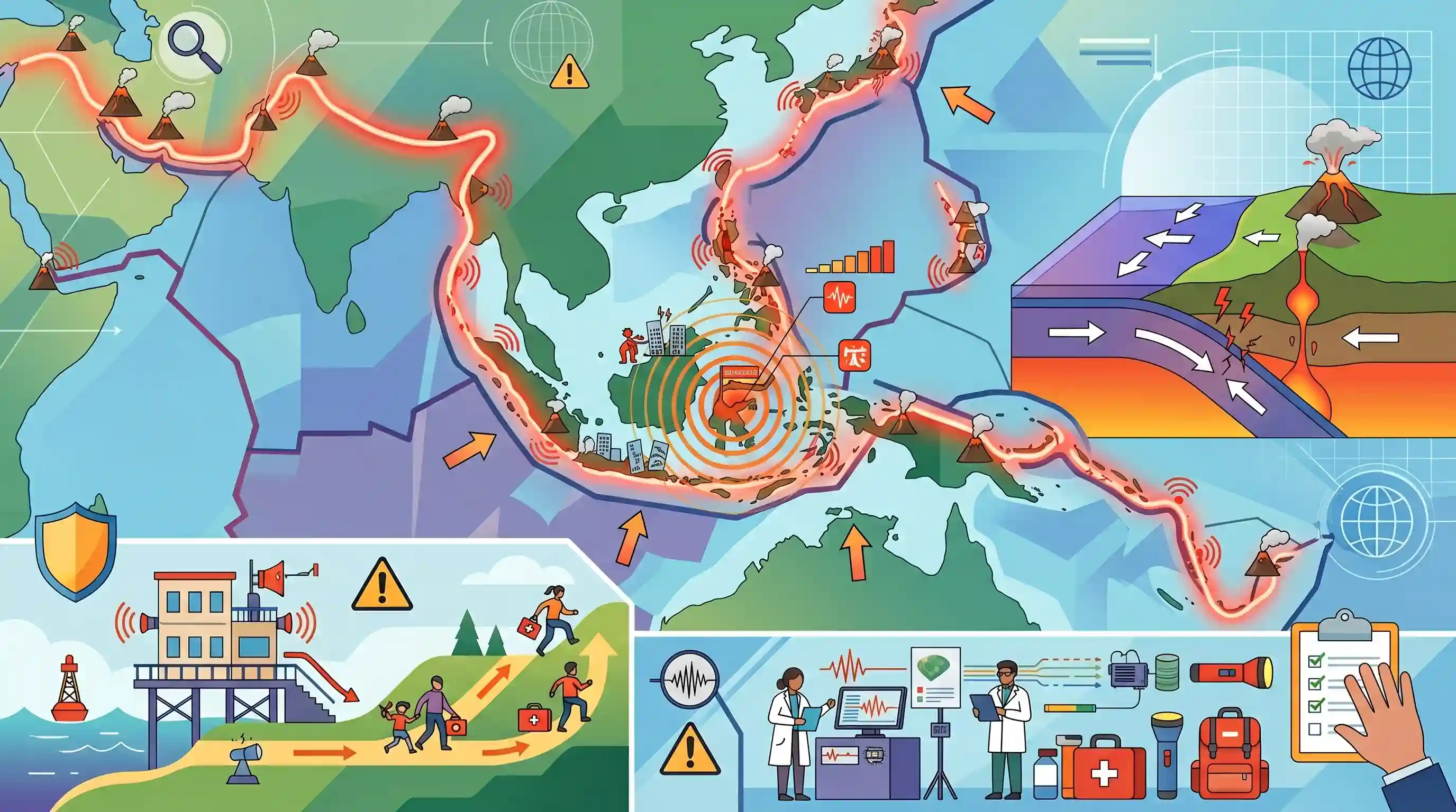
Why It Matters
Indonesia's geographic position on the Circum-Pacific Zone provides a textbook real-world example of plate tectonics, volcanism, and seismic hazards. Such events are highly relevant to the UPSC GS1 syllabus concerning important geophysical phenomena (earthquakes, Tsunami, volcanic activity) and geographical features. Furthermore, managing the aftermath of such disasters relates closely to the disaster preparedness and mitigation strategies covered in GS3.
Summary
A magnitude 5.8 earthquake hit Indonesia's Central Sulawesi province, injuring at least 29 people. Though no tsunami warning was issued, the event highlights Indonesia's extreme vulnerability to seismic activity. This vulnerability is primarily due to the country's location along the Pacific 'Ring of Fire', a horseshoe-shaped arc of fault lines and volcanoes in the Pacific Basin resulting from converging tectonic plates. The article contextualizes this risk by citing catastrophic historical events, including the 2004 Indian Ocean tsunami and the 2018 Sulawesi earthquake, underscoring the ongoing need for disaster mitigation and preparedness in tectonically active zones.
Key Points
- A magnitude 5.8 earthquake struck Central Sulawesi province in Indonesia, causing at least 29 injuries.
- The epicenter was located 15 kilometers north of Poso district; no tsunami warning was issued.
- Indonesia frequently faces seismic hazards like earthquakes and volcanic eruptions due to its location on the Pacific 'Ring of Fire', an active zone of tectonic plate boundaries.
- The incident recalls previous devastating disasters in the region, most notably the 2004 Indian Ocean earthquake and tsunami that caused over 2,30,000 casualties primarily in Aceh province.
Important Terms
Pacific Ring of Fire

A 40,000 km horseshoe-shaped belt encircling the Pacific Ocean, where approximately 90% of the world's earthquakes and 75% of active volcanoes occur.
UPSC context
GS I (Physical Geography); tests knowledge of global seismic zones and tectonic plate boundaries.
Plate Tectonics
The scientific theory describing how Earth's lithosphere is divided into large plates that move over the asthenosphere, driving mountain-building, volcanism, and earthquakes.
UPSC context
GS I (Geomorphology); a core concept for understanding endogenetic forces and major geophysical phenomena.
Meteorology, Climatology, and Geophysical Agency (BMKG)
Indonesia's primary agency for monitoring earthquakes and providing early warnings for tsunamis and extreme weather events.
UPSC context
GS III (Disaster Management); case study for Early Warning Systems (EWS) and international monitoring cooperation.
National Disaster Mitigation Agency (BNPB)
The Indonesian national board responsible for disaster affairs, coordinating emergency response, risk reduction, and mitigation strategies across the archipelago.
UPSC context
GS III (Disaster Management); relates to institutional frameworks and Sendai Framework implementation in high-risk nations.
Disaster Mitigation
Proactive measures taken before a disaster occurs to reduce or eliminate its long-term risk and impact on life and property.
UPSC context
GS III (Disaster Management); tests ability to propose structural and non-structural risk-reduction strategies.
Tsunami
Giant sea waves typically caused by underwater tectonic activity, such as subduction-zone earthquakes, that pose severe risks to coastal populations.
UPSC context
GS I and III; concerns coastal hazards, geomorphology, and specialized disaster response protocols.
Prelims Trap
"Tsunamis are primarily generated by the horizontal displacement of tectonic plates during massive offshore earthquakes."
Tsunamis require massive *vertical* displacement of the seafloor (typically at megathrust subduction zones) to displace the water column above. Horizontal strike-slip movements rarely cause tsunamis.
Static Concepts Connected
How do subduction zones along the Ring of Fire create volcanic island arcs?
- Convergent boundaries: Heavier oceanic plates subduct beneath lighter continental crust or younger oceanic plates at ocean trenches.
- Flux melting: As the subducting plate sinks into the hot mantle, it releases water, lowering the melting point and causing flux melting.
- Magma ascent: The resulting buoyant magma rises through the overlying plate to form chains of volcanoes (island arcs or continental arcs).
What is Seismic Hazard Microzonation in disaster management?
- Local mapping: The process of subdividing a region into smaller zones based on localized geological and soil characteristics.
- Liquefaction risk: It identifies high-risk areas prone to liquefaction, where saturated soils temporarily lose strength and behave like a liquid during shaking.
- Targeted urban planning: Provides the scientific basis for enforcing zone-specific, stringent building codes and designing resilient urban infrastructure.
Cross-Topic Patterns
Regional Tsunami Early Warning Systems (ITEWC)
Post-2004, the Indian Tsunami Early Warning Centre (ITEWC) under INCOIS provides regional alerts, linking tectonic subduction events in Indonesia (Sunda trench) directly to India's coastal disaster preparedness.
Ring of Fire and Geothermal Potential
The extreme geothermal gradient along the Ring of Fire’s subduction zones gives nations like Indonesia massive geothermal energy potential, bridging physical geography with renewable energy transitions.

Expect a multi-statement question linking plate boundaries (convergent vs divergent), trench formation, and Ring of Fire volcanism in 2026.
Linked PYQs · 4
Linked PYQs · 4
- 2020MainsGS1
Discuss the geophysical characteristics of Circum-Pacific Zone.
- 2017MainsGS3
On December 2004, tsunami brought havoc on fourteen countries including India. Discuss the factors responsible for occurrence of tsunami and its effects on life and economy. In the light of guidelines of NDMA (2010) describe the mechanisms for preparedness to reduce the risk during such events.
- 2024PrelimsGS1
Consider the following: 1. Pyroclastic debris 2. Ash and dust 3. Nitrogen compounds 4. Sulphur compounds How many of the above are products of volcanic eruptions?
- 2025MainsGS1
Discuss how the changes in shape and sizes of continents and ocean basins of the planet take place due to tectonic movements of the crustal masses.
