Rudraprayag Madmaheshwar yatra resumes after weather disruption
Source:theprint ↗
Why It Matters
It provides specific geographical details (Madmaheshwar Temple, Rudraprayag, Morkhanda River) important for Uttarakhand State Specific questions. It also exemplifies the practical challenges of climate-induced disasters and the role of SDRF in the state.
Summary
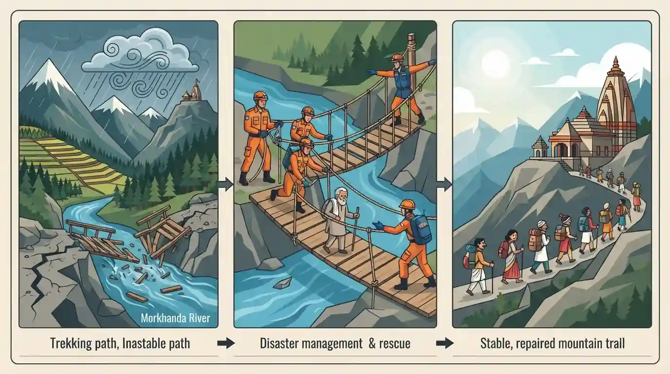
The Madmaheshwar yatra in Uttarakhand's Rudraprayag district has resumed after a 12-day suspension. The pilgrimage to the 11,473-foot-high temple, part of the Panch Kedar, was halted after heavy rains washed away a vital footbridge over the Morkhanda River and damaged the trekking route. The State Disaster Response Force (SDRF) prepared an alternative path and safely escorted pilgrims, underscoring the region's geographical fragility and the challenges of disaster management during monsoons.
Key Points
- The Madmaheshwar yatra in Rudraprayag district resumed after a 12-day halt caused by heavy rains on August 14.
- The suspension occurred because a key footbridge over the Morkhanda River was washed away, and parts of the 16-km trekking path were heavily damaged.
- The State Disaster Response Force (SDRF) played a crucial role in creating a safe alternative route and assisting stranded pilgrims.
- Madmaheshwar is one of the Panch Kedar temples, situated at an altitude of 11,473 feet, highlighting the challenging geography of the region.
- The incident underscores Uttarakhand's high vulnerability to extreme weather events, climate change, and infrastructure destruction during the monsoon.
Important Terms
State Disaster Response Force (SDRF)

A specialized force of the Uttarakhand Police that conducts search and rescue operations during natural disasters.
UPSC context
Relevant for UKPSC General Studies (Disaster Management). Tests knowledge of state-level emergency response mechanisms and agencies handling monsoon challenges in hilly terrain.
Ukhimath tehsil
The local administrative block in Uttarakhand's Rudraprayag district. It manages governance, disaster relief, and yatra arrangements for major regional shrines like Madmaheshwar and Kedarnath.
UPSC context
Important for UKPSC Geography and Polity. Highlights local administration's role in disaster management, pilgrimage regulation, and district-level geographical awareness.
Madmaheshwar Temple
A Hindu temple dedicated to Lord Shiva, located at 11,473 feet in Uttarakhand. It is the second temple in the sacred Panch Kedar pilgrimage circuit.
UPSC context
Crucial for UKPSC Art, Culture, and Geography. Tests knowledge of Uttarakhand's Panch Kedar shrines, their altitudes, and locations.
Morkhanda River
A river in Uttarakhand's Rudraprayag district that intersects the Madmaheshwar trekking route. It merges with the Madhu Ganga near the village of Banatoli.
UPSC context
Relevant for UKPSC Geography. Tests knowledge of local river systems, drainage patterns, and natural challenges on major Uttarakhand trekking routes.
Prelims Trap
"Madmaheshwar, where the face of Lord Shiva is worshipped, is located in the Chamoli district."
Madmaheshwar (navel) is in Rudraprayag. Rudranath (face) and Kalpeshwar (hair) are in Chamoli. Examiners frequently swap the districts and body parts in statement-based questions.
Static Concepts Connected
What are the locations and worshipped attributes of the Panch Kedar temples?
- Rudraprayag shrines: Kedarnath, Tungnath, and Madmaheshwar are all located in the Rudraprayag district.
- Chamoli shrines: Rudranath and Kalpeshwar are situated in the neighboring Chamoli district.
- Body parts worshipped: Kedarnath (Hump), Tungnath (Arms), Madmaheshwar (Navel), Rudranath (Face), and Kalpeshwar (Hair/Jata).
What is the structure and mandate of the State Disaster Response Force (SDRF) in Uttarakhand?
- Origin: Mandated in late 2013 and officially formed in 2014 following the devastating Kedarnath floods.
- Operational structure: It operates as a specialized wing of the Uttarakhand Police, trained for rapid emergency search, rescue, and evacuation.
- Yatra management: SDRF is deployed along critical Char Dham and Panch Kedar trekking routes to manage crowd safety during monsoons.
Cross-Topic Patterns
Yatra routes & climate vulnerability
The frequent washing away of bridges on Panch Kedar routes highlights the recurring friction between expanding religious tourism and managing the fragile, disaster-prone Himalayan ecology.
Glacial rivers & localized flash floods
The Morkhanda river originating from Chaukhamba demonstrates how localized glacial melt and monsoonal cloudbursts rapidly amplify flash-flood risks in narrow Garhwal gorges.

Expect a 'Match the following' question pairing Panch Kedar temples with their respective districts or worshipped body parts of Lord Shiva.
Linked PYQs · 3
Linked PYQs · 3
- 2024UKPSC_PRELIMSGS1
Hindu religious pilgrimage place named 'Purnagiri' is situated in which of the following districts of Uttarakhand ?
- 2025UKPSC_PRELIMSGS1
Which of the following pairs is not correctly matched ? Name of Airport District
- 2025UKPSC_PRELIMSGS1
Consider the following statements and select the correct answer from the options given below : Statement 1 : Uttarakhand is highly vulnerable to climate change. Statement 2 : Climate change is causing water stress and depleting biodiversity in Uttarakhand.
