Southwest Monsoon Advances Across Northern Madhya Pradesh Divisions
Source:newsonair ↗
Why It Matters
Monsoon distribution and regional climate dynamics are major focus areas in the MPPSC State Service Prelims (Unit 3: Geography of Madhya Pradesh). Understanding the direction of monsoon progression, division-wise impact, new district administrative updates (like Pandhurna), and IMD color-coded warning systems is vital for the exam.
Summary
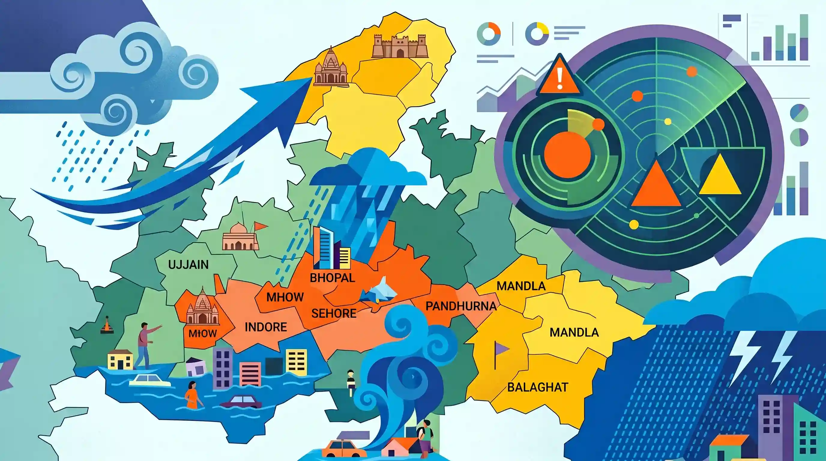
The southwest monsoon is progressing rapidly across Madhya Pradesh, expected to reach the Ujjain and Gwalior-Chambal divisions. Heavy rainfall has triggered waterlogging and flood-like situations in parts of Bhopal, Indore, Mhow, and Sehore. The India Meteorological Department (IMD) has issued Orange and Yellow alerts across several districts, including newly formed Pandhurna and high-rainfall zones in the south-east like Balaghat and Mandla.
Key Points
- The southwest monsoon is advancing rapidly across Madhya Pradesh, reaching the north-western and northern regions of Ujjain and Gwalior-Chambal divisions [1.1].
- Heavy rainfall has caused localized flooding and waterlogging in low-lying areas of Indore, Mhow, and Sehore district [1.1].
- The India Meteorological Department (IMD) issued an 'Orange Alert' for heavy to very heavy rain in Harda, Narmadapuram, Raisen, Chhindwara, Pandhurna, and Balaghat districts [1.1].
- A 'Yellow Alert' has been issued for Ashoknagar, Dewas, Khandwa, Betul, Sagar, Mandla, and Dindori districts [1.1].
- The pattern of rainfall highlights MP's unique monsoon geography, where the south-eastern parts (e.g., Balaghat, Mandla) receive high rainfall from the Bay of Bengal branch of the monsoon.
- Pandhurna, which was carved out of Chhindwara as a new district in late 2023, is explicitly listed under the IMD Orange Alert zone.
Important Terms
Southwest Monsoon

A seasonal wind system occurring from June to September, bringing moisture-laden winds from the Indian Ocean, responsible for 75-80% of India's annual rainfall.
UPSC context
Relevant for GS Paper I (Physical Geography - Climatology) and GS Paper III (Agriculture and Food Security).
India Meteorological Department
The principal government agency under the Ministry of Earth Sciences responsible for meteorological observations, weather forecasting, seismology, and early warnings of weather-related hazards.
UPSC context
Relevant for GS Paper I (Geography) and GS Paper III (Disaster Management).
IMD Color-Coded Weather Warnings
A four-stage alert system (Green, Yellow, Orange, Red) used by the IMD to convey the severity, impact, and disruption probability of extreme weather events.
UPSC context
Relevant for GS Paper III (Disaster Management and Disaster Risk Reduction).
Urban Flooding
The inundation of land in built-up environments caused when intense local rainfall exceeds the capacity of municipal stormwater drainage networks, distinct from riverine floods.
UPSC context
Relevant for GS Paper III (Disaster Management, Infrastructure, and Urbanization).
Prelims Trap
Madhya Pradesh receives its monsoon precipitation exclusively from the Arabian Sea branch due to its geographic position.
Southeastern districts like Balaghat receive heavy rainfall from the Bay of Bengal branch, and both branches merge over the state.
Static Concepts Connected
How do the two branches of the Southwest Monsoon interact over Central India?
- Arabian Sea Branch: Enters via the west coast and moves over central India through the Narmada and Tapi river troughs.
- Bay of Bengal Branch: Deflected by regional topography to move westward along the Indo-Gangetic plains, delivering high rainfall to eastern MP.
- Convergence Zone: The two branches merge over the north-central and eastern parts of Madhya Pradesh, causing prolonged heavy spells.
What are the IMD's four color-coded weather warnings?
- Green Alert: No advisory is issued; normal, non-hazardous weather conditions are expected.
- Yellow Alert: Indicates potentially hazardous weather; authorities and public should keep a watch on local updates.
- Orange Alert: Indicates severe weather likely to cause disruptions; residents must prepare for potential power and transport outages.
- Red Alert: Indicates extremely severe weather posing a high threat to life and property; immediate protective action is mandatory.
Cross-Topic Patterns
Demographics and Monsoon Geography
Southeastern MP (Balaghat) has the highest sex ratio (1021) and high Bay of Bengal monsoon rainfall, contrasting with dry, low sex ratio northern districts like Bhind (837).
District creation and disaster management
Newly created administrative units like Pandhurna (2023) require localized disaster response infrastructure to manage recurring extreme precipitation and urban flash floods.

IMD color-coded warning criteria integrated with regional monsoon branch convergence points likely to feature in 2026 physical geography.
Linked PYQs · 2
Linked PYQs · 2
- 2024MPPSC_PRELIMSGS1
The south-eastern part of Madhya Pradesh receives maximum rainfall from :
- 2025MPPSC_PRELIMSGS1
Read the following statements regarding the climate of Madhya Pradesh and select the correct answer from the codes given below: 1. Most of the rainfall in the state is received from the monsoon. 2. Wind speed during winters is faster than in summer and rainy seasons. 3. Distance from sea also affects the distribution of monsoon rains in the state. 4. Summer temperature in Pachmarhi is related to the altitude above sea level. Codes:
