IMD Issues Heavy Rain Alert for Southern and Southeastern MP Districts
Source:freepressjournal ↗
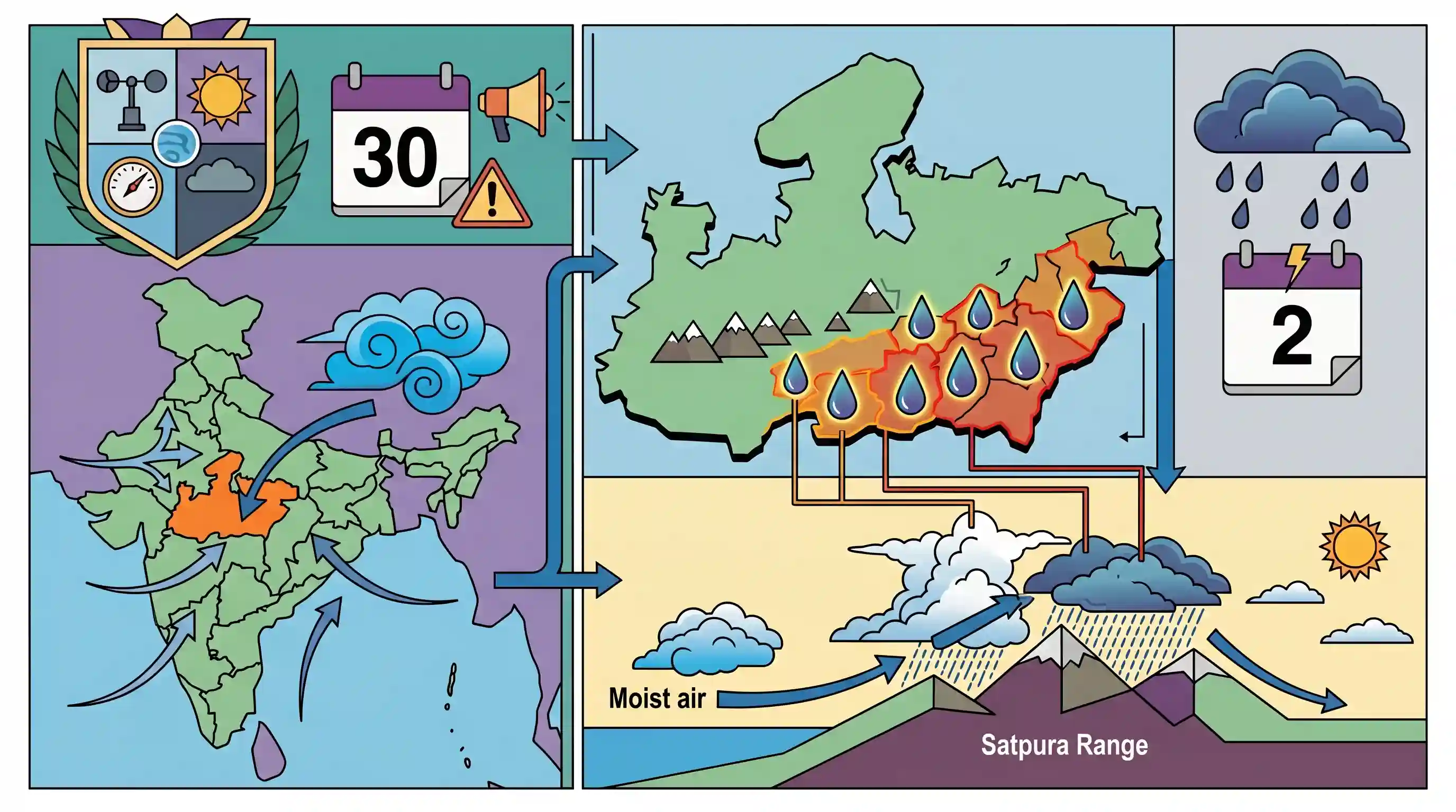
Why It Matters
Understanding the monsoon distribution, regional precipitation variations, and specific meteorological systems in Madhya Pradesh is a recurring and highly high-yield topic in the MPPSC State Service Prelims geography section.
Summary
An India Meteorological Department (IMD) weather warning issued on June 30, 2026, highlights the intensification of Southwest Monsoon activities in Madhya Pradesh. Heavy rain alerts were issued for several southern and southeastern districts (including Betul, Chhindwara, Seoni, Balaghat, Narmadapuram, and Dindori) with expectations of extremely heavy precipitation by July 2, 2026, due to an active weather system. This highlights important MPPSC geographic themes, such as regional rainfall distribution, the role of the Bay of Bengal branch in the south-eastern districts, and how topography (like the Satpura Range) impacts local weather patterns.
Key Points
- The India Meteorological Department (IMD) issued a heavy rainfall alert for several southern and southeastern districts of Madhya Pradesh as the southwest monsoon advanced.
- An active new weather system starting from July 2, 2026, is expected to bring very heavy to extremely heavy precipitation, triggering Orange Alerts for Narmadapuram, Balaghat, and Dindori.
- Other districts expected to see significant rain or storm activity include Dewas, Harda, Khandwa, Betul, Pandhurna, and Chhindwara.
- Southern and southeastern districts of MP are physically positioned along the Satpura-Maikal range, making them highly susceptible to strong orographic rainfall and monsoon winds.
- In MPPSC Geography, the monsoon pattern of the state is characterized by the dominance of the Southwest Monsoon, with the south-eastern part receiving its maximum rainfall from the Bay of Bengal branch.
Important Terms
India Meteorological Department (IMD)

India's principal government agency responsible for meteorological observations, weather forecasting, and seismology. Established in 1875 under the Ministry of Earth Sciences, it issues critical weather warnings and monsoon updates.
UPSC context
GS Paper I (Climatology) & GS Paper III (Disaster Management). Tests understanding of institutional mechanisms for early weather warnings.
Meteorological Centre Bhopal
A regional unit of the India Meteorological Department (IMD) in Madhya Pradesh, responsible for local weather forecasting, issuing district-wise severe weather alerts, and monitoring monsoon progress across the state's divisions.
UPSC context
MPPSC GS Papers (Geography of MP). Tests candidates on local climate monitoring, regional administrative hubs, and state disaster warning setups.
Southwest Monsoon
A seasonal wind system blowing from the southwest to the northeast over India from June to September. Driven by differential heating of land and sea, it brings over 75% of India’s annual rainfall.
UPSC context
GS Paper I (Indian Geography) & GS Paper III (Agriculture). Crucial for understanding India's agricultural cycle and monsoon dynamic mechanisms.
Satpura Range
A major tectonic horst mountain range in central India, running parallel to the Vindhyas. It spans Gujarat, Maharashtra, Madhya Pradesh, and Chhattisgarh, serving as a critical water divide between the Narmada and Tapi rivers.
UPSC context
GS Paper I (Physical Geography of India) & MPPSC. Tests knowledge of central Indian topography, block faulting, and local climate effects.
Orographic Rainfall
Also known as relief rain, it occurs when moisture-laden air is forced to rise over a physical barrier like a mountain range, cooling and condensing to cause heavy precipitation on the windward side.
UPSC context
GS Paper I (Physical Geography / Climatology). Evaluates understanding of precipitation mechanisms, rain-shadow effects, and spatial rainfall distribution.
Prelims Trap
Rainfall in Central India exhibits a positive spatial gradient, increasing progressively from the eastern districts to the western districts.
In reality, rainfall decreases from east/southeast (heavy, ~140-160 cm) to west (dry, ~75-100 cm) because the Bay of Bengal branch gradually loses moisture as it travels westward.
Static Concepts Connected
How do the two branches of the Southwest Monsoon interact over Central India?
- Arabian Sea Branch: Enters through the west coast, channeling moisture along the Narmada-Tapti rift valleys to water western and central districts.
- Bay of Bengal Branch: Sweeps across the Bay of Bengal, moving westward over the plains to supply heavy precipitation to eastern and southeastern districts.
- Convergence Zone: The two branches merge over northern and central India, creating a convergence zone that triggers prolonged, heavy precipitation cycles.
How does the Satpura-Maikal range influence regional precipitation?
- Orographic Barrier: The southern slopes of the Satpura-Maikal range force moisture-laden winds upward, triggering intense orographic rainfall.
- Water Divide: It serves as a key hydrological divide between the Narmada basin to the north and the Godavari and Tapti basins to the south.
Cross-Topic Patterns
Orographic barriers & Rainfed Agriculture
Topography-induced monsoon variations directly dictate the sowing windows, crop selection, and soil-moisture management of critical kharif crops like soybean in central India.
Monsoon Trough dynamics & IMD alerts
The spatial oscillation of the monsoon trough connects thermodynamic forces with early warning systems and localized disaster mitigation protocols under the NDMA guidelines.

UPSC may couple physical topography (Satpura range) with thermodynamic characteristics of the Southwest Monsoon branches in Central India.
Linked PYQs · 3
Linked PYQs · 3
- 2025MPPSC_PRELIMSGS1
Read the following statements regarding the climate of Madhya Pradesh and select the correct answer from the codes given below: 1. Most of the rainfall in the state is received from the monsoon. 2. Wind speed during winters is faster than in summer and rainy seasons. 3. Distance from sea also affects the distribution of monsoon rains in the state. 4. Summer temperature in Pachmarhi is related to the altitude above sea level. Codes:
- 2024MPPSC_PRELIMSGS1
The south-eastern part of Madhya Pradesh receives maximum rainfall from :
- 2018MPPSC_PRELIMSGS1
The climate of Madhya Pradesh is
