Pre-Monsoon Storms Affect Madhya Pradesh Amid Rainfall Deficit
Source:freepressjournal ↗
Why It Matters
Understanding the regional rainfall patterns, monsoon onset timelines, and meteorological divisions of Madhya Pradesh is essential for MPPSC physical geography, agricultural planning, and regional climate analysis.
Summary
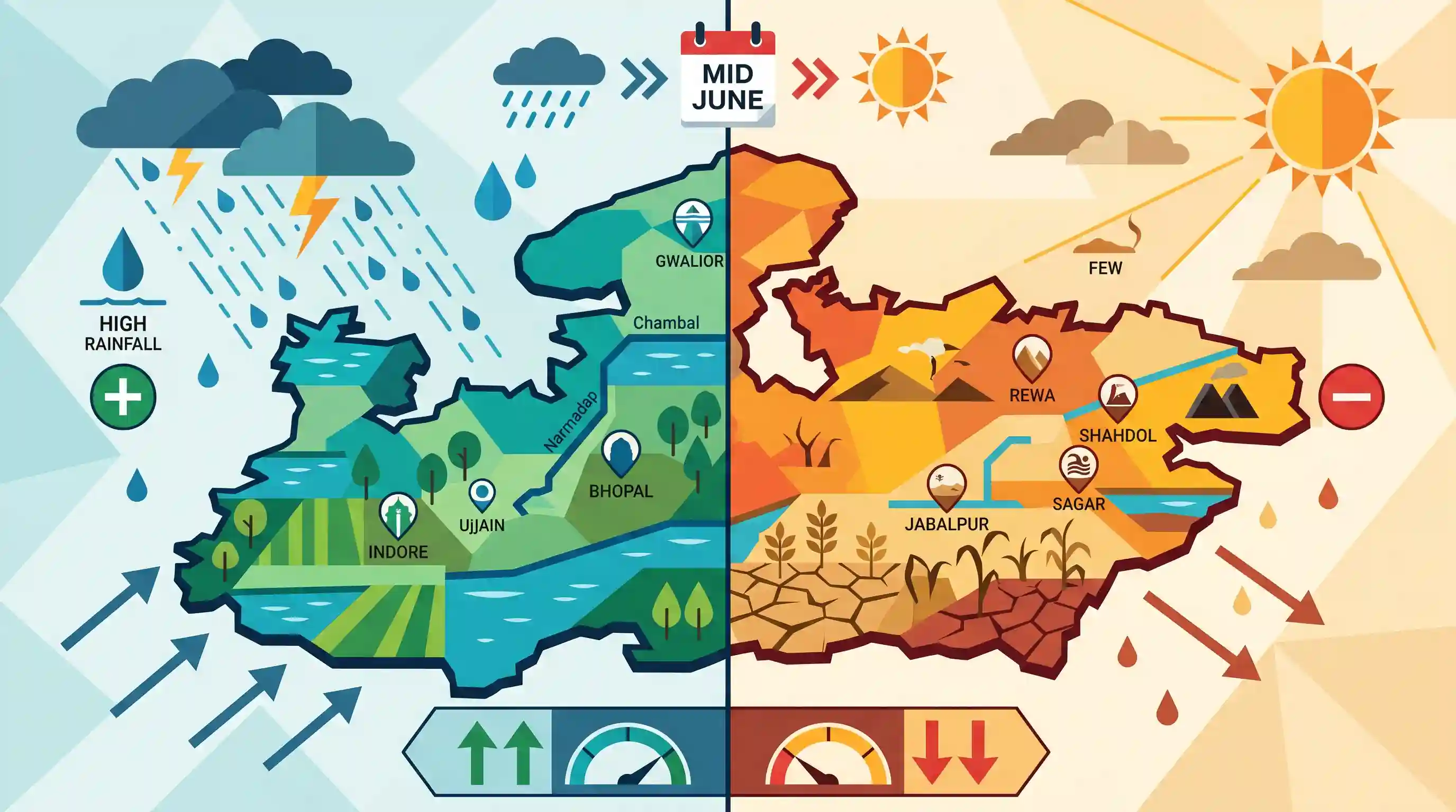
This weather update for Madhya Pradesh in mid-June 2026 highlights the imminent arrival of the southwest monsoon (expected June 15–18) and the active pre-monsoon weather systems across the state. Despite widespread activity, MP recorded an overall 23% rainfall deficit, driven by a severe 55% deficit in its eastern divisions (Jabalpur, Rewa, Shahdol, Sagar) contrasted against a 2% surplus in western divisions (Bhopal, Indore, Ujjain, Gwalior, Chambal, Narmadapuram). This illustrates significant spatial microclimatic variations during the transition phase of the Indian monsoon.
Key Points
- The southwest monsoon of 2026 is projected to enter Madhya Pradesh between June 15 and June 18, following active pre-monsoon conditions across the state.
- Severe pre-monsoon activities like strong winds (50-60 kmph), thunderstorms, lightning, and rain are experienced in central, northern, and eastern districts including Bhind, Datia, Chhatarpur, Panna, and Sagar.
- As of mid-June 2026, Madhya Pradesh has recorded a cumulative 23% rainfall deficit below the normal range.
- A stark regional disparity exists in rainfall distribution: Eastern MP divisions (Jabalpur, Rewa, Shahdol, Sagar) have a severe 55% deficit, whereas Western MP divisions (Bhopal, Indore, Ujjain, Gwalior, Chambal, Narmadapuram) have registered 2% above-normal rainfall.
- The climate of Madhya Pradesh is predominantly of the monsoon type, heavily influenced by both the Arabian Sea and Bay of Bengal branches of the southwest monsoon, with the southeastern regions historically receiving the highest precipitation.
Important Terms
India Meteorological Department (IMD)

India's national meteorological agency under the Ministry of Earth Sciences, responsible for weather forecasting, climate monitoring, and issuing early disaster warnings.
UPSC context
GS Paper I & III; tests institutional frameworks for weather monitoring, forecasting, and disaster risk reduction.
Southwest Monsoon
A seasonal moisture-laden wind system blowing from the Indian Ocean to the subcontinent from June to September, bringing most of India's annual rainfall.
UPSC context
GS Paper I (Indian Geography); tests climate dynamics, monsoon onset/retreat mechanisms, and rainfall distribution patterns.
Pre-monsoon Showers
Convective, heat-induced thunderstorms and rainfall occurring from March to June before the southwest monsoon's arrival, crucial for regional agriculture.
UPSC context
GS Paper I (Geography); tests local weather systems, seasonal convective heating, and regional nomenclatures like Mango Showers.
Microclimate
The localized climate of a small, specific area that differs significantly from the general surrounding regional climate due to local environmental factors.
UPSC context
GS Paper I (Geography - Climatology); tests concepts of local weather variation, human impact, and shifting climate zones.
Prelims Trap
Winter rainfall (Mawath) in Central and Western India is primarily brought by the retreating Northeast Monsoon winds.
Aspirants often confuse southern winter rain (driven by the retreating Northeast Monsoon) with central/northern winter rain (Mawath), which is actually caused by Mediterranean Western Disturbances.
Static Concepts Connected
How do the two branches of the Southwest Monsoon interact over Central India?
- Arabian Sea Branch: Enters via the Narmada-Tapti valleys, delivering moisture predominantly to the western and southwestern parts of the state.
- Bay of Bengal Branch: Advances across the Bay of Bengal, bringing heavy precipitation to eastern and southeastern districts like Mandla and Balaghat.
- Zone of Convergence: The two branches merge over the Baghelkhand plateau, creating a zone of high microclimatic variability and localized thunderstorms.
What are Mawath and Loo, and how do they impact local agro-climatology?
- Mawath (Mawat): Light winter showers caused by Western Disturbances; highly beneficial for the maturation of Rabi crops, especially wheat.
- Loo Winds: Incredibly hot, dry winds blowing from the west during May-June that cause severe heatwaves before monsoon onset.
Cross-Topic Patterns
Monsoon anomalies + Cropping shift
Persistent regional rainfall deficits in eastern MP are forcing agricultural shifts from water-guzzling paddy to climate-resilient oilseeds and millets.
Convective storms + Grid resilience
High-velocity pre-monsoon convective winds (50-60 kmph) increasingly threaten rural power distribution infrastructure and rooftop solar installations.

Expect questions testing the precise spatial boundaries and rain-bearing mechanisms of the Arabian Sea versus Bay of Bengal monsoon branches.
Linked PYQs · 3
Linked PYQs · 3
- 2025MPPSC_PRELIMSGS1
Read the following statements regarding the climate of Madhya Pradesh and select the correct answer from the codes given below: 1. Most of the rainfall in the state is received from the monsoon. 2. Wind speed during winters is faster than in summer and rainy seasons. 3. Distance from sea also affects the distribution of monsoon rains in the state. 4. Summer temperature in Pachmarhi is related to the altitude above sea level. Codes:
- 2024MPPSC_PRELIMSGS1
The south-eastern part of Madhya Pradesh receives maximum rainfall from :
- 2018MPPSC_PRELIMSGS1
The climate of Madhya Pradesh is
