Madhya Pradesh Monsoon Rainfall and River Overflow Update
Source:freepressjournal ↗
Why It Matters
The MPPSC Prelims frequently tests candidates on physical geography, specifically the tributaries of major river basins (such as Chambal, Narmada, and Yamuna) and regional monsoon patterns (like the influence of the Bay of Bengal branch and depressions on local rainfall). This update directly links real-time meteorological events in MP to core syllabus topics.
Summary
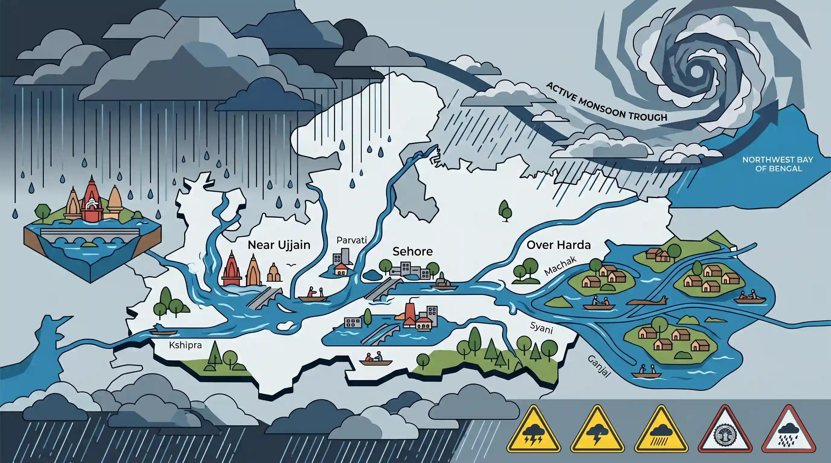
Heavy and continuous monsoon rainfall lashed Madhya Pradesh on July 5–6, 2026, causing widespread river flooding, submerging bridges, and isolating rural communities. Key rivers like the Kshipra in Ujjain, Parvati in Sehore, and the Machak, Syani, and Ganjal in Harda overflowed. Driven by a well-marked low-pressure area over the northwest Bay of Bengal and an active monsoon trough, the India Meteorological Department (IMD) predicted continued widespread rainfall and issued heavy weather alerts for several districts.
Key Points
- Meteorological Drivers: The intense rainfall across Madhya Pradesh in July 2026 is driven by a well-marked low-pressure area (depression) over the northwest Bay of Bengal and an active, region-wide monsoon trough.
- Affected Rivers & Tributaries: Torrential rains led to the overflowing of major and minor river systems in the state: Kshipra (tributary of Chambal) submerged temples near Ram Ghat in Ujjain; Parvati (tributary of Chambal) swelled in Sehore; and local streams/tributaries of Narmada like Machak, Syani, and Ganjal overflowed in Harda district, disrupting rural connectivity.
- Monsoon Pattern in MP: The weather activity reflects the classic tropical monsoon climate of Madhya Pradesh, which heavily relies on the Bay of Bengal and Arabian Sea branches of the southwest monsoon for over 85-90% of its annual precipitation.
- Administrative Alerts: The IMD issued high-level alerts for heavy to very heavy rain, lightning, and gusty winds for multiple districts, including the newly formed district of Pandhurna, alongside Betul, Mandla, Balaghat, and Seoni.
Important Terms
India Meteorological Department (IMD)

India's principal government agency, under the Ministry of Earth Sciences, responsible for meteorological observations, weather forecasting, and seismology.
UPSC context
GS Paper I (Geography) & Paper III (Disaster Management); tests knowledge of national climate-monitoring bodies and disaster preparedness.
Monsoon Trough
An elongated, low-pressure belt extending across the Indo-Gangetic Plain that represents the continental extension of the Inter-Tropical Convergence Zone (ITCZ) during the southwest monsoon.
UPSC context
GS Paper I (Physical Geography); tests understanding of the Indian monsoon mechanics and precipitation distribution.
Low-Pressure Area (LPA)
An atmospheric region where pressure is lower than surrounding areas, enclosed by a closed isobar, characterized by rising air, convergence, cloud formation, and precipitation.
UPSC context
GS Paper I (Climatology/Geography); tests knowledge of cyclonic systems, weather formations, and pressure gradients in physical geography.
Kshipra River
A major river in Madhya Pradesh rising in the Vindhya Range, flowing north across the Malwa Plateau to join the Chambal River, sacred for the Simhastha Kumbh Mela.
UPSC context
GS Paper I (Indian Geography); tests familiarity with central Indian river systems, their tributaries, and associated cultural sites.
Parvati River
A key river in central India originating in the Vindhya Range of Sehore district, Madhya Pradesh, flowing northward to join the Chambal River as a major tributary.
UPSC context
GS Paper I (Indian Geography/River Interlinking); tests knowledge of Chambal River tributaries and regional water projects like PKC.
Prelims Trap
All rivers originating in the Vindhya Range flow southwards or westwards to join the Narmada or Tapi systems.
Aspirants often assume rivers originating in the Vindhyas flow southward into the Narmada rift valley, whereas key rivers like Chambal, Kshipra, and Parvati flow north/north-east into the Yamuna/Ganga system.
Static Concepts Connected
What governs the drainage patterns and water divides of Central India?
- Water Divide: The Vindhya and Satpura ranges act as the primary water divide, separating the extra-peninsular Ganga basin from peninsular river systems.
- Northward Slope: Rivers like Chambal, Betwa, Kshipra, and Son flow north/north-east due to the northward slope of the Malwa Plateau.
- Rift Valley Flow: The Narmada and Tapi flow westwards through rift valleys formed due to tectonic divergence, bypassing the general eastward tilt of the peninsula.
How do the two branches of the Southwest Monsoon interact over Central India?
- Monsoon Convergence: Central India, particularly Madhya Pradesh, acts as the primary zone of convergence for the Arabian Sea and Bay of Bengal monsoon branches.
- East-West Gradient: Rainfall decreases from east to west because the Bay of Bengal branch gradually loses its moisture payload as it travels inland.
- Orographic Uplift: The Satpura-Maikal ranges force moisture-laden winds upward, causing high orographic precipitation in southeastern districts like Balaghat and Mandla.
Cross-Topic Patterns
Hydrology + Disaster Risk Reduction
Changes in river hydrology due to extreme rain require integrating geomorphological mapping of minor tributaries into State Disaster Management Plans to mitigate localized flash floods.
Administrative Reorganization + Disaster Resilience
The creation of new administrative units like Pandhurna necessitates immediate decentralization of localized flood-forecasting and disaster response infrastructure.

Expect multi-statement questions linking minor Central Indian tributaries (Ganjal, Kshipra, Kanhan) to their correct primary river basins.
Linked PYQs · 5
Linked PYQs · 5
- 2021MPPSC_PRELIMSGS1
| List-I (Tributaries) | List-II (Rivers) | |---------------------|----------------| | A. Betwa | ii. Yamuna | | B. Kshipra | iii. Narmada | | C. Vainganga | iv. Godavari | | D. Tawa | i. Chambal | Codes:
- 2018MPPSC_PRELIMSGS1
Which one of the following rivers does not join river Chambal?
- 2024MPPSC_PRELIMSGS1
The south-eastern part of Madhya Pradesh receives maximum rainfall from :
- 2025MPPSC_PRELIMSGS1
Read the following statements regarding the climate of Madhya Pradesh and select the correct answer from the codes given below: 1. Most of the rainfall in the state is received from the monsoon. 2. Wind speed during winters is faster than in summer and rainy seasons. 3. Distance from sea also affects the distribution of monsoon rains in the state. 4. Summer temperature in Pachmarhi is related to the altitude above sea level. Codes:
- 2018MPPSC_PRELIMSGS1
The climate of Madhya Pradesh is
