Protests and Hunger Strike Against Ken Betwa Project in Madhya Pradesh
Source:etv-bharat ↗
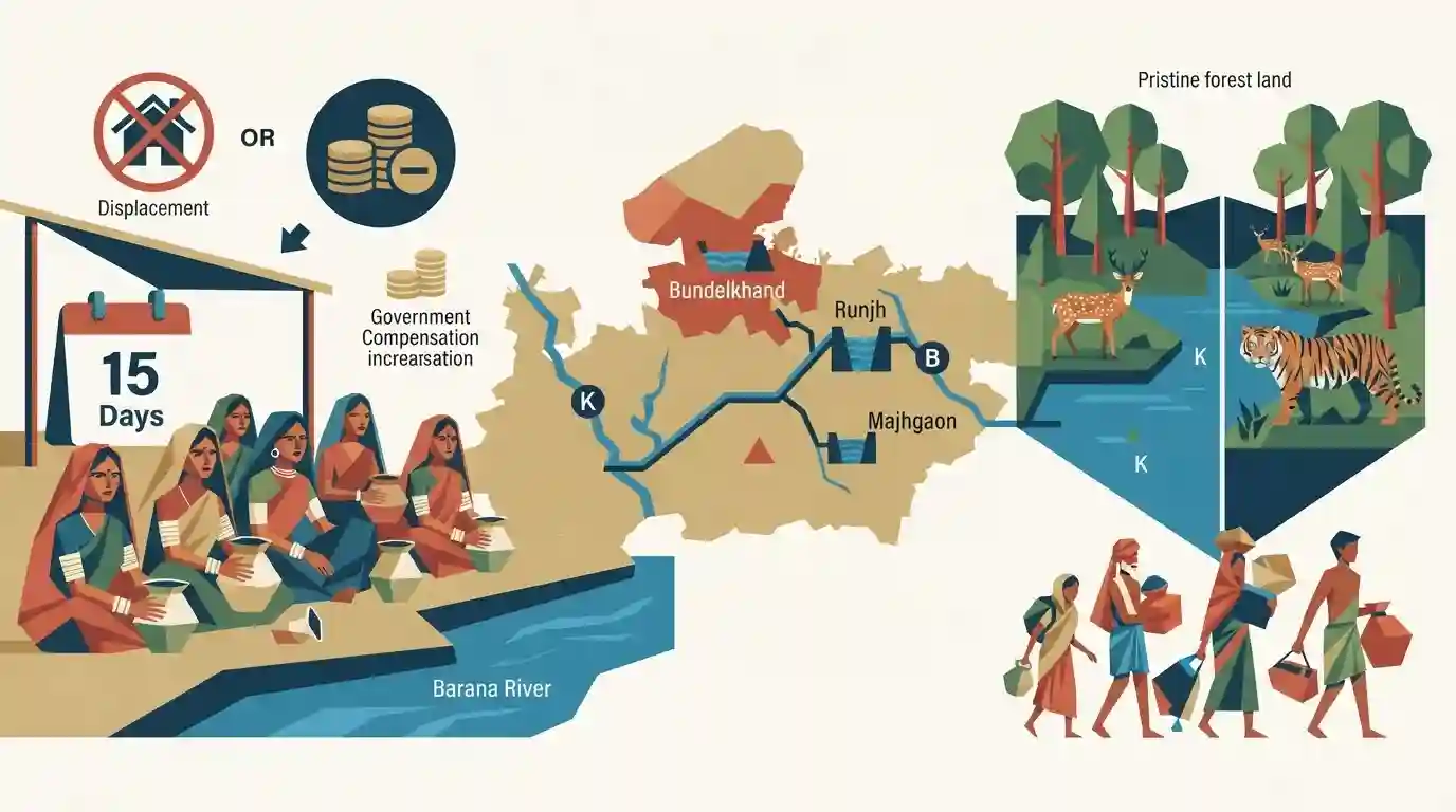
Why It Matters
The Ken-Betwa link project is India's first river interlinking project under the National Perspective Plan, carrying massive environmental (submerging part of Panna Tiger Reserve) and socioeconomic (displacement of tribal families) consequences in the Bundelkhand region. It is highly relevant for MPPSC questions regarding state rivers, irrigation schemes, and protected areas.
Summary
A prolonged hunger strike by local, mostly tribal, women has entered its 15th day in Chhatarpur district, Madhya Pradesh, opposing the Ken-Betwa river interlinking project and the Runjh and Majhgaon irrigation schemes. Protestors stationed near the Barana river highlight unresolved displacement and rehabilitation grievances, even after the state government recently sanctioned an additional Rs 202.50 crore to increase family compensation from Rs 5 lakh to Rs 12.50 lakh. The Ken-Betwa project, designed to quench the arid Bundelkhand region, remains contentious due to large-scale displacement and the submergence of pristine forest land within the Panna Tiger Reserve.
Key Points
- A hunger strike by local tribal women in Chhatarpur district against the Ken-Betwa link and other irrigation projects has reached its 15th day.
- Protesters cite inadequate displacement and rehabilitation compensation despite a recent state government boost in relief amounts from Rs 5 lakh to Rs 12.50 lakh per family.
- The Ken-Betwa Link Project aims to transfer surplus water from the Ken river to the parched Betwa basin for irrigating Bundelkhand.
- The project faces severe environmental opposition as it submerges significant forest lands, including portions of the Panna Tiger Reserve.
Important Terms
Ken-Betwa Link Project

India's first major river interlinking initiative under the National Perspective Plan, designed to transfer surplus water from the Ken River in Madhya Pradesh to the water-deficit Betwa River in Uttar Pradesh.
UPSC context
GS Paper I & III: Geography, water resources, and environmental impacts of large-scale infrastructure projects.
National Perspective Plan
A framework formulated in 1980 for water resources development in India, managed by the National Water Development Agency, proposing 30 interbasin water transfer projects to balance surplus and deficit river basins.
UPSC context
GS Paper III: Infrastructure, irrigation, and inter-basin water transfer policies for addressing droughts and floods.
Runjh irrigation project
A medium irrigation scheme involving a composite dam on the Runjh River in Ajaygarh, Panna district, Madhya Pradesh, designed to irrigate over 12,000 hectares but facing local protests over displacement.
UPSC context
GS Paper I & III: Regional geography of Madhya Pradesh and socio-environmental impacts of local dam projects.
Majhgaon irrigation project
A medium irrigation scheme in Panna district, Madhya Pradesh, involving a 33-metre-high dam on the Bada Nala (a Ken River tributary) to irrigate 9,900 hectares, contested due to rehabilitation delays.
UPSC context
GS Paper I & III: Madhya Pradesh geography, tribal resettlement policies, and micro-irrigation conflicts.
Prelims Trap
The project transfers surplus water from the Betwa river basin to the water-deficit Ken basin.
It is exactly the reverse: Ken is the surplus river and Betwa is the water-deficit basin. UPSC frequently reverses directional flows of interlinking schemes to trap candidates.
Static Concepts Connected
What is the National Perspective Plan (NPP) for water resources development?
- Origin & Objective: Formulated in 1980 by the Ministry of Irrigation to address regional water imbalances through massive inter-basin water transfers.
- Two Components: Divided into the Himalayan Rivers Development Component and the Peninsular Rivers Development Component.
- Nodal Agency: The National Water Development Agency (NWDA) is the nodal agency tasked with carrying out feasibility studies under the NPP.
What are the ecological features of the Panna Tiger Reserve?
- Geographic Terrain: Characterized by a discontinuous 'Table Top' plateau topography within the Vindhyan hill range of Madhya Pradesh.
- Flora Indicator: Represents the absolute northernmost limit of natural teak (Tectona grandis) forest distribution in India.
- Hydrology: The Ken River flows northwards through the reserve, hosting a vital sanctuary for the endangered Gharial.
Cross-Topic Patterns
ILR Projects + Tribal Land Rights
Mega-water projects in Scheduled V areas highlight the governance gap between state land acquisition acts and the LARR Act 2013 safeguards for displaced tribal populations.
Eco-Compensation vs SDG Targets
Inter-basin transfers solve Bundelkhand's SDG 6 (Clean Water) goals but directly compromise SDG 15 (Life on Land) by fragmenting pristine deciduous ecosystems.

2026 Prelims may test Yamuna's right-bank tributaries alongside the micro-ecology of Panna, specifically its teak distribution limit.
Linked PYQs · 4
Linked PYQs · 4
- 2023MPPSC_PRELIMSGS1
Which of the following rivers of Madhya Pradesh flows in three states?
- 2020MPPSC_PRELIMSGS1
Betwa river originate from
- 2025MPPSC_PRELIMSGS1
Match List-I with List-II and select the correct answer using the codes given below the lists: | List-I (River) | List-II (Place/Town) | |---------------------|----------------------| | (i) Betwa | 1. Balaghat | | (ii) Tapti (Tapi) | 2. Ujjain | | (iii) Kshipra | 3. Multai | | (iv) Wainganga | 4. Orchha | Codes: (i) (ii) (iii) (iv)
- 2020MPPSC_PRELIMSGS1
Panna district of Madhya Pradesh famous for which mineral?
