Heavy rainfall triggers flood-like conditions across Madhya Pradesh
Source:freepressjournal ↗
Why It Matters
Understanding the monsoon climate, rainfall distribution, and major river basins (like the Narmada) is a core component of the MPPSC Prelims Geography syllabus. This event highlights the practical impact of regional rainfall variations.
Summary
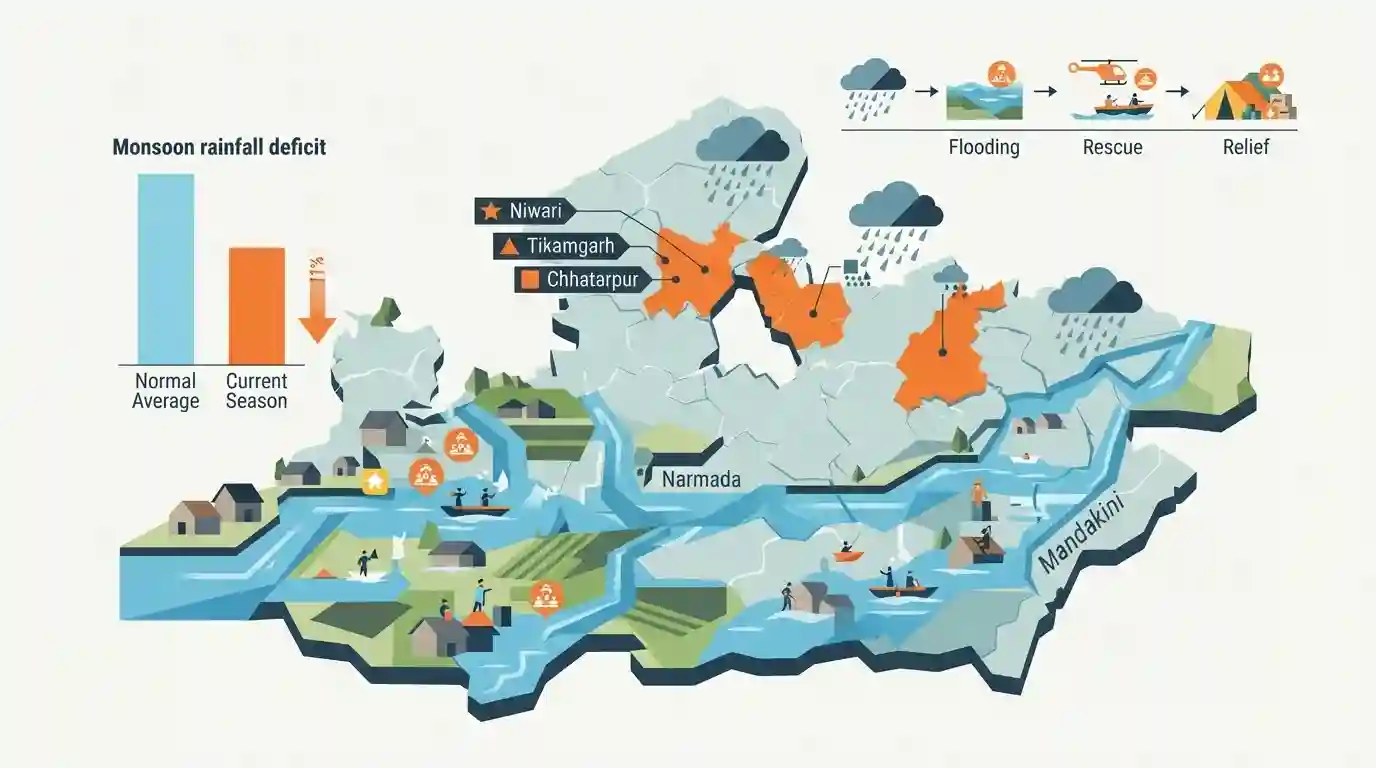
Recent heavy rains have triggered flood-like conditions across several districts in Madhya Pradesh, prompting alerts in 16 districts including Niwari, Tikamgarh, and Chhatarpur. Major rivers such as the Narmada and Mandakini are flowing above their danger levels. Despite these extreme weather events, the state's cumulative monsoon rainfall remains approximately 11% below the normal average for the season.
Key Points
- Intense rainfall driven by active weather systems has led to flood-like conditions in Madhya Pradesh, placing 16 districts on alert.
- Water levels in major rivers, particularly the Narmada and Mandakini, have surged past their danger marks.
- Despite the recent heavy downpours, overall seasonal rainfall in the state remains at 599 mm, which is 11% below the normal average of 675.1 mm.
- Districts in the Bundelkhand region like Niwari, Tikamgarh, and Chhatarpur are heavily affected.
- The rainfall activity is expected to gradually shift towards the central and western parts of Madhya Pradesh.
Important Terms
Narmada River

The longest west-flowing river in India, originating from Madhya Pradesh's Amarkantak plateau. Flowing through a rift valley, this "Lifeline of Madhya Pradesh" drains into the Arabian Sea.
UPSC context
Tested heavily in MPPSC Paper 1 (Geography) regarding its 1312 km length, tributaries, rift valley flow, and major hydroelectric dams.
Mandakini River
A prominent river in the Bundelkhand region that flows through the sacred town of Chitrakoot. It is known for its deep religious significance and is susceptible to sudden flooding during heavy monsoons.
UPSC context
Crucial for MPPSC Paper 1 (Geography and Culture) due to its direct association with the major pilgrimage and tourism center of Chitrakoot.
Niwari District
A district in Madhya Pradesh's Bundelkhand region, formed in 2018 by bifurcating Tikamgarh. It is currently the state's smallest district by both area and population, and houses the historic town of Orchha.
UPSC context
A frequent MPPSC Prelims fact regarding state administration, demographic rankings (smallest district), and state geography.
India Meteorological Department (IMD)
The central agency under the Ministry of Earth Sciences responsible for weather forecasting, meteorological observations, and issuing extreme weather alerts—such as flood warnings—across India.
UPSC context
Relevant for MPPSC Paper 1 (Disaster Management) and Paper 3 (Science and Technology) concerning early warning systems and climate pattern predictions.
Prelims Trap
"Madhya Pradesh has recorded excess cumulative rainfall this monsoon due to severe floods in Bundelkhand."
Flash floods are driven by intense, localized, short-duration rainfall. Despite overflowing rivers in some districts, MP’s cumulative seasonal rainfall actually remains in deficit.
Static Concepts Connected
What are the key geographical facts about the Mandakini River in MP?
- Origin: It originates in the Satna district of Madhya Pradesh.
- Yamuna Tributary: It flows northwards and is an important tributary of the Yamuna River system.
- Cultural Significance: The famous religious and historical city of Chitrakoot is located on its banks, spanning the MP-UP border.
How is monsoon rainfall distributed geographically across Madhya Pradesh?
- Regional Gradient: Rainfall progressively decreases as one moves from the southeastern and eastern parts of the state toward the western and northwestern regions.
- Maximum Rainfall: Pachmarhi in the Narmadapuram district records the highest average annual rainfall in the state (over 212 cm).
- Minimum Rainfall: Gohad in the Bhind district (northwestern MP) records the state's lowest average rainfall at approximately 55 cm.
Cross-Topic Patterns
Bundelkhand districts & Sagar Division
Floods in Niwari, Tikamgarh, and Chhatarpur bring focus to the Sagar Division. MPPSC frequently tests the administrative grouping of these 6 core Bundelkhand districts in Prelims.
Paradox of localized flash floods
The phenomenon of rivers breaching danger marks while the state faces an 11% rainfall deficit highlights climate volatility, linking MP Geography directly to Mains Disaster Management topics.

Expect statement-based questions contrasting localized floods in Bundelkhand rivers (Mandakini) with the state's overall rainfall deficit.
Linked PYQs · 4
Linked PYQs · 4
- 2018MPPSC_PRELIMSGS1
The climate of Madhya Pradesh is
- 2025MPPSC_PRELIMSGS1
Read the following statements regarding the climate of Madhya Pradesh and select the correct answer from the codes given below: 1. Most of the rainfall in the state is received from the monsoon. 2. Wind speed during winters is faster than in summer and rainy seasons. 3. Distance from sea also affects the distribution of monsoon rains in the state. 4. Summer temperature in Pachmarhi is related to the altitude above sea level. Codes:
- 2024MPPSC_PRELIMSGS1
The south-eastern part of Madhya Pradesh receives maximum rainfall from :
- 2018MPPSC_PRELIMSGS1
The second largest river basin of India is
