Leh Ladakh Earthquakes and Himalayan Tectonic Vulnerability
Source:Indian Express ↗
Why It Matters
Continuous seismic activity in the Himalayas is a prime topic for both Prelims (geography/apps like BhooKamp) and Mains (GS1 physical geography, GS3 disaster vulnerability). Understanding how nodal agencies track and disseminate this information is critical for disaster management answers.
Summary
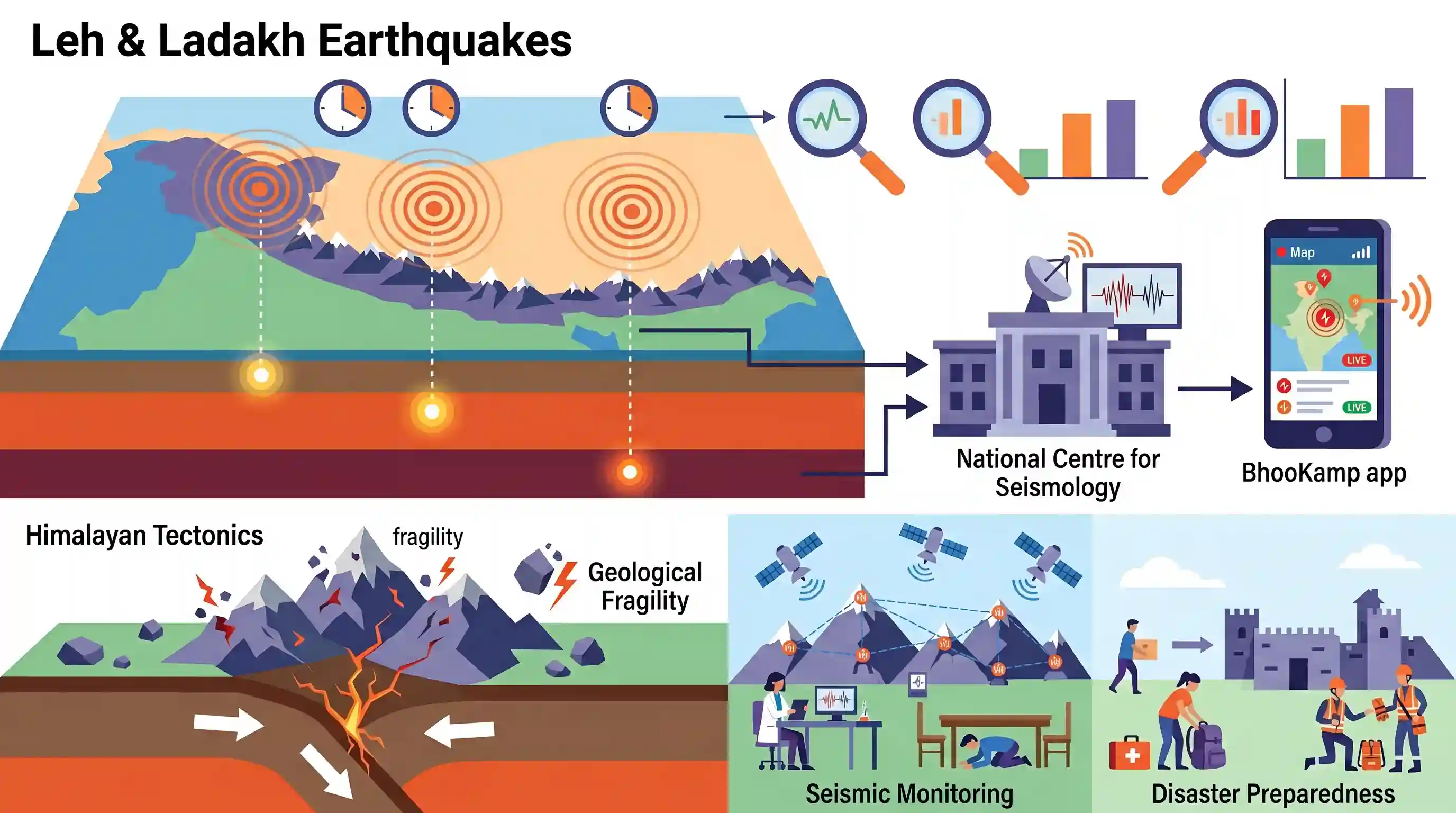
The Leh and Ladakh regions experienced a sequence of three earthquakes within just two hours, with magnitudes varying from 3.9 to 4.8. According to the National Centre for Seismology (NCS), these seismic events occurred at depths between 10 km and 44 km. Real-time earthquake parameters were communicated through the BhooKamp app. The cluster of tremors underscores the region's geological fragility and reiterates the importance of continuous seismic monitoring and disaster preparedness in the Himalayas.
Key Points
- Three consecutive earthquakes, with magnitudes ranging from 3.9 to 4.8, struck the Leh and Ladakh regions within a span of two hours.
- The epicenters of the quakes were recorded at varying depths of 44 km, 10 km, and 28 km by the National Centre for Seismology (NCS).
- Seismic data and alerts were promptly disseminated to the public via the NCS's BhooKamp mobile application.
- The frequent tremors highlight the persistent seismic vulnerability of the Himalayan tectonic zone.
Important Terms
National Centre for Seismology (NCS)

The nodal agency of the Government of India, under the Ministry of Earth Sciences, responsible for 24/7 monitoring of earthquake activity and conducting seismological research nationwide.
UPSC context
GS Paper I (Physical Geography) and GS Paper III (Disaster Management); tests knowledge of institutional frameworks for disaster monitoring.
BhooKamp App
A mobile application developed by the National Centre for Seismology to provide real-time earthquake alerts, location data, and magnitude information to the public and disaster management authorities.
UPSC context
GS Paper III (Science & Technology/Disaster Management); relates to technology-driven early warning systems and public awareness.
Seismic Zones in India
A classification of India's landmass into regions (Zones II to VI) based on earthquake intensity and frequency, as defined by the Bureau of Indian Standards (BIS).
UPSC context
GS Paper I (Geography); critical for understanding regional vulnerability. Note the 2025 update introducing Zone VI for the Himalayan arc.
Himalayan Tectonics
The geological process of the Indian Plate colliding with the Eurasian Plate, causing the folding and uplift of the Himalayas and creating a high-risk seismic belt.
UPSC context
GS Paper I (Physical Geography); core concept for Indian physiography and seismic hazard analysis.
Seismic Hazard Microzonation
A technical study that classifies urban areas into sub-zones based on local soil conditions and geology to determine site-specific earthquake risk for safer urban planning.
UPSC context
GS Paper III (Disaster Management); relevant for mitigation strategies, building codes, and urban resilience.
National Seismological Network (NSN)
A nationwide web of 150+ seismological observatories maintained by the NCS that records ground motion and provides data for rapid earthquake characterization.
UPSC context
GS Paper III (Infrastructure/Disaster Management); focuses on the physical monitoring infrastructure vital for national security and safety.
Prelims Trap
"The National Centre for Seismology (NCS) is an agency functioning under the National Disaster Management Authority (NDMA) or Ministry of Home Affairs."
NCS is an attached office of the Ministry of Earth Sciences (MoES). While NDMA (under MHA) handles disaster response, MoES handles scientific monitoring.
Static Concepts Connected
Why is the Himalayan and Ladakh region highly susceptible to earthquakes?
- Continental collision: The continuous convergent movement and underthrusting of the Indian plate beneath the Eurasian plate at 40-50 mm/year builds immense tectonic strain.
- Active fault lines: The presence of major fault lines like the Main Central Thrust (MCT) and Main Boundary Thrust (MBT) periodically release this accumulated stress.
- Shallow foci: Earthquakes here often have shallow depths (0-70 km), which cause greater surface destruction because seismic energy reaches the surface with less attenuation.
How is earthquake monitoring and hazard classification managed in India?
- Seismic Zoning: The Bureau of Indian Standards (BIS) historically classified the country into Seismic Zones II to V based on tectonic setup and historical seismicity.
- Nodal Agency: NCS, under the Ministry of Earth Sciences, serves as the nodal agency monitoring earthquake activity via the National Seismological Network.
- BhooKamp App: It disseminates real-time earthquake parameters, location, and magnitude to the public and disaster authorities for rapid response.
Cross-Topic Patterns
Himalayan seismicity vs. Border Infra
The frequent tremors in Ladakh complicate engineering for strategic border infrastructure like the Zojila Tunnel, highlighting the friction between tectonic fragility and border security needs.
Disaster Tech and E-Governance
Tools like the BhooKamp App mirror other early-warning systems (e.g., Damini for lightning), demonstrating a governance shift towards mobile-first, real-time disaster alert mechanisms.

Expect a mixed Prelims statement linking NCS's parent ministry, the BhooKamp app, and the destructive mechanics of shallow-focus quakes.
Linked PYQs · 3
Linked PYQs · 3
- 2021MainsGS3
Discuss about the vulnerability of India to earthquake related hazards. Give examples including the salient features of major disasters caused by earthquakes in different parts of India during the last three decades.
- 2019MainsGS3
Disaster preparedness is the first step in any disaster management process. Explain how hazard zonation mapping will help disaster mitigation in the case of landslides.
- 2025MainsGS1
Discuss how the changes in shape and sizes of continents and ocean basins of the planet take place due to tectonic movements of the crustal masses.
