Chamoli Landslides and Jyotirmath Village Evacuation
Source:newindianexpress ↗
Why It Matters
Landslides and flash floods are chronic geohazards in Uttarakhand. Questions assessing the vulnerability of the region, the impact of natural calamities, and the geographical location of key pilgrimage sites and river routes are highly recurrent in the UKPSC PCS Prelims examination.
Summary
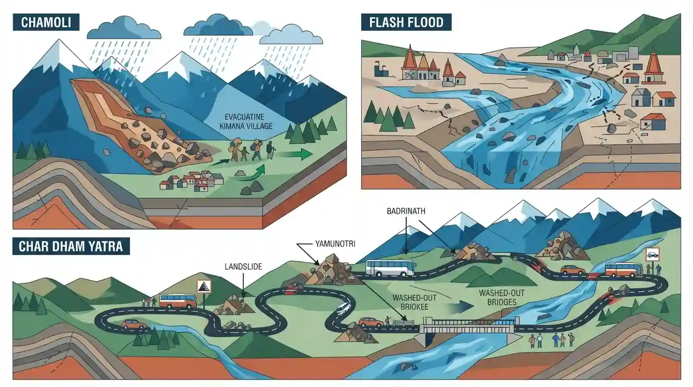
Recent intense monsoon rains in Uttarakhand have triggered devastating landslides and flash floods, particularly impacting Chamoli district. In Jyotirmath's Kimana village, active landslides have forced families to evacuate. Furthermore, unexpected flash floods in dry riverbeds near Haridwar caused significant damage. The extreme weather events severely disrupted the Char Dham Yatra by blocking key transport routes to Yamunotri and Badrinath, underscoring the state's persistent vulnerability to geomorphological hazards.
Key Points
- Severe monsoon rains triggered extensive landslides in Chamoli district's Jyotirmath block, forcing residents of Kimana village to flee their homes.
- Flash floods were reported in normally dry seasonal rivers, notably sweeping away vehicles near Haridwar's Kharkhari cremation ground.
- Heavy rainfall severely damaged vital transportation infrastructure, blocking major arterial routes including the Nandprayag-Nandanagar and Pokhari-Gopeshwar motor roads.
- The recurrent landslides and road closures have disrupted the Char Dham Yatra, significantly affecting the Yamunotri and Badrinath pilgrim routes.
- The disaster highlights the extreme vulnerability of Uttarakhand's fragile Himalayan geology to climate-driven hazards.
Prelims Trap
Jyotirmath (Joshimath) is highly prone to land subsidence because it sits directly on active fault lines of solid granite bedrock.
Joshimath does not rest on solid bedrock; it is built on a highly unstable, unconsolidated deposit of ancient landslide debris and glacial moraines.
Static Concepts Connected
Why is the Himalayan region uniquely vulnerable to frequent landslides?
- Tectonic Activity: Ongoing collision of Indian and Eurasian plates causes high seismicity (Zone V) and extensively fractured rock formations.
- Glacial Moraines: Many settlements, including Joshimath, sit on loose, unconsolidated glacial and landslide debris rather than stable bedrock.
- Hydrological Triggers: Intense monsoonal downpours and cloudbursts rapidly saturate soil, increasing pore water pressure and triggering slope failures.
What is Landslide Hazard Zonation (LHZ)?
- Definition: Mapping technique classifying areas based on slope stability, lithology, and structural features to predict landslide susceptibility.
- NDMA Strategy: Mandated under National Landslide Risk Management Strategy to restrict unscientific development in high-risk zones.
Cross-Topic Patterns
Tourism infrastructure vs Ecological capacity
Rapid expansion of religious tourism corridors like Char Dham exacerbates slope instability through heavy blasting and unscientific slope cutting.
Climate change and hydro-disasters
Erratic cloudbursts trigger flash floods in dry, seasonal channels, highlighting how shifting precipitation regimes bypass traditional disaster zoning.

Himalayan slope instability, glacial moraine foundations, and LHZ regulations will likely feature as a GS-1/GS-3 integrated question.
Linked PYQs · 2
Linked PYQs · 2
- 2007UKPSC_PRELIMSGS1
Which of the following Natural Calamity has the most devastating impact in Uttarakhand State?
- 2025UKPSC_PRELIMSGS1
Which of the following is the correct order of rivers from west to east in Uttarakhand?
