Papua New Guinea Landslide Highlights Mountainous Terrain Risks
Source:The Hindu ↗
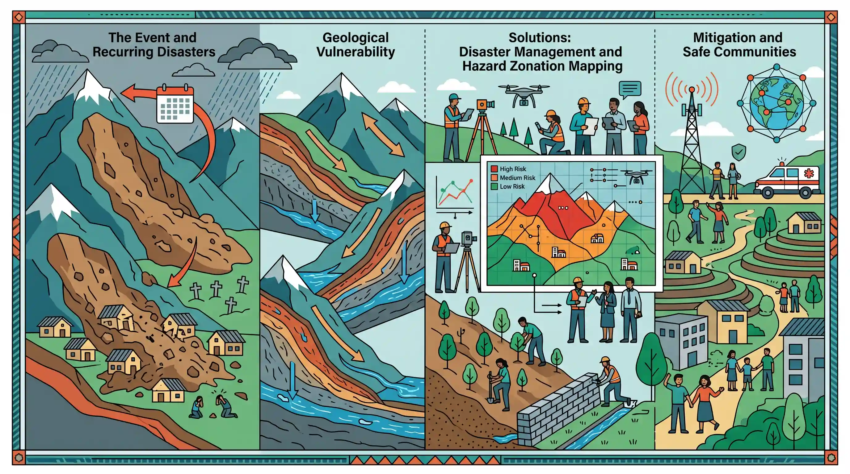
Why It Matters
Serves as a grim international case study on the devastating impacts of recurring landslides, highlighting the urgent need for structural and non-structural mitigation measures, hazard zonation, and disaster preparedness in geologically fragile regions.
Summary
A devastating landslide in Papua New Guinea’s Enga province has claimed at least 21 lives after flattening homes in the village of Kukas. The tragedy strikes a highland region that experienced another catastrophic landslide the previous year, leaving hundreds dead. These recurring disasters emphasize the extreme geological vulnerability of mountainous terrains and highlight the global necessity for implementing effective disaster management, vulnerability mapping, and mitigation strategies to protect at-risk communities.
Key Points
- A devastating landslide in Papua New Guinea's Enga province killed at least 21 people, completely flattening homes in Kukas village.
- The tragedy occurred just over a year after another massive landslide in the same province claimed between 670 and 2,000 lives.
- The recurrent nature of such events highlights the severe geographical vulnerability of highland and mountainous terrains to slope failures.
- This disaster underscores the pressing global need for robust disaster mitigation strategies, including hazard zonation mapping and community preparedness.
Important Terms
Landslide Hazard Zonation (LHZ)

Classification of land into homogeneous areas ranked by their potential for landslides based on geology, slope, and rainfall factors.
UPSC context
GS Paper I (Geography) and GS III (Disaster Management); tests knowledge of risk assessment tools for mountainous regions.
Vulnerability Mapping
A cartographic tool used to identify the spatial distribution of risks and the susceptibility of populations or infrastructure to natural hazards.
UPSC context
GS Paper III (Disaster Management); essential for disaster preparedness and formulating localized mitigation plans.
Disaster Mitigation
Proactive measures and strategies implemented before an emergency to eliminate or reduce the long-term risk and impacts of disasters.
UPSC context
GS Paper III (Disaster Management); tests the ability to suggest non-structural and structural preventive measures.
Disaster Management
An integrated process of planning, organizing, and implementing measures necessary for prevention, mitigation, preparedness, response, and recovery from disasters.
UPSC context
GS Paper III (Disaster Management); core syllabus topic covering the DM Act 2005 and institutional frameworks like NDMA.
United Nations (UN)
Global intergovernmental organization that establishes international frameworks (e.g., Sendai Framework) and provides humanitarian assistance through agencies like UNDRR and OCHA.
UPSC context
GS Paper II (International Relations) and GS III (DM); focuses on global cooperation and international disaster risk reduction.
Australian Broadcasting Corp (ABC)
Australia’s public broadcaster; a primary source of information for reporting on disasters and geopolitical shifts in the Indo-Pacific region.
UPSC context
GS Paper II (IR); relevant for regional stability and information exchange under India's Act East policy.
Prelims Trap
The National Disaster Management Authority (NDMA) is the nodal agency for landslide hazard zonation mapping in India.
The Geological Survey of India (GSI) is the nodal agency for landslide studies and mapping, while NDMA issues broader policy guidelines.
Static Concepts Connected
What are the key parameters evaluated in Landslide Hazard Zonation Mapping (LHZM)?
- Slope morphometry: Steepness and shape of the terrain heavily dictate shear stress and susceptibility to failure.
- Lithology and structure: The underlying rock types, soil characteristics, and structural weaknesses (faults/joints) determine inherent stability.
- Triggering factors: Rainfall intensity and seismic activity act as the primary catalysts for destabilizing slopes.
- Land-use patterns: Current vegetation, deforestation rates, and construction stress alter the natural slope equilibrium.
How does tectonic activity trigger landslides in the Ring of Fire?
- Tectonic uplift: Continuous plate convergence pushes mountain ranges upward, creating unnaturally steep, unstable slopes prone to gravity-driven collapse.
- Ground acceleration: Seismic waves from earthquakes overcome the shear strength of slope materials, triggering sudden mass movements.
- Soil liquefaction: Intense shaking forces waterlogged soils to lose structural integrity, turning solid ground into a mobile slurry.
Cross-Topic Patterns
Landslides + Mountain carrying capacity
Highland vulnerability in PNG mirrors India's Himalayan instability, making the carrying capacity of mountain terrains and infrastructure projects (like Char Dham) highly relevant for GS-3.
Ring of Fire + Induced secondary hazards
UPSC frequently shifts focus from primary disasters (earthquakes/volcanism) to secondary induced hazards like massive slope failures along the tectonically active Pacific Ring of Fire.

Expect a multi-statement Prelims question linking tectonic triggers (Ring of Fire) with India's LHZM and GSI's nodal role in mapping.
Linked PYQs · 4
Linked PYQs · 4
- 2021MainsGS3
Describe the various causes and the effects of landslides. Mention the important components of the National Landslide Risk Management Strategy.
- 2019MainsGS3
Disaster preparedness is the first step in any disaster management process. Explain how hazard zonation mapping will help disaster mitigation in the case of landslides.
- 2021MainsGS1
Differentiate the causes of landslides in the Himalayan region and Western Ghats.
- 2016MainsGS1
The Himalayas are highly prone to landslides. Discuss the causes and suggest suitable measures of mitigation.
