ISRO Launches NVS-03 Navigation Satellite for NavIC Expansion
Source:Indian Express ↗
Why It Matters
The successful launch of NVS-03 is crucial for expanding and modernizing India's indigenous regional navigation system (NavIC), enhancing strategic independence, positioning accuracy, and technological self-reliance in space infrastructure.
Summary
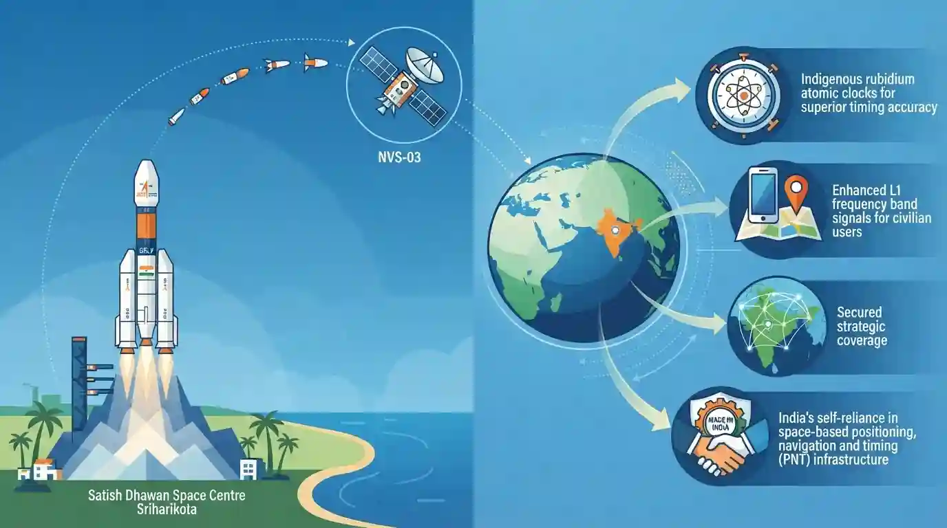
ISRO successfully launched the NVS-03 navigation satellite into its designated orbit using a GSLV rocket from the Satish Dhawan Space Centre in Sriharikota. Part of the second-generation Navigation with Indian Constellation (NavIC) series, NVS-03 incorporates advanced features including indigenous rubidium atomic clocks for superior timing accuracy, enhanced L1 frequency band signals for civilian users, and secured strategic coverage. This milestone reinforces India's self-reliance in space-based positioning, navigation, and timing (PNT) infrastructure.
Key Points
- ISRO successfully launched the NVS-03 navigation satellite into its designated orbit using a GSLV rocket from Sriharikota.
- NVS-03 is part of the second-generation Navigation with Indian Constellation (NavIC) series, designed to provide enhanced positioning, navigation, and timing (PNT) services.
- The satellite features indigenous rubidium atomic clocks, enhancing precision, timing accuracy, and national security capabilities.
- NavIC serves both civilian and strategic applications across India and surrounding regions up to 1,500 km.
Important Terms
NavIC

India's regional satellite navigation system, formerly known as IRNSS, providing accurate position, navigation, and timing services across India and surrounding regions up to 1,500 km.
UPSC context
UPSC Prelims/Mains (GS Paper III): Space Technology, indigenous navigation systems, strategic self-reliance, and dual-use space infrastructure.
NVS-03
The third second-generation navigation satellite launched by ISRO under the NavIC series, featuring indigenous rubidium atomic clocks and enhanced L1 frequency signals.
UPSC context
UPSC Prelims: Key updates on ISRO missions, satellite technology, and improvements in civilian positioning accuracy.
ISRO
India's national space agency responsible for planning, developing, and executing space exploration, launch vehicles, and satellite-based navigation and communication systems.
UPSC context
UPSC Prelims/Mains (GS Paper III): Achievements of Indians in science & technology and institutional framework of space policy.
Prelims Trap
NavIC provides global coverage
NavIC is a regional navigation satellite system (IRNSS), covering only the Indian mainland and an extended region up to 1,500 km around it, unlike global systems like GPS or Galileo.
Static Concepts Connected
What are the key technical parameters and service areas of India's NavIC system?
- Service Area: Regional coverage spans the Indian mainland plus an extended area of up to 1,500 km beyond its borders.
- Frequency Bands: Utilizes L5 and S bands, with second-generation NVS satellites adding the civilian-friendly L1 frequency band.
- Atomic Clocks: Features indigenous Rubidium Atomic Frequency Standards (RAFS) to ensure precise timing accuracy and independence from foreign imports.
- Service Types: Divided into Standard Position Service (SPS) for civilian users and Restricted Service (RS) for strategic users.
Cross-Topic Patterns
NavIC L1 Band & Civil-Military Fusion
NavIC's integration of the L1 band mirrors the dual-use technology strategy seen in Defence Indigenization, bridging commercial smartphone accessibility and encrypted military navigation requirements.

NavIC coverage specs (1500 km range, L1/L5/S bands, rubidium atomic clocks) are high-yield static traps for prelims matching questions.
Linked PYQs · 2
Linked PYQs · 2
- 2018PrelimsGS1
With reference to the Indian Regional Navigation Satellite System (IRNSS), consider the following statements: 1. IRNSS has three satellites in geostationary and four satellites in geosynchronous orbits. 2. IRNSS covers entire India and about 5500 sq. km beyond its borders. 3. India will have its own satellite navigation system with full global coverage by the middle of 2019. Which of the statements given above is/are correct?
- 2015MainsGS3
What do you understand by 'Standard Positioning Systems' and 'Precision Positioning Systems' in the GPS era? Discuss the advantages India perceives from its ambitious IRNSS programme employing just seven satellites.
