ISRO Launches NVS-03 Satellite for NavIC Constellation
Source:Indian Express ↗
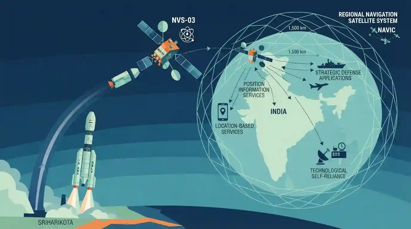
Why It Matters
Important for understanding India's indigenous space infrastructure, strategic navigation capabilities (NavIC), and advancements in launch vehicle technology (GSLV).
Summary
ISRO launched the NVS-03 navigation satellite on board the GSLV-F18 rocket from Sriharikota, bolstering India's second-generation NavIC satellite constellation. NavIC (Navigation with Indian Constellation) is India's regional navigation satellite system designed to provide accurate position information services to users in India and the region extending up to 1,500 km around it. The inclusion of advanced satellites like NVS-03 with enhanced features like indigenous rubidium atomic clocks strengthens India's technological self-reliance, strategic defense applications, and commercial location-based services.
Key Points
- ISRO successfully launched the NVS-03 navigation satellite using the GSLV-F18 launch vehicle from Sriharikota.
- NVS-03 is part of India's second-generation NavIC (Navigation with Indian Constellation) satellite series, which provides regional positioning, navigation, and timing services.
- The GSLV deployment ensures precise orbital placement for high-altitude navigation satellites equipped with indigenous rubidium atomic clocks.
- NavIC enhances strategic autonomy, disaster management, fleet management, and location-based services across India and surrounding regions.
Important Terms
NavIC

India's independent regional satellite navigation system (formerly IRNSS) providing accurate position, navigation, and timing services to India and surrounding regions up to 1,500 km.
UPSC context
UPSC Prelims/Mains (GS Paper III - Space Technology): Tests understanding of indigenous satellite navigation systems and strategic autonomy.
NVS-03
The third satellite in India's second-generation NavIC series, featuring an indigenous rubidium atomic clock and an L1 frequency band for enhanced civilian and commercial applications.
UPSC context
UPSC Prelims: Important for current developments in space payloads, indigenous technology (rubidium atomic clocks), and constellation restoration.
GSLV-F18
ISRO's Geosynchronous Satellite Launch Vehicle used to carry heavy payloads like the NVS-03 navigation satellite into geosynchronous transfer orbit.
UPSC context
UPSC Prelims: Tests knowledge of ISRO launch vehicle configurations and mission designations.
ISRO
India's national space agency responsible for planning, executing, and deploying space-based applications, research, and launch vehicle technologies.
UPSC context
UPSC Prelims/Mains (GS Paper III - Science & Tech): Fundamental institutional body for India's achievements in space exploration.
Prelims Trap
NavIC is India's global satellite navigation system providing uninterrupted positioning worldwide.
NavIC is a regional navigation system covering India and 1,500 km around it, not a global system like GPS or Galileo.
Static Concepts Connected
What are the key features, orbits, and services of India's NavIC system?
- Coverage Area: Regional coverage area spanning India and 1,500 km beyond its borders.
- Orbit Types: Comprises satellites in Geostationary (GEO) and Geosynchronous (GSO) orbits.
- Service Types: Provides Standard Position Service (SPS) for civilians and Restricted Service (RS) for strategic users.
- New Generation: Second-generation satellites introduce L1 band signals and indigenous rubidium atomic clocks for enhanced accuracy.
Cross-Topic Patterns
NavIC + Global Navigation Interoperability
NavIC's integration of the L1 frequency band directly mirrors GPS/Galileo civilian standards, bridging domestic self-reliance (Make in India) with global smartphone interoperability standards.
Space Tech + Strategic Self-Reliance
Indigenous rubidium atomic clocks demonstrate critical deep-tech manufacturing capabilities, intersecting with national initiatives on critical components and strategic autonomy.

NavIC's 1500km coverage, dual services (SPS/RS), and 2nd-gen L1 frequency upgrades are prime targets for a statement-based Prelims question.
Linked PYQs · 2
Linked PYQs · 2
- 2018PrelimsGS1
With reference to the Indian Regional Navigation Satellite System (IRNSS), consider the following statements: 1. IRNSS has three satellites in geostationary and four satellites in geosynchronous orbits. 2. IRNSS covers entire India and about 5500 sq. km beyond its borders. 3. India will have its own satellite navigation system with full global coverage by the middle of 2019. Which of the statements given above is/are correct?
- 2016MainsGS3
Discuss India's achievements in the field of Space Science and Technology. How the application of this technology has helped India in its socio-economic development?
