ISRO and Andhra University Launch AI Based Rip Current Study
Source:The Hindu ↗
Why It Matters
The application of AI and space technology to mitigate coastal hazards like rip currents represents a crucial intersection of GS3 S&T and Disaster Management, while also touching upon core GS1 Oceanography concepts. It showcases a modern, tech-driven approach to early warning systems and disaster resilience.
Summary
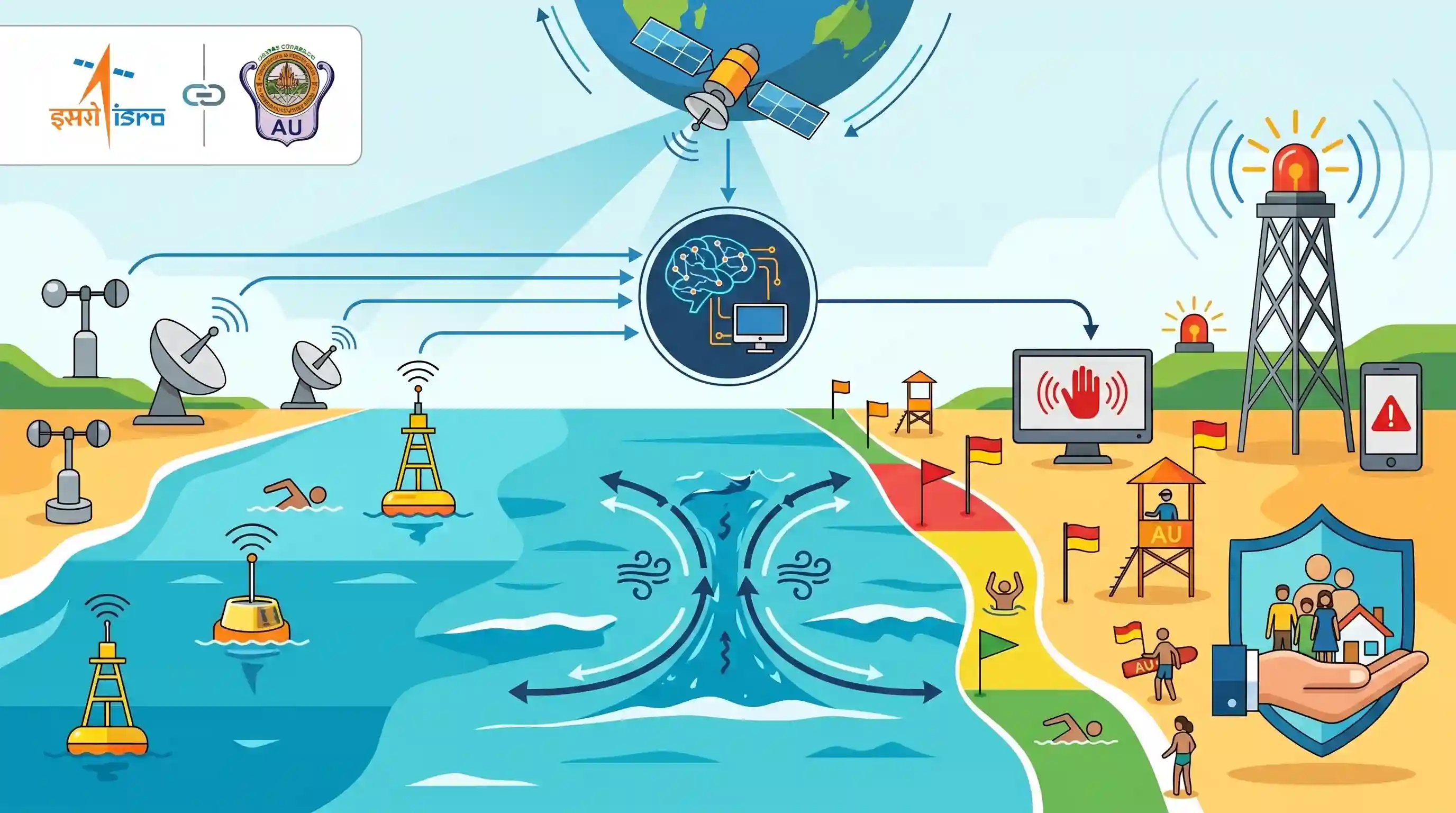
ISRO's Space Applications Centre (SAC) and Andhra University (AU) are collaborating on a two-year research project to study rip currents off the Visakhapatnam coast. The project will utilize satellite data and artificial intelligence to monitor oceanographic and atmospheric parameters, aiming to predict rip current occurrences and create early warning systems. This initiative seeks to mitigate coastal hazards, prevent drowning incidents, and enhance overall disaster-risk reduction and coastal safety.
Key Points
- ISRO's Space Applications Centre (SAC) and Andhra University (AU) have initiated a joint research project to study rip currents along the Visakhapatnam coast.
- The two-year project aims to develop AI and satellite technology-based tools to improve beach safety and reduce drowning incidents.
- The research focuses on monitoring atmospheric and oceanographic parameters to predict rip current occurrences and establish an AI-driven early warning system.
- This initiative supports broader disaster-risk reduction and coastal safety management goals.
Important Terms
ISRO

India's national space agency responsible for space-based applications like remote sensing and meteorology, which are critical for monitoring coastal hazards and providing early warning data.
UPSC context
GS Paper III: Science & Technology and Disaster Management; tests space tech applications for societal benefits.
Space Applications Centre (SAC)
A major ISRO center in Ahmedabad focusing on space-borne instrument design and applications in communication, meteorology, and physical oceanography for national development.
UPSC context
GS Paper III: Science & Tech institutional framework; relevant for specialized research in oceanography and disaster monitoring.
Rip Currents
Powerful, narrow channels of fast-moving water flowing from the shore back to the ocean; they are a leading cause of beach drowning incidents worldwide.
UPSC context
GS Paper I: Physical Geography (Oceanography) and GS III: Disaster Management; tests understanding of coastal hazards.
Disaster-risk reduction (DRR)
The policy objective of anticipating and reducing disaster risk to strengthen resilience; this study aims to implement DRR through AI-based early warning systems.
UPSC context
GS Paper III: Disaster Management; core concept regarding mitigation strategies and technology-driven safety frameworks.
Andhra University (AU)
A premier Indian public university collaborating with ISRO on 'Project Bharati' to utilize AI and satellite data for coastal safety research.
UPSC context
GS Paper III: Science & Tech; tests the role of academic-government partnerships in solving regional environmental challenges.
Prelims Trap
"Rip currents are deep underwater currents that pull swimmers beneath the ocean surface."
Rip currents are narrow, powerful surface currents that pull swimmers away from the shore, not underwater. Aspirants often confuse them with sub-surface undertows or deep-ocean thermohaline circulation.
Static Concepts Connected
How do coastal rip currents form and what drives their movement?
- Wave Accumulation: Breaking waves constantly push surface water towards the beach, leading to a localized buildup of water volume near the shoreline.
- Topographic Trapping: This excess water becomes trapped between the shoreline and underwater topographical features like sandbars, reefs, or piers.
- The Rip Neck: The trapped water rapidly escapes seaward through narrow gaps in these underwater barriers, creating a fast, jet-like surface current.
Which ISRO satellites are crucial for oceanographic observation and early warning?
- Oceansat Series: Utilizes Ku-band scatterometers and Ocean Colour Monitors to track ocean surface winds, sea state, and marine biospheres.
- SARAL: An Indo-French satellite mission utilizing the AltiKa Ka-band altimeter to measure sea surface elevation and ocean circulation.
- NRSC vs SAC: Plays a critical role in data reception, but note that the Space Applications Centre (SAC) designs the payloads and applications.
Cross-Topic Patterns
Sendai Framework + Space Tech
Links ISRO's earth observation capabilities directly to Target G of the Sendai Framework, emphasizing the expansion of public access to multi-hazard early warning systems.
AI mapping of coastal geomorphology
Merges traditional physical geography (sandbars, wave dynamics, bathymetry) with emerging AI predictive models to map dynamic, localized coastal hazards continuously.

Expect a multi-statement prelims question in 2026 contrasting rip currents, undertows, and tidal bores alongside ISRO satellites.
Linked PYQs · 5
Linked PYQs · 5
- 2022MainsGS1
What are the forces that influence ocean currents? Describe their role in fishing industry of the world.
- 2019MainsGS1
How do ocean currents and water masses differ in their impacts on marine life and coastal environment? Give suitable examples.
- 2015MainsGS1
Explain the factors responsible for the origin of ocean currents. How do they influence regional climates, fishing and navigation?
- 2019MainsGS3
Disaster preparedness is the first step in any disaster management process. Explain how hazard zonation mapping will help disaster mitigation in the case of landslides.
- 2024MainsGS3
What is disaster resilience? How is it determined? Describe various elements of a resilience framework. Also mention the global targets of Sendai Framework for Disaster Risk Reduction (2015–2030).
