Indore Ujjain Metropolitan Region Blueprint and Malwa Economy
Source:indianmasterminds ↗
Why It Matters
The Indore-Ujjain Metropolitan Region (UIMR) represents one of the largest metropolitan planning exercises in Central India, covering 16,000+ sq km. For MPPSC State Service Prelims, knowing the specific districts included (6 districts), the key infrastructural corridors (such as Indore-Bhopal and Indore-Ujjain Greenfield Expressways, Tihi-Dhar and Dhar-Dahod rail projects), and the geographical nuances of the Malwa region is vital for questions on the state\'s economy, geography, and development projects.
Summary
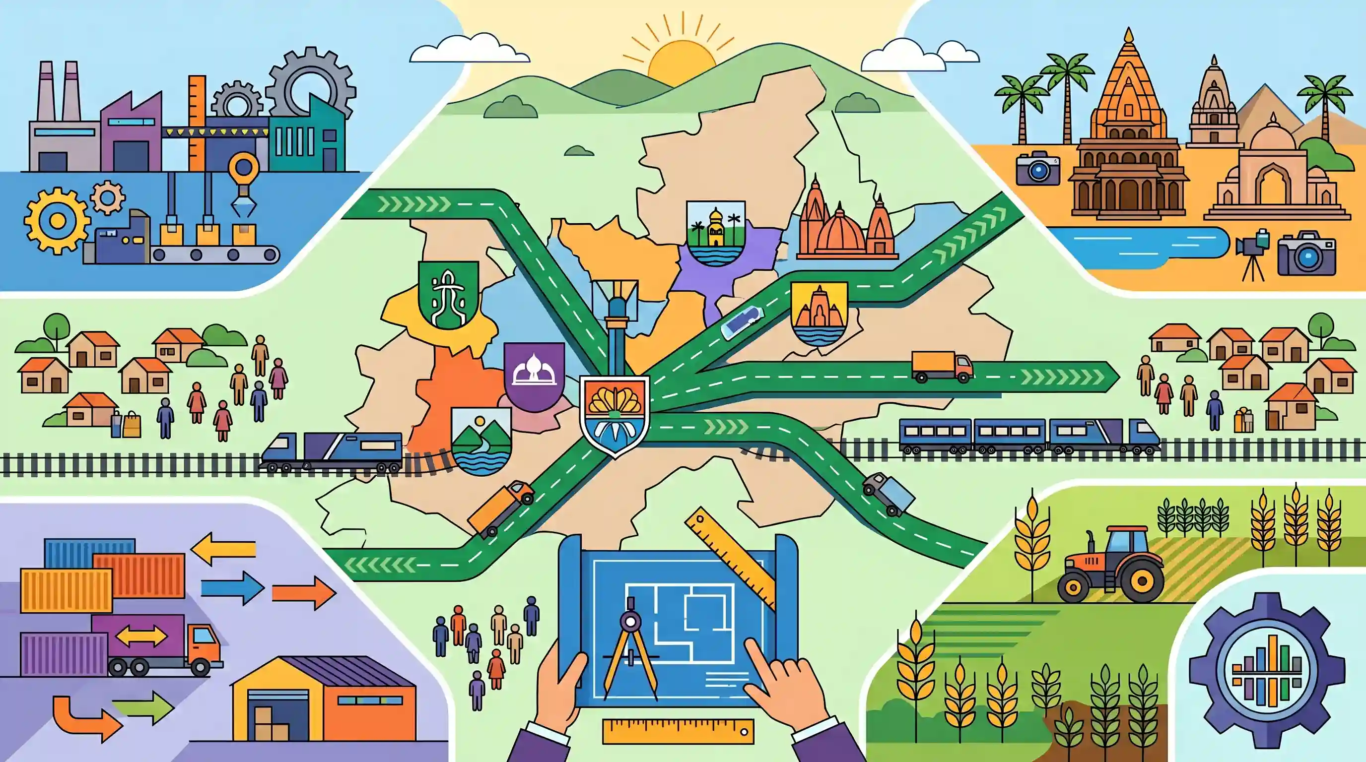
The blueprint for the proposed Indore–Ujjain Metropolitan Region (UIMR) has been finalized, marking a major milestone in Madhya Pradesh\'s urban and economic planning. Spanning over 16,000 sq km, the mega development plan integrates 6 districts of the Malwa region (Indore, Ujjain, Dewas, Dhar, Shajapur, and Ratlam), encompassing 38 tehsils, 2,781 villages, and a population of nearly 85–90 lakh people. The plan aims to unify regional economic development across sectors such as tourism, manufacturing, logistics, and agriculture. Significant connectivity improvements are proposed, including major greenfield expressways (Indore-Bhopal, Indore-Ujjain) and railway extensions (such as Dhar-Dahod and Mhow-Manmad). A comprehensive Situation Analysis Report across 50 sectors will be prepared in 2.5 months as the next step toward a formal investment and development roadmap.
Key Points
- The blueprint for the Indore–Ujjain Metropolitan Region (UIMR) is ready, planning to integrate 6 districts in the Malwa region: Indore, Ujjain, Dewas, Dhar, Shajapur, and Ratlam.
- The regional development plan will cover over 16,000 square kilometers, incorporating 38 tehsils, 2,781 villages, and a population of 85–90 lakh (9 million) people.
- Indore district will be 100% included in the metropolitan region, while nearly 90% of Shajapur district will be covered.
- Key road infrastructure highlights include the Indore–Bhopal Greenfield Expressway, Indore–Ujjain Greenfield Expressway, Ujjain–Maksi Corridor, Ujjain–Javra Corridor, and eastern/western bypasses in Indore.
- Proposed rail network expansions under the blueprint include Tihi–Dhar, Dhar–Dahod, Dhar–Jobat, Mhow–Manmad, and Mangaliya–Budhni routes.
- The economic model aims to combine the distinct strengths of the region: Indore\'s commercial base, Ujjain\'s religious tourism, Dewas\'s manufacturing, and Ratlam\'s trading ecosystem.
- A Situation Analysis Report will be prepared within 2.5 months evaluating 50 sectors, followed by a detailed Regional Development and Investment Plan.
Important Terms
Indore–Ujjain Metropolitan Region (UIMR)

An ambitious urban development initiative in Madhya Pradesh integrating six districts to decentralize growth, create coordinated infrastructure, and drive economic, industrial, and tourism expansion across the Malwa plateau.
UPSC context
GS Paper I (Urbanization) & GS III (Infrastructure); tests regional planning models and growth corridors.
Metropolitan Planning Committee (MPC)
A constitutional body mandated under Article 243ZE of the 74th Amendment Act to prepare draft development plans for designated metropolitan areas with a population of ten lakh or more.
UPSC context
GS Paper II (Polity & Governance); tests constitutional provisions for decentralization and urban governance.
Blue-Green Development Policy
An environmental and urban planning strategy that integrates water bodies (blue) and green open spaces (green) with built infrastructure to conserve ecosystems, manage flood risks, and mitigate urban heat.
UPSC context
GS Paper III (Environment & Disaster Management); tests climate-resilient urban infrastructure and sustainability frameworks.
Land Pooling Model
A collaborative, voluntary land assembly mechanism where owners pool adjacent parcels for infrastructure development and receive a portion of reconstituted, highly-valued developed land in return, minimizing compulsory acquisition disputes.
UPSC context
GS Paper III (Economy & Infrastructure); tests land acquisition reforms, infrastructure funding, and participatory development.
Malwa Plateau
A volcanic tableland in west-central India formed by Deccan Trap lava, characterized by highly fertile moisture-retaining black cotton soil and drained by northern-flowing rivers like the Chambal and Shipra.
UPSC context
GS Paper I (Geography); tests physical geography of India, regional soil characteristics, and river drainage systems.
Prelims Trap
Metropolitan areas spanning multiple districts can only be designated and notified by the President of India.
Under Article 243P(c) of the Constitution, a 'Metropolitan area' is specified and notified by the Governor of a State, not by the President of India or through a separate Act of Parliament.
Static Concepts Connected
What is a Metropolitan Planning Committee (MPC) under the Indian Constitution?
- Constitutional Basis: Mandated under Article 243ZE of the 74th Amendment Act for every metropolitan area having a population of 10 lakh or more.
- Membership Ratio: At least two-thirds of the MPC members must be elected by and from the elected members of local municipalities and panchayats in that area.
- Core Function: Responsible for preparing a draft development plan for the metropolitan area, taking into account coordinated spatial planning, water, and infrastructure.
How does the Land Pooling Model function in infrastructure development?
- Mechanism: Landowners voluntarily assemble their land parcels and hand them over to a government agency for consolidated development.
- Return Share: A portion of the developed, higher-value land with modern infrastructure is returned to the original owners, while the rest is used for public utility.
- Advantages: Minimizes social conflict, avoids high cash-compensation costs under the LARR Act 2013, and prevents legal disputes.
Cross-Topic Patterns
Heritage Tourism + Infrastructure Funding
Aligning mega-regional blueprints with spiritual events like the 2028 Simhastha Kumbh shows how religious tourism acts as a direct catalyst for massive state infrastructure and riverfront development.
Hinterland Corridors + Port Logistics
Connecting regional industrial clusters (Pithampur) to JNPT via the Mhow-Manmad rail bypass demonstrates how internal economic corridors are strategically engineered to optimize global trade logistics.

Constitutional mandates of Metropolitan Planning Committees (Art 243ZE) versus state-led regional bodies will likely feature in 2026.
Linked PYQs · 5
Linked PYQs · 5
- 2024MPPSC_PRELIMSGS1
In which district of Madhya Pradesh was the production of soybean initially started?
- 2023MPPSC_PRELIMSGS1
Which of the following statements is not correct regarding the roadways of Madhya Pradesh according to Basic Road Statistics 2018-19?
- 2021MPPSC_PRELIMSGS1
Atal Pragati Path is related to
- 2019MPPSC_PRELIMSGS1
Direction: Consider the following statements. I. Mandu is in Dhar district. II. Hindola Mahal is in Mandu. Select the correct answer on the basis of above statements.
- 2022MPPSC_PRELIMSGS1
Where was the Global Investors Summit - 2023 held in Madhya Pradesh?
