Cabinet Approves Brahmaputra Road cum Rail Tunnel Project
Source:Indian Express ↗
Why It Matters
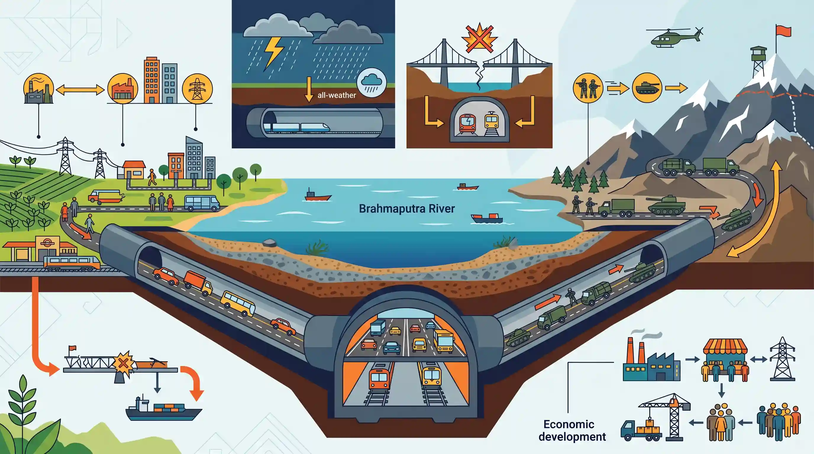
The construction of an underwater road-cum-rail tunnel is a major engineering and strategic milestone. It addresses the vulnerabilities of surface bridges to extreme weather and enemy targeting, thereby securing logistics along the volatile LAC. This directly ties into the UPSC syllabus themes of border area management, infrastructure as a driver for economic growth, and the geographic nuances of the Brahmaputra river system.
Summary
The Union Cabinet has approved the construction of India's first road-cum-rail tunnel under the Brahmaputra river. The strategic project aims to enhance year-round connectivity between Assam and Arunachal Pradesh, critically improving military logistics and rapid troop deployment towards the Line of Actual Control (LAC). By building a tunnel instead of a bridge, the infrastructure remains shielded from extreme weather and potential enemy attacks. Besides its immense strategic and defense value, the project is set to boost civilian mobility and economic development across Northeast India.
Key Points
- The Union Cabinet has approved the construction of India's first road-cum-rail tunnel under the Brahmaputra River.
- The strategic tunnel will provide year-round, all-weather connectivity between Assam and Arunachal Pradesh.
- It is designed to significantly improve military logistics and troop mobilization towards the Line of Actual Control (LAC), while being less vulnerable to enemy strikes compared to bridges.
- The engineering marvel will also foster civilian mobility, economic integration, and regional development in Northeast India.
Important Terms
Union Cabinet

The highest decision-making body of the Indian government, consisting of the Prime Minister and senior ministers; it exercises collective responsibility for major policy and infrastructure approvals.
UPSC context
GS Paper II (Polity): Tests understanding of the executive branch and constitutional provisions like Article 74.
Line of Actual Control (LAC)
The 3,488-km de facto boundary separating Indian-controlled territory from Chinese-controlled territory, categorized into Western, Middle, and Eastern sectors.
UPSC context
GS Paper II & III (IR/Security): Crucial for India-China relations and border management challenges.
Strategic Infrastructure
Essential physical assets (e.g., all-weather tunnels, airfields) built in sensitive border regions to facilitate rapid military logistics and ensure national security.
UPSC context
GS Paper III (Infrastructure/Security): Focuses on the role of physical development in defense preparedness.
Brahmaputra River
A major transboundary Himalayan river known for its complex hydrology and shifting channels, serving as a vital lifeline for Northeast India.
UPSC context
GS Paper I (Geography): Tests knowledge of Indian drainage systems and physical features.
EPC (Engineering, Procurement, and Construction) Mode
A project delivery model where a private contractor is responsible for the entire design, procurement, and construction, while the government provides the funding.
UPSC context
GS Paper III (Economy): Tests understanding of public investment models and infrastructure execution.
Act East Policy
A foreign policy initiative focused on strengthening economic, cultural, and strategic ties with Southeast and East Asia, with Northeast India as a gateway.
UPSC context
GS Paper II (IR): Evaluates India’s regional diplomacy and strategic regional development.
Prelims Trap
"The Brahmaputra underwater tunnel directly connects the borders of Assam and Arunachal Pradesh."
The tunnel is located entirely within Assam (connecting Gohpur to Numaligarh). It facilitates rapid logistics to Arunachal Pradesh and the LAC, but does not geographically cross the state border itself.
Static Concepts Connected
What are the key geographical features of the Brahmaputra river system?
- Origin: Rises in the Chemayungdung glacier of the Kailash range near the Mansarovar lake in Tibet, where it is known as the Tsangpo.
- Major Tributaries: Right bank includes Subansiri, Kameng, Manas, and Teesta. Left bank includes Dibang, Lohit, Dhansiri, and Kolong.
- National Waterway 2: The 891 km stretch of the river between Sadiya and Dhubri in Assam is designated as National Waterway-2.
How does the EPC (Engineering, Procurement, Construction) model function?
- Total Government Funding: The government bears the entire financial burden of the project, unlike Public-Private Partnership models where private entities invest capital.
- Private Risk Allocation: The private contractor is only responsible for executing the engineering, procurement, and construction phases within a fixed time and cost.
- No Revenue Risk: Unlike BOT (Build-Operate-Transfer), the private entity does not collect tolls, operate the asset, or bear traffic and revenue risks.
Cross-Topic Patterns
Eco-Sensitive Zones + Strategic Infra
Bypassing Kaziranga National Park demonstrates how strategic military logistics can be aligned with wildlife corridor conservation, reducing surface traffic and anthropogenic stress on the vital rhinoceros habitat.
Civil-Military Funding Fusion
The 80:20 funding split between MoRTH and MoD highlights India's shifting doctrine towards dual-use border infrastructure, mirroring initiatives like the Vibrant Villages Programme to counter China's LAC buildup.

Expect a multi-statement 2026 question linking Brahmaputra's geography, Kaziranga's ecological corridors, and LAC border infrastructure.
Linked PYQs · 3
Linked PYQs · 3
- 2024MainsGS3
India has a long and troubled border with China and Pakistan fraught with contentious issues. Examine the conflicting issues and security challenges along the border. Also give out the development being undertaken in these areas under the Border Area Development Programme (BADP) and Border Infrastructure and Management (BIM) Scheme.
- 2021MainsGS3
“Investment in infrastructure is essential for more rapid and inclusive economic growth.” Discuss in the light of India's experience.
- 2011PrelimsGS1
The Brahmaputra, Irrawady and Mekong rivers originate in Tibet and flow through narrow and parallel mountain ranges in their upper reaches. Of these rivers, Brahmaputra makes a “U” turn in its course to flow into India. This “U” turn is due to
