Sleemanabad Tunnel Completed in Madhya Pradesh
Source:theindianeye ↗
Why It Matters
Irrigation, river interlinking, and water diversion projects in Madhya Pradesh (like the Bargi and Chambal projects) are high-yield areas for MPPSC Prelims. Being India's longest irrigation tunnel, this project holds high factual significance for MP-specific geography and economy questions.
Summary
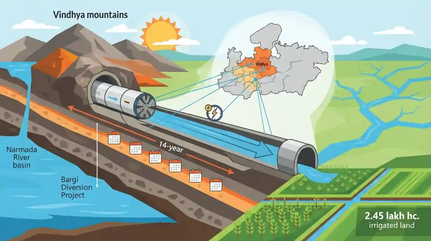
India has successfully completed the Sleemanabad Tunnel in Madhya Pradesh, which stands as the country's longest irrigation water tunnel. Carved through the Vindhya mountains over 14 years, the almost 12-km structure is a vital component of the Bargi Diversion Project. It transfers water from the Narmada River to the Son River basin purely by gravity, saving massive energy costs. The tunnel aims to irrigate 2.45 lakh hectares of agricultural land across six districts, fundamentally transforming the agrarian landscape of the Vindhya region.
Key Points
- The 11.95-km Sleemanabad Tunnel in Madhya Pradesh's Katni district has been completed, making it India's longest irrigation water tunnel.
- It was constructed as part of the Bargi Diversion Project by the Narmada Valley Development Authority (NVDA).
- The tunnel cuts through the Vindhya mountains to divert water from the Narmada river basin into the Son river basin.
- Because it utilizes a natural gradient, the water flows via gravity, completely eliminating the need for mechanical pumping.
- The project will provide irrigation to approximately 2.45 lakh hectares across Jabalpur, Katni, Maihar, Satna, Rewa, and Panna districts.
Important Terms
Bargi Diversion Project

A major trans-valley irrigation project in Madhya Pradesh transferring Narmada River water to the Son River basin. Its 197-km canal network aims to irrigate 2.45 lakh hectares across the drought-prone Vindhya region.
UPSC context
GS Paper 1 (Geography) and GS Paper 3 (Irrigation). Tests knowledge of inter-basin water transfer projects and regional development.
Narmada Valley Development Authority (NVDA)
A statutory body created in 1985 by the Madhya Pradesh government to plan, coordinate, and execute multipurpose water resource projects—like irrigation and hydropower—within the state's portion of the Narmada basin.
UPSC context
GS Paper 2 (Statutory Bodies) and GS Paper 3 (Infrastructure). Highlights institutional frameworks for managing river basin allocations.
Sleemanabad Tunnel
An 11.95-km underground water conveyance structure in Madhya Pradesh, recognized as India's longest gravity-flow irrigation tunnel. Carved through the Vindhyas, it sustainably transfers Narmada water to the Son basin.
UPSC context
GS Paper 1 (Geography) and GS Paper 3 (Infrastructure). Tests awareness of sustainable engineering marvels and geographical watershed barriers.
Gravity-Flow Irrigation
An irrigation system utilizing the natural force of gravity to transport water from a higher elevation to agricultural fields. It eliminates the need for electricity-intensive pumping, significantly reducing long-term operational costs.
UPSC context
GS Paper 3 (Agriculture & Technology). Evaluates understanding of sustainable, cost-effective agricultural practices and energy-efficient rural infrastructure.
Prelims Trap
The Sleemanabad tunnel pumps water from the Narmada to the Son basin under the Ken-Betwa link.
It is a 100% gravity-fed tunnel (no pumping) and belongs to the Bargi Diversion Project, distinct from the Ken-Betwa river interlinking project.
Static Concepts Connected
What is a radial drainage pattern and where is it observed?
- Radial Drainage: A drainage system where rivers originate from a central elevated landmass or peak and flow outwards in all directions.
- Amarkantak Plateau: The Amarkantak Plateau is a classic example, serving as the source for both the Narmada (flowing west) and the Son (flowing north/east).
How does the Vindhya Range act as a major water divide?
- Catchment Separation: The Vindhyas act as a central barrier separating the Ganga river system (which the Son eventually joins) in the north from the Narmada river system in the south.
- Rift Valley Flow: The Narmada River flows westward through a geological rift valley formed between the Vindhyan Range to its north and the Satpura Range to its south.
Cross-Topic Patterns
Lift Irrigation vs. Gravity Flow
Unlike Telangana's Kaleshwaram project which relies on energy-intensive mechanical pumping, the Sleemanabad tunnel leverages natural geographical gradients. This highlights a shift towards sustainable, low-carbon inter-basin water transfers.
Inter-basin links and ecological impact
Connecting west-flowing and east-flowing basins mirrors the National Perspective Plan's goal of moving water from surplus to deficit regions, an ongoing theme for UPSC Mains regarding ecological impacts of river-linking.

Expect a matched-pair Prelims question in 2026 linking major irrigation infrastructure (Sleemanabad, Kaleshwaram) to their river basins.
Linked PYQs · 5
Linked PYQs · 5
- 2018MPPSC_PRELIMSGS1
Which one of the following valleys of Madhya Pradesh is not a rift valley?
- 2020MPPSC_PRELIMSGS1
Chambal Canal Irrigation Project is related with
- 2022MPPSC_PRELIMSGS1
Which of the following is a major source of irrigation in Madhya Pradesh?
- 2022MPPSC_PRELIMSGS1
Which of the following pairs of irrigation projects and their location is incorrect? Irrigation Project District
- 2021MPPSC_PRELIMSGS1
In which region of Madhya Pradesh Solar Floating Project of 600 MW capacity is proposed?
