INCOIS Marine Pollution Monitoring and Technology Initiative
Source:The Hindu ↗
Why It Matters
Marine pollution (like microplastics and oil spills) is a critical environmental challenge for India given its extensive coastline. 'NIRMAL Sagar' is highly relevant for GS-3 Environment and Science, as it highlights India's technological capability (using remote sensing and AI) for environmental monitoring and mitigating ocean degradation.
Summary
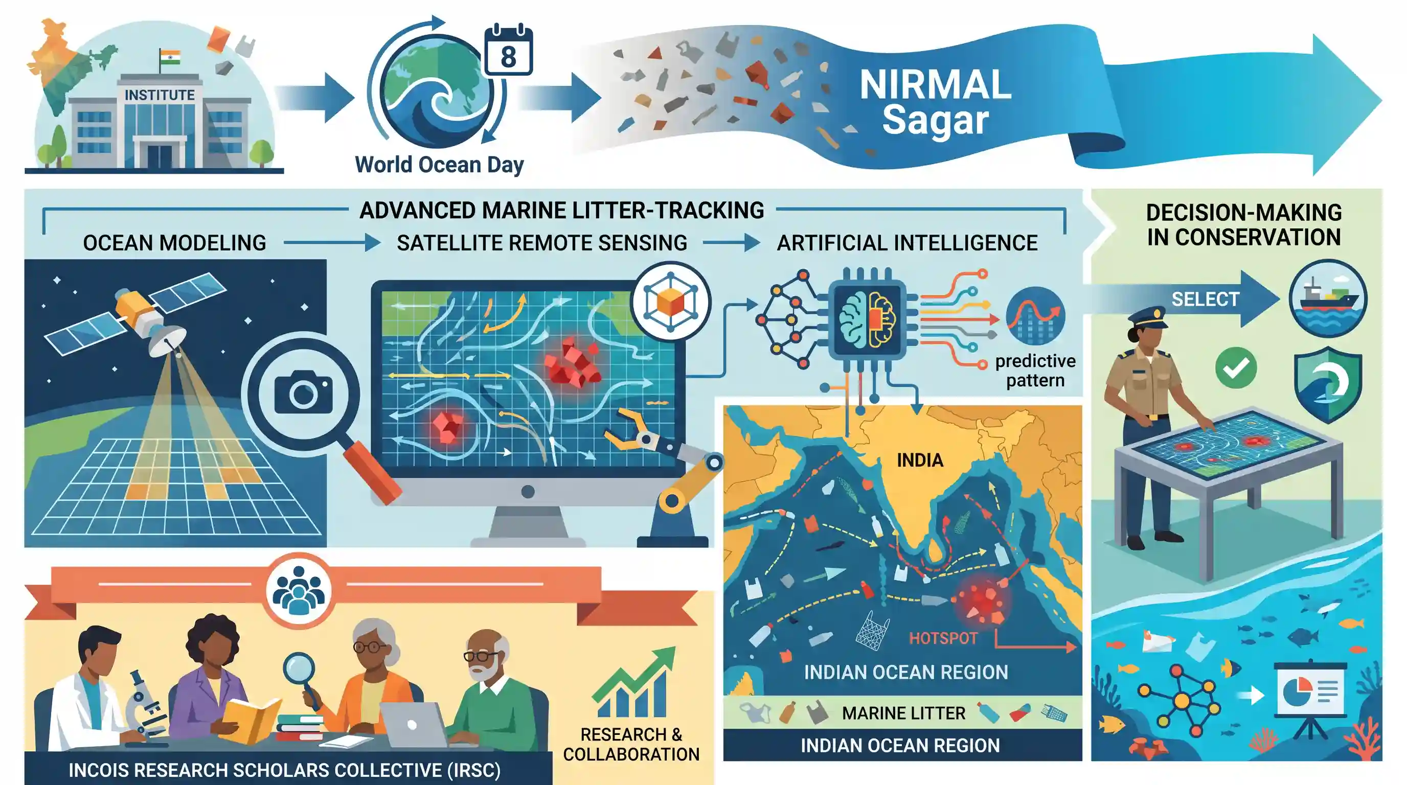
The Indian National Centre for Ocean Information Services (INCOIS) has launched 'NIRMAL Sagar', an advanced marine litter-tracking initiative, on World Ocean Day. By leveraging ocean modeling, satellite remote sensing, and artificial intelligence, the system will monitor marine pollution across the Indian Ocean Region to aid decision-making in conservation efforts. Additionally, the INCOIS Research Scholars Collective (IRSC) was inaugurated to promote research and collaboration in ocean sciences.
Key Points
- INCOIS launched a clean-ocean initiative called 'NIRMAL Sagar' on World Ocean Day.
- The project aims to create an integrated marine litter-tracking system in the Indian Ocean Region using ocean modeling, satellite remote sensing, and AI/ML algorithms.
- The resultant data is expected to help the government and related authorities make informed decisions regarding ocean conservation and pollution mitigation.
- Additionally, INCOIS launched the 'INCOIS Research Scholars Collective (IRSC)' to foster collaborative research and knowledge sharing among ocean science scholars.
Important Terms
NIRMAL Sagar

An INCOIS-led initiative for tracking marine litter in the Indian Ocean using AI, satellite sensing, and ocean modeling. It identifies pollution hotspots and debris movement to aid conservation efforts.
UPSC context
GS III (Environment/Pollution); tests knowledge of technology-led marine conservation and India’s commitment to UN Ocean Decade goals.
INCOIS (Indian National Centre for Ocean Information Services)
An autonomous body under the Ministry of Earth Sciences providing real-time ocean data. Key functions include tsunami early warnings, potential fishing zone (PFZ) mapping, and monitoring marine debris.
UPSC context
GS III (Science & Technology/Disaster Management); essential for understanding India’s early-warning systems and institutional capacity in marine resource management.
Ministry of Earth Sciences
The Indian ministry providing the administrative framework for earth system sciences. It manages national programs like the Deep Ocean Mission and oversees agencies for weather, climate, and oceanography.
UPSC context
GS II (Government Institutions); critical for knowing the administrative lead on strategic national missions like the Deep Ocean Mission.
INCOIS Research Scholars Collective (IRSC)
A student-led platform established within INCOIS to foster interdisciplinary collaboration and mentorship among researchers. It aims to strengthen the ocean science research community and professional development.
UPSC context
GS III (Science & Technology); highlights human resource capacity-building and collaborative research environments within India's premier scientific institutions.
Prelims Trap
"INCOIS is an apex body under the Ministry of Environment, Forest and Climate Change monitoring marine pollution."
Aspirants often assume marine pollution initiatives are led by MoEFCC. However, INCOIS is an autonomous organization under the Ministry of Earth Sciences (MoES).
Static Concepts Connected
What is the mandate and administrative control of INCOIS?
- Nodal Ministry: It is an autonomous body operating under the Ministry of Earth Sciences (MoES), established in 1999 in Hyderabad.
- Core Mandates: Provides Potential Fishing Zone (PFZ) advisories, Ocean State Forecasts, and operates the Indian Tsunami Early Warning Centre (ITEWC).
How does marine litter interact with oceanographic features?
- Ocean Gyres: Circulating ocean currents create massive vortexes (e.g., Indian Ocean Gyre) that trap floating plastics, creating localized "garbage patches".
- Microplastics & Sinks: Wave action and UV radiation break debris down. These microplastics either sink to the benthic zone or bioaccumulate in marine life.
Cross-Topic Patterns
Space Tech in Conservation
UPSC regularly tests remote sensing applications. NIRMAL Sagar links satellite data, AI, and marine ecology, mirroring past questions on crop-fire and groundwater tracking.
UN Plastics Treaty compliance
India's domestic data generation via NIRMAL Sagar strengthens its baseline for the UN Global Plastics Treaty (UNEA 5/14) aimed at ending plastic pollution globally.

Expect a Prelims question combining INCOIS mandates (tsunami/fishing zones), its MoES affiliation, and its AI-driven marine tracking.
Linked PYQs · 2
Linked PYQs · 2
- 2021PrelimsGS1
Consider the following statements : 1. The Global Ocean Commission grants licences for seabed exploration and mining in international waters. 2. India has received licences for seabed mineral exploration in international waters. 3. 'Rare earth minerals' are present on seafloor in international waters. Which of the statements given above are correct?
- 2023MainsGS3
What is oil pollution? What are its impacts on the marine ecosystem? In what way is oil pollution particularly harmful for a country like India?
