Coastal Andhra Pradesh Meteorological Thunderstorm and Wind Warnings
Source:The Hindu ↗
Why It Matters
Questions relating to the regional geography, climatic patterns, and specific district locations of Andhra Pradesh are commonly featured in the APPSC Prelims. Furthermore, understanding the functions of the IMD and early warning mechanisms is crucial for Disaster Management topics.
Summary
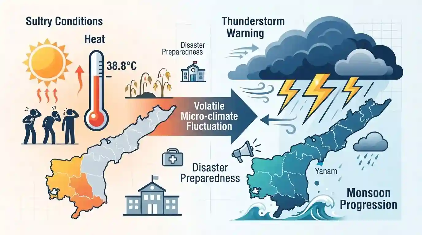
The India Meteorological Department (IMD) has issued a weather warning predicting thunderstorms accompanied by lightning and gusty winds across coastal Andhra Pradesh and Yanam up to August 18. The forecast applies to various districts spanning North Coastal AP, South Coastal AP, and Rayalaseema. Concurrently, the state has been enduring sultry conditions with daytime maximum temperatures rising above normal levels, such as the 38.8°C recorded in Jangamaheswarapuram. The fluctuation highlights the characteristic volatile micro-climate and monsoon progression in the coastal regions of Andhra Pradesh.
Key Points
- The India Meteorological Department (IMD) has forecast thunderstorms, lightning, and gusty winds (30-40 kmph) for parts of coastal Andhra Pradesh and Yanam until August 18.
- The weather warnings cover several districts across North Coastal Andhra Pradesh (NCAP), South Coastal Andhra Pradesh (SCAP), and Rayalaseema.
- Prior to the storms, the state has been experiencing above-normal temperatures and sultry weather, with Jangamaheswarapuram recording a high of 38.8°C and Kalingapatnam 36.1°C.
Important Terms
India Meteorological Department (IMD)

India's principal agency under the Ministry of Earth Sciences responsible for meteorological observations, weather forecasting, seismology, and issuing warnings for severe weather events like cyclones and thunderstorms.
UPSC context
Important for GS-1 (Geography) and GS-3 (Disaster Management), testing knowledge of institutional disaster preparedness and early warning systems.
Micro-climate
A localized set of atmospheric conditions—such as temperature and humidity—that differs significantly from the surrounding regional climate, often driven by local topography, vegetation, or urbanization.
UPSC context
Relevant to GS-1 (Climatology) and GS-3 (Environment), testing concepts of localized weather patterns and urban heat islands.
Yanam
A coastal district of the Union Territory of Puducherry situated as a geographical enclave completely surrounded by the state of Andhra Pradesh near the Godavari delta.
UPSC context
Tested in GS-1 (Indian Geography/Map-based questions) regarding political boundaries, enclaves, and post-independence territorial consolidation.
Rayalaseema
A geographic region in southern Andhra Pradesh characterized by a rain-shadow climate, making it structurally drought-prone and highly susceptible to elevated temperatures and volatile weather.
UPSC context
Vital for GS-1 (Indian Geography), often tested in relation to drought-prone areas, spatial rainfall distribution, and regional planning.
Monsoon Progression
The gradual seasonal advancement of the southwest monsoon winds across the Indian subcontinent, which dictates regional weather variations, precipitation levels, and the timing of agricultural cycles.
UPSC context
Core GS-1 (Physical Geography) topic, testing the mechanics, timing, and regional impacts of the Indian Monsoon system.
Prelims Trap
Coastal Andhra Pradesh and Rayalaseema receive no precipitation during the Southwest Monsoon season.
While they receive their major rainfall from the Northeast Monsoon, these regions still experience localized convective thunderstorms and scattered rain during the Southwest Monsoon.
Static Concepts Connected
Why does Coastal Andhra Pradesh experience intense thunderstorms during the monsoon?
- Localized heating: High daytime temperatures (often above normal) create strong local low-pressure zones, leading to vigorous atmospheric updrafts.
- Moisture incursion: Continuous moisture supply from the adjacent Bay of Bengal fuels deep convective cloud formation.
- High CAPE: High Convective Available Potential Energy (CAPE) creates acute atmospheric instability, manifesting as sudden squalls and severe lightning.
Why is the Rayalaseema region semi-arid despite being relatively close to the eastern coast?
- Rain shadow effect: It lies in the rain shadow zone of the Western Ghats and Nallamala Hills, depriving it of significant Southwest Monsoon moisture.
- Storm tracks: Depressions and cyclones forming in the Bay of Bengal often bypass this interior region, tracking further north toward Odisha or West Bengal.
Cross-Topic Patterns
Lightning as a State-Specific Disaster
Despite causing high fatalities, lightning is not a notified 'National Disaster'. States compensate victims using a 10% SDRF window, raising ongoing federal disaster-funding debates.
Koeppen's 'As' climate classification anomaly
Coastal AP and TN fall under Koeppen's 'As' (tropical savanna, dry summer) classification. This anomaly in Indian monsoon geography is a frequent Prelims match-the-following target.

Expect a 2026 Prelims statement mapping Koeppen's 'As' climate against regional monsoon variations and convective thunderstorms in Coastal AP.
Linked PYQs · 2
Linked PYQs · 2
- 2024APPSC_PRELIMSGS1
Match the following Climatic regions of India according to Koeppen's scheme: | List-I(Type of Climate) | List-II.(Areas) | |---|---| | A. Monsoon with short dry season | I. West coast of India, south of Goa | | B. Monsoon with dry summer | II. Coromandel coast of Tamil Nadu | | C. Monsoon with dry winter | III. Most of North-East India | | D. Semi-arid Steppe climate | IV. Northwestern Gujarat | Choose the correct answer using the codes given below: Code: A B C D
- 2012APPSC_PRELIMSGS1
The impact of disasters can be greatly reduced by
