Bay of Bengal Deep Depression Crosses Bengal Coast
Source:The Hindu ↗
Why It Matters
Provides a real-world case study of early warning systems and disaster preparedness in response to Bay of Bengal depressions, directly aligning with UPSC geography and disaster management syllabi.
Summary
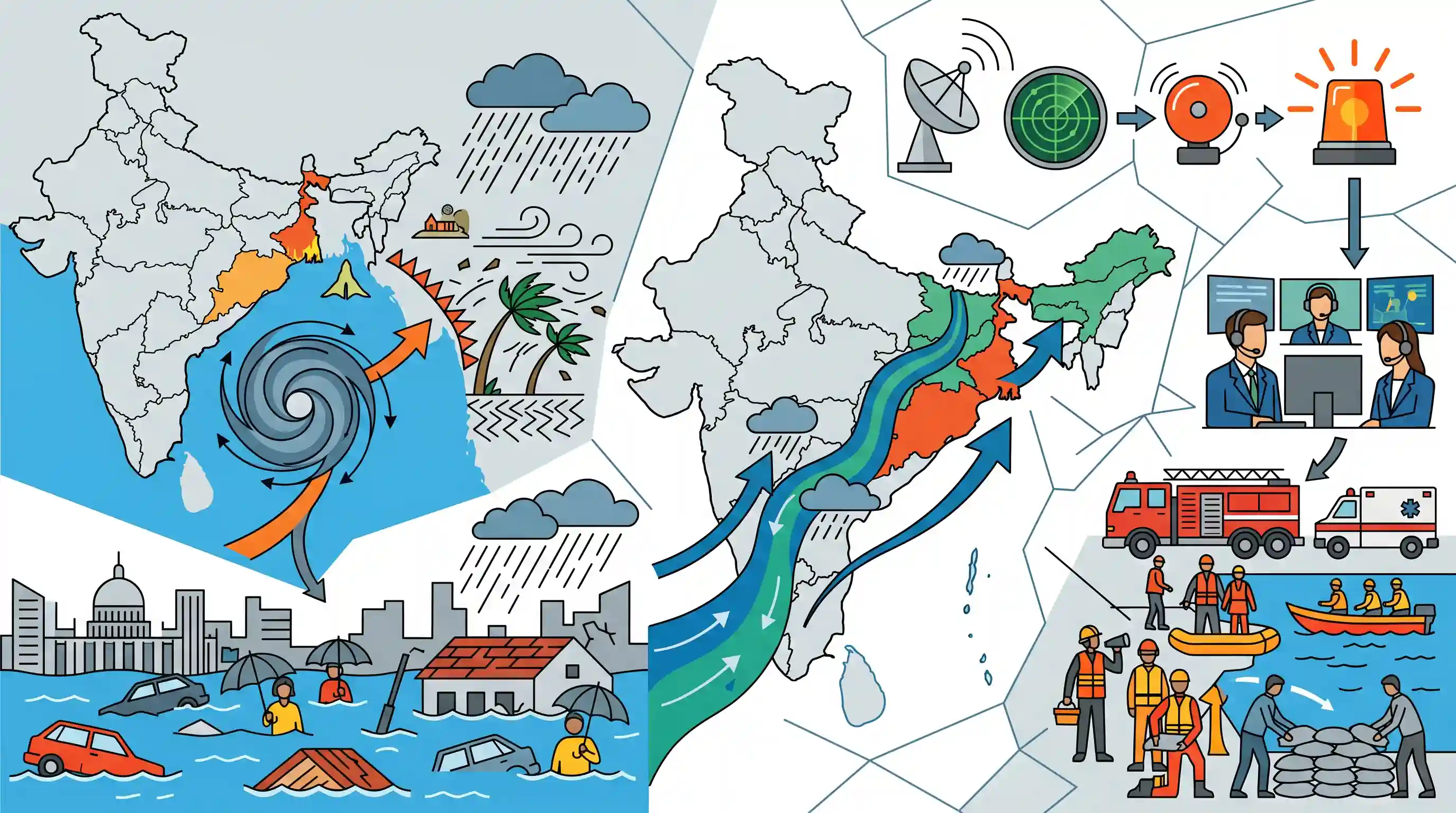
The India Meteorological Department (IMD) issued severe weather alerts as a deep depression from the Bay of Bengal made landfall across the West Bengal coast between Sagar Island and Khepupara. The weather system triggered squally winds and torrential rainfall, causing substantial waterlogging in Kolkata and adjoining districts. Concurrently, the IMD noted that the atmospheric conditions facilitated the steady progression of the Southwest Monsoon into adjoining eastern and northeastern states. The event underscores the critical role of IMD warnings in coordinating timely state-level disaster response and tracking seasonal meteorological shifts.
Key Points
- A deep depression formed over the Bay of Bengal and crossed the West Bengal coast between Sagar Island and Khepupara, Bangladesh.
- The India Meteorological Department (IMD) issued critical alerts, initiating proactive coastal disaster management operations.
- The weather system brought squally winds and heavy rainfall, resulting in severe waterlogging in parts of Kolkata and South Bengal.
- In tandem with the depression, conditions became favorable for the further advance of the Southwest Monsoon into parts of eastern India and the northeast.
Important Terms
India Meteorological Department (IMD)

The premier agency under the Ministry of Earth Sciences responsible for meteorological observations, weather forecasting, and seismology in India.
UPSC context
GS Paper 1 and 3; tests knowledge of national scientific institutions and disaster monitoring roles.
Deep Depression
A stage in cyclonic intensification where sustained surface wind speeds range between 50 and 61 kmph (28–33 knots).
UPSC context
GS Paper 1; tests the ability to categorize tropical disturbances based on IMD wind-speed scales.
Landfall
The event where the center (eye) of a tropical cyclone crosses from the ocean onto land, often causing peak damage before the storm weakens.
UPSC context
GS Paper 1; relevant for understanding the lifecycle, dynamics, and terrestrial impact of tropical cyclones.
Southwest Monsoon
A seasonal wind system (June–September) that carries moisture from the Indian Ocean to the mainland, providing approximately 80% of India's annual rainfall.
UPSC context
GS Paper 1; core topic for physical geography, climate patterns, and Indian economic/food security.
Early Warning Systems (EWS)
Integrated monitoring and communication systems designed to provide timely hazard information, enabling communities to act and reduce disaster risk.
UPSC context
GS Paper 3; central to disaster management strategies and the implementation of the Sendai Framework.
Prelims Trap
Deep depressions over the Bay of Bengal disrupt and delay the normal progression of the Southwest Monsoon.
While pre-monsoon severe cyclones (like Biparjoy) can divert moisture and delay onset, monsoon depressions act as primary rain-bearing systems that actively pull the monsoon forward.
Static Concepts Connected
Why is the Bay of Bengal more prone to cyclogenesis than the Arabian Sea?
- Higher SST: The relatively higher Sea Surface Temperature provides constant latent heat for system intensification.
- Freshwater stratification: Major river influx creates surface stratification, preventing cooler, deeper ocean waters from upwelling and dampening storms.
- Pacific remnants: Low-pressure remnants from typhoons in the South China Sea frequently travel across into the Bay.
How does the IMD classify low-pressure systems by wind speed?
- Depression: Associated with maximum sustained surface wind speeds between 31 and 50 kmph (17-27 knots).
- Deep Depression: Characterized by wind speeds ranging from 51 to 61 kmph (28-33 knots).
- Cyclonic Storm: System is upgraded to this category when sustained wind speeds reach 62 kmph or higher.
Cross-Topic Patterns
Urban Flooding & East Kolkata Wetlands
Severe waterlogging in Kolkata frequently links to the encroachment of the East Kolkata Wetlands, a Ramsar site crucial for natural flood mitigation and urban sewage treatment.
Monsoon Trough & Agricultural Planning
Depressions originating in the Bay of Bengal are critical for pushing the monsoon trough into central India, directly dictating kharif sowing patterns and agricultural yields.

Expect a 2026 prelims question contrasting how Bay of Bengal depressions advance the monsoon while Arabian Sea cyclones often delay its onset.
Linked PYQs · 4
Linked PYQs · 4
- 2014MainsGS1
Tropical cyclones are largely confined to South China Sea, Bay of Bengal and Gulf of Mexico. Why?
- 2022MainsGS1
Discuss the meaning of colour-coded weather warnings for cyclone prone areas given by India Meteorological Department.
- 2024MainsGS1
What is sea surface temperature rise? How does it affect the formation of tropical cyclones?
- 2012PrelimsGS1
Consider the following statements: 1. The duration of the monsoon decreases from southern India to northern India. 2. The amount of annual rainfall in the northern plains of India decreases from east to west. Which of the statements given above is/are correct?
