Weather Department Issues Heavy Rain Alert for Himachal Pradesh
Source:theprint.in ↗
Why It Matters
Understanding state-specific rainfall patterns and monsoon impacts is crucial for HPAS Prelims GS1, as past questions frequently test knowledge on climatic zones, extreme weather events, and affected infrastructure within Himachal Pradesh. The context of cultural sites like the Manimahesh yatra also touches upon regional geography and tourism.
Summary
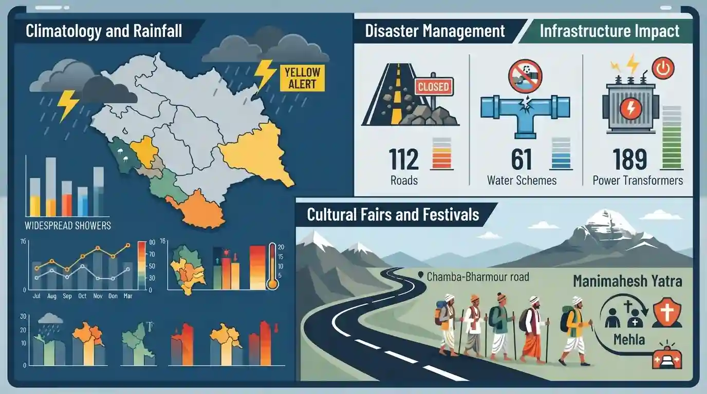
The local meteorological office has issued a yellow alert for heavy rain in Himachal Pradesh, forecasting widespread showers until August 11. The ongoing monsoon has severely impacted infrastructure, leading to the closure of 112 roads, particularly in Mandi, Kullu, and Sirmaur, and disrupting 61 water supply schemes and 189 power transformers. Tragedy struck the Manimahesh yatra when a devotee from Punjab was killed near Mehla on the Chamba-Bharmour road. Significant localized rainfall and distinct temperature variations across districts highlight the intense monsoon activity in the state.
Key Points
- The Shimla meteorological office issued a yellow alert for heavy rain across Himachal Pradesh until August 11.
- Heavy monsoon rains resulted in the closure of 112 roads, mostly in Mandi, Kullu, and Sirmaur districts.
- 61 water supply schemes and 189 power transformers were disrupted across the state, according to the State Emergency Operation Centre.
- A devotee from Punjab lost his life near Mehla on the Chamba-Bharmour road while traveling for the Manimahesh yatra.
- Significant rainfall was recorded at Jatton Barrage, Raipur Maidan, Naina Devi, and Nahan, while temperatures varied between 13.2°C at Kukumseri and 34.2°C at Una.
Important Terms
Manimahesh Yatra

An annual Hindu pilgrimage in Himachal Pradesh's Chamba district. Devotees undertake a challenging high-altitude trek to the sacred Manimahesh Lake, situated at the base of the Kailash peak, to worship Lord Shiva.
UPSC context
Important for GS1 (Art & Culture/Geography), highlighting regional tribal customs (Gaddis), Himalayan topography, and associated high-altitude disaster risks.
State Emergency Operation Centre (SEOC)
A state-level 24/7 command and communication hub under the State Disaster Management Authority. It acts as the nerve center for disseminating early warnings, deploying resources, and coordinating disaster response efforts.
UPSC context
Crucial for GS3 (Disaster Management). Tests knowledge of India's institutional framework for disaster risk reduction and state-level emergency response mechanisms.
Yellow Alert
A color-coded meteorological warning issued by the India Meteorological Department (IMD) advising the public and authorities to "Be Aware." It signals potentially adverse weather that could cause localized disruptions.
UPSC context
Relevant for GS1 (Climatology) and GS3 (Disaster Management), testing the IMD's early warning protocols for severe weather events.
Prelims Trap
Manimahesh Lake is located in the Zanskar range and holds immense cultural significance for the Gujjar and Bakarwal tribes.
It is actually located in the Pir Panjal range (Chamba district, HP) and is the primary pilgrimage for the indigenous Gaddi tribe.
Static Concepts Connected
What is the geographical and cultural significance of the Manimahesh Yatra?
- Location: Situated in the Pir Panjal Range of the Himalayas within the Chamba district of Himachal Pradesh.
- Cultural Importance: Considered the abode of Lord Shiva, it is the most important annual pilgrimage for the indigenous Gaddi pastoral tribe.
- Glacial Origin: The high-altitude lake is a glacial depression primarily fed by snowmelt from the surrounding peaks.
What is the geographical profile of the Giri River?
- Yamuna Tributary: Rising in the Kotkhai hills of Shimla, it is a significant Himalayan tributary of the Yamuna River.
- Regional Divide: It geographically divides the Sirmaur district into two distinct socio-cultural regions: Cis-Giri and Trans-Giri.
- Jatton Barrage: The Jatton Barrage is built across the Giri River to manage water discharge and generate hydroelectricity.
Cross-Topic Patterns
Himalayan ecology vs. Religious tourism
Extreme weather disrupting the Manimahesh Yatra parallels the ongoing Chardham debate, highlighting the conflict between mass religious tourism and the carrying capacity of fragile Himalayan ecologies.
IMD Alerts + Sendai Framework
IMD's color-coded weather warnings serve as a practical domestic application of the Sendai Framework's priority to significantly enhance multi-hazard early warning systems by 2030.

Mapping high-altitude lakes (Manimahesh) with their specific mountain ranges (Pir Panjal) and local tribes (Gaddis) is highly probable.
Linked PYQs · 2
Linked PYQs · 2
- 2024HPAS_PRELIMSGS1
Arrange the following climatic zones of Himachal Pradesh according to rainfall amount from lowest to highest : (1) Frigid aridic zone (2) Wet temperate zone (3) Humid sub-tropical zone (4) Sub-humid sub-tropical zone Choose the correct answer from the options given below :
- 2023HPAS_PRELIMSGS1
Consider the following statements : (1) The rainiest district in Himachal Pradesh is Kangra. (2) Rainfall in the Alpine region of Himachal Pradesh varies between 300-600 mm. (3) Winter season in Himachal Pradesh extends from October to March. (4) Mandi is the hottest place in Himachal Pradesh. Choose the correct answer from the options given below :
