Cloudburst causes severe destruction and damage in Kangra district
Source:newsonair ↗
Why It Matters
Demonstrates the geographical vulnerability of Himachal Pradesh to extreme weather phenomena like cloudbursts. State-specific locations such as Kangra district and Boh Valley are highly relevant for the HPAS Prelims geography and disaster management sections.
Summary
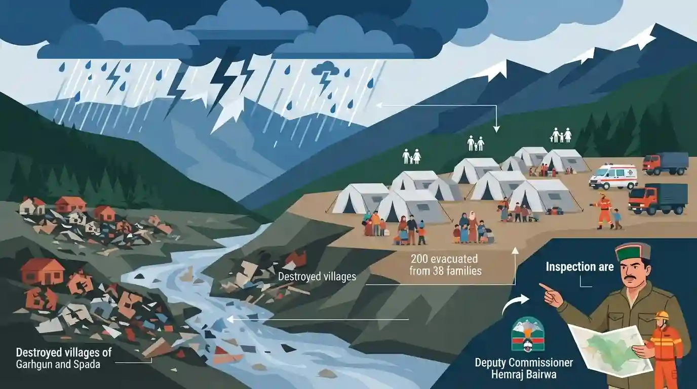
A severe cloudburst has caused massive devastation in the Boh Valley of Kangra district, Himachal Pradesh, completely washing away 25 houses in the villages of Garhgun and Spada. Due to prompt action by the administration, around 200 affected individuals from 38 families were safely evacuated to a relief camp, and no loss of life has been reported. Deputy Commissioner Hemraj Bairwa visited the affected areas to assess the damage. The event highlights the recurring threat of extreme weather events in the hilly terrains of the state.
Key Points
- A severe cloudburst caused extensive devastation in the Boh Valley of Kangra district, Himachal Pradesh.
- 25 houses were completely washed away in the villages of Garhgun and Spada.
- The local administration successfully evacuated around 200 people (38 families) to a relief camp at a local school, preventing any loss of life.
- The incident underscores the extreme vulnerability of Himachal Pradesh's valleys to localized heavy rainfall events and natural disasters.
Important Terms
Cloudburst

A sudden, intense, and highly localized rainfall event, defined meteorologically as precipitation exceeding 100 mm per hour over a 20-30 sq km area, primarily occurring in mountainous terrains.
UPSC context
Highly relevant for GS Paper 1 (Geography) and GS 3 (Disaster Management). Tests understanding of extreme weather phenomena and orographic lift.
Local Administration
The administrative machinery at the district level, headed by the Deputy Commissioner or District Magistrate, responsible for governance, policy implementation, and acting as the primary responder during disasters.
UPSC context
Essential for GS Paper 2 (Governance) and GS 3 (Disaster Management). Evaluates decentralized planning and the developmental role of the DC.
Boh Valley
A picturesque and ecologically fragile valley situated in the Kangra district of Himachal Pradesh, recently affected by severe cloudbursts and massive landslides triggered by extreme rainfall.
UPSC context
Relevant for GS Paper 1 (Geography) and Prelims mapping. Illustrates the vulnerability of Himalayan regions to climate change and geohazards.
District Disaster Management Authority (DDMA)
The statutory body for disaster management at the district level under the DM Act, 2005. Headed by the District Magistrate, it plans, coordinates, and implements risk reduction measures.
UPSC context
Core to GS Paper 3 (Disaster Management). Tests knowledge of India's institutional framework for preparedness, response, and decentralized crisis governance.
Prelims Trap
A cloudburst is defined as unexpected precipitation exceeding 100 mm in a 24-hour period.
The IMD defines a cloudburst by an extreme *rate* of rainfall (exceeding 100 mm per hour), over a small localized area, not a 24-hour total. It is about intensity, not volume over a day.
Static Concepts Connected
What are the meteorological drivers and IMD criteria for a cloudburst?
- IMD Criteria: Rainfall exceeding 100 mm (10 cm) per hour over a geographical area of 20-30 sq. km.
- Orographic Lifting: Moist air is forced up steep mountain slopes, forming massive cumulonimbus clouds.
- Vertical Updrafts: Strong upward air currents hold moisture until it becomes too heavy, causing a sudden, torrential downpour.
Why is early warning for Himalayan cloudbursts difficult despite Doppler Weather Radars (DWR)?
- Topographical Obstruction: Steep mountain terrains physically obstruct radar signals, creating blind spots for DWRs in deep valleys.
- Hyper-Localized Nature: Cloudbursts occur over tiny areas and develop rapidly, making precise nowcasting (2-3 hour prediction) extremely difficult.
Cross-Topic Patterns
Cloudbursts + Compound Hazards
In the Himalayas, cloudbursts act as triggers for severe geohydrological compound hazards like flash floods, mudflows, and landslides, multiplying the overall disaster impact.
Climate Change + Extreme Precipitation
Warming temperatures increase the atmosphere's moisture-holding capacity (Clausius-Clapeyron relation), leading to more frequent, hyper-localized extreme precipitation events in ecologically fragile regions like Himachal.

Expect a 2026 question mixing IMD’s 100mm/hr criteria, cumulonimbus cloud physics, and Doppler radar limitations in Himalayan topography.
Linked PYQs · 4
Linked PYQs · 4
- 2024HPAS_PRELIMSGS1
Consider the following statements : (1) Monkey valley lies in Chamba. (2) Kiarda Dun valley lies in Kangra. (3) The Great Himalayas are referred as Alpine zone in Himachal Pradesh. (4) Churadhar pertain to Zanskar range in Himachal Pradesh Choose the correct answer from the options given below :
- 2017HPAS_PRELIMSGS1
Which of the following valleys lies between the Dhauladhar and Pir Panjal ?
- 2024HPAS_PRELIMSGS1
Arrange the following states of India from highest to lowest flood prone area : (1) Bihar (2) Punjab (3) Rajasthan (4) Uttar Pradesh Choose the correct answer from the options given below :
- 2023HPAS_PRELIMSGS1
Consider the following statements : (1) The rainiest district in Himachal Pradesh is Kangra. (2) Rainfall in the Alpine region of Himachal Pradesh varies between 300-600 mm. (3) Winter season in Himachal Pradesh extends from October to March. (4) Mandi is the hottest place in Himachal Pradesh. Choose the correct answer from the options given below :
