Himachal Monsoon Disasters Cause Extensive Infrastructure Damage
Source:newsx ↗
Why It Matters
HPAS Prelims frequently tests candidates on the geography and climatic zones of Himachal Pradesh, as well as on regional disaster management mechanisms. Understanding the impact of monsoons and landslides on local infrastructure and ecology is crucial for both objective questions and policy formulation.
Summary
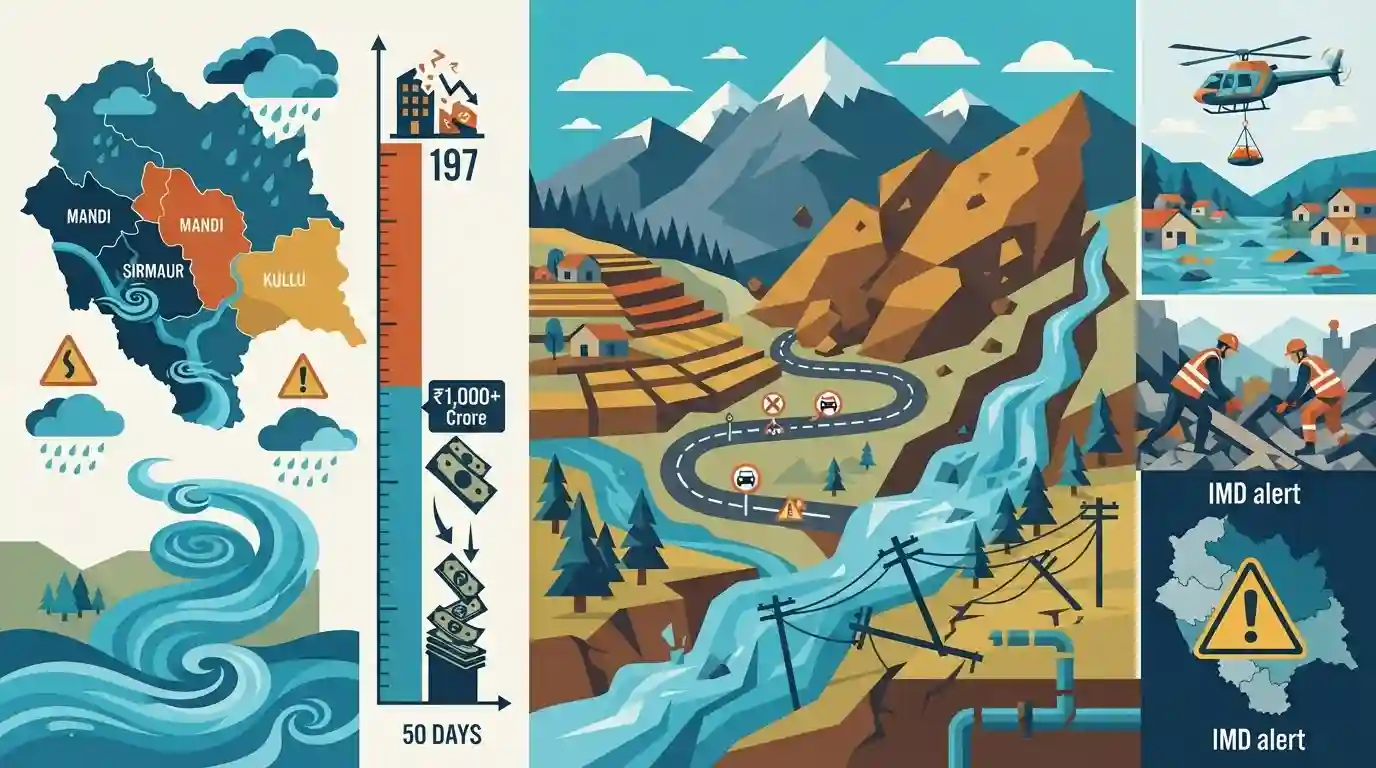
The current monsoon season in Himachal Pradesh has caused immense devastation, claiming 197 lives and inflicting over Rs 1,000 crore in infrastructure damage within 50 days. Triggered by heavy rains, relentless landslides and flash floods have blocked numerous roads, including critical National Highways, severely impacting districts like Mandi, Sirmaur, and Kullu. Essential utilities such as power and water supply schemes have experienced widespread disruptions. The IMD has issued a yellow alert for continued heavy downpours in nine districts, underscoring the extreme vulnerability of the Himalayan ecosystem to climate-induced weather extremes and highlighting an urgent need for robust regional disaster management frameworks.
Key Points
- Monsoon-induced landslides and flash floods in Himachal Pradesh have led to 197 deaths and over Rs 1,000 crore in infrastructural damage in just 50 days.
- 88 roads, including two National Highways, remain blocked, severely disrupting transportation, particularly in Mandi, Sirmaur, and Kullu districts.
- Essential services are severely affected, with hundreds of power transformers and water supply schemes disrupted.
- The India Meteorological Department (IMD) issued a 'yellow' alert for heavy rains in nine districts, warning of continued vulnerability to extreme weather.
Important Terms
India Meteorological Department (IMD)

The principal government agency responsible for meteorological observations, weather forecasting, and issuing disaster warnings like monsoon alerts to mitigate weather-related risks.
UPSC context
Fits HPAS General Studies Paper III (Disaster Management) under early warning systems for natural hazards.
Flash Floods
Rapid flooding of low-lying areas, rivers, and streams, caused by extreme rainfall or cloudbursts typical of monsoon extremes in hilly terrains.
UPSC context
Crucial for HPAS GS Paper III (Hazard Vulnerability of Himachal Pradesh) testing structural and non-structural mitigation.
Disaster Management
The systematic organization and management of resources and responsibilities for mitigating, preparing for, responding to, and recovering from natural or anthropogenic disasters.
UPSC context
Core topic in HPAS Mains GS Paper III syllabus, particularly evaluating state disaster preparedness frameworks.
Yellow Alert
A color-coded meteorological advisory signifying the need to 'be updated', indicating that severe weather is possible and could disrupt daily life.
UPSC context
Relevant to HPAS GS Paper III (Disaster Preparedness and Early Warning Systems).
Himalayan Ecosystem
A fragile, high-altitude ecological zone featuring high biodiversity but extreme vulnerability to climate change, extreme weather, and large-scale infrastructure projects.
UPSC context
Important for HPAS GS Paper I (Geography of HP) and Paper III (Environment) mapping structural vulnerabilities.
Prelims Trap
The entire disaster relief fund for Himachal Pradesh is completely funded by the Centre.
False. While central assistance is high, Himachal Pradesh as a special category state receives a 90:10 cost-sharing ratio for the SDRF, not 100%.
Static Concepts Connected
What is the funding pattern for the State Disaster Response Fund (SDRF) in Himachal Pradesh?
- General States: Under normal circumstances, the Centre contributes 75% and the State 25% to the SDRF.
- Special Category: For special category states like Himachal Pradesh and North-Eastern states, the Centre contributes 90% and the State 10%.
- Finance Commission: The annual corpus and allocation for each state's SDRF are recommended by the successive Finance Commissions.
What are the key characteristics of the Mountain Soil Zone in Himachal Pradesh?
- Elevation: Found primarily at altitudes ranging between 1500 to 3000 meters above sea level.
- Vulnerability: Highly susceptible to severe soil erosion and destabilization during heavy monsoonal rains.
- Composition: Typically acidic and rich in humus, supporting horticulture, but geologically fragile when saturated with water.
Cross-Topic Patterns
Infrastructure vs Ecology: Reservoir Seismicity
Relates monsoon destruction to anthropogenic vulnerabilities. Construction of dams and hydropower projects alters slope stability, triggering reservoir-induced seismicity and worsening landslide impacts.
IMD Alerts and Climatic Zones
Links color-coded weather warnings (yellow alerts) to HP's micro-climatic diversity, potentially testing candidates on historical rainfall distribution patterns, such as Kangra being the state's rainiest district.

Expect a multi-statement question linking Himalayan soil zones, SDRF funding patterns (90:10), and anthropogenic causes of landslides.
Linked PYQs · 3
Linked PYQs · 3
- 2024HPAS_PRELIMSGS1
Arrange the following climatic zones of Himachal Pradesh according to rainfall amount from lowest to highest : (1) Frigid aridic zone (2) Wet temperate zone (3) Humid sub-tropical zone (4) Sub-humid sub-tropical zone Choose the correct answer from the options given below :
- 2023HPAS_PRELIMSGS1
Consider the following statements : (1) The rainiest district in Himachal Pradesh is Kangra. (2) Rainfall in the Alpine region of Himachal Pradesh varies between 300-600 mm. (3) Winter season in Himachal Pradesh extends from October to March. (4) Mandi is the hottest place in Himachal Pradesh. Choose the correct answer from the options given below :
- 2025HPAS_PRELIMSGS1
When was the National Centre for Disaster Management established in India ?
