Himachal Pradesh Monsoon Crisis and Disaster Management Vulnerability
Source:newindianexpress ↗
Why It Matters
The recurring and intensifying nature of monsoon-induced disasters in Himachal Pradesh is highly relevant for HPAS Prelims, particularly in sections evaluating state geography, climate zones, and disaster management. It illustrates the real-world implications of infrastructure vulnerability in fragile Himalayan ecology.
Summary
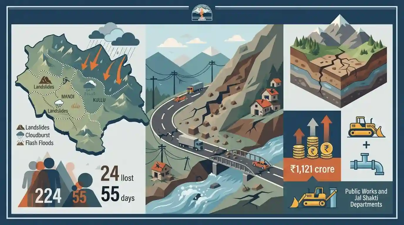
Himachal Pradesh is grappling with a severe monsoon crisis that has claimed 224 lives over a span of 55 days. Devastating landslides, cloudbursts, and flash floods have triggered widespread destruction, predominantly in the fragile mountainous terrains of Mandi and Kullu. The state's infrastructure is heavily compromised, with 149 roads remaining blocked and cumulative financial losses surpassing Rs 1,121 crore. Key state departments, including the Public Works Department and the Jal Shakti Department, account for the bulk of the infrastructural damages. The persistent crisis underscores the acute vulnerability of the Himalayan ecosystem to changing climatic patterns and extreme weather events.
Key Points
- A severe monsoon crisis in Himachal Pradesh has resulted in 224 fatalities over 55 days due to extreme weather events like landslides, cloudbursts, and flash floods.
- The state has suffered a massive economic loss exceeding Rs 1,121 crore, with significant damages reported by the PWD and the Jal Shakti Department.
- Mandi district is identified as the worst-affected region, followed closely by Kullu, demonstrating the high vulnerability of these mountainous tracts.
- Infrastructure is severely paralyzed with 149 roads blocked, severely impeding rescue, relief, and daily life in the state.
Important Terms
Public Works Department (PWD)

The state engineering agency in Himachal Pradesh responsible for planning, constructing, and maintaining critical physical infrastructure, including all-weather roads, bridges, ropeways, and government buildings.
UPSC context
Crucial for GS-1 and GS-3 (Infrastructure/Geography). Highlights the challenges of building and maintaining road connectivity in fragile mountainous terrains.
Jal Shakti Department
The Himachal Pradesh government department tasked with managing water resources, ensuring uninterrupted drinking water supply, and maintaining sanitation infrastructure across challenging topographies, especially during disasters.
UPSC context
Relevant for GS-3 (Water Resources & Disaster Management). Highlights the vulnerability and restoration of rural water schemes during extreme monsoons.
State Emergency Operation Centre (SEOC)
A centralized nodal control room under the State Disaster Management Authority that coordinates round-the-clock emergency response, manages relief operations, and disseminates situational reports and weather advisories.
UPSC context
Core to GS-3 (Disaster Management). Tests understanding of institutional frameworks, early warning systems, and state-level crisis coordination in Himachal Pradesh.
Cloudburst
A localized, extreme weather event featuring sudden and intense rainfall (often over 10 cm per hour), frequently triggered by orographic lift in mountainous terrains, causing massive destruction.
UPSC context
Essential for GS-1 (Geography) and GS-3 (Disasters), frequently tested regarding meteorological triggers, topographical impact, and mitigation in the Himalayas.
Himalayan Ecosystem Vulnerability
The acute susceptibility of the fragile Himalayan environment to climate-induced hazards and unscientific development, leading to frequent landslides, flash floods, soil erosion, and habitat destruction.
UPSC context
Key theme for GS-3 (Environment & Ecology). Focuses on climate change impacts and the pressing need for sustainable, ecosystem-based disaster management.
Prelims Trap
Kangra was the worst-hit district in recent disasters because it receives the highest annual rainfall in Himachal Pradesh.
While Kangra (specifically Dharamshala) records the state's highest overall rainfall, the recent concentrated destruction and highest human/financial losses occurred in Mandi and Kullu due to localized cloudbursts.
Static Concepts Connected
What drives the mechanism of cloudbursts in the Himachal Himalayas?
- Orographic lifting: Moisture-laden monsoon winds strike steep mountainous terrain and are forced to ascend rapidly.
- Cumulonimbus formation: This rapid cooling causes massive, vertical cloud formation, leading to sudden and extreme precipitation.
- High intensity: Rainfall exceeds 100mm per hour, typically concentrated over a highly localized geographical area of 20-30 sq km.
Why are the Himalayan slopes in Himachal highly prone to landslides?
- Geological youth: The Himalayas are young fold mountains comprising fragile, unconsolidated, and heavily jointed rocks.
- Anthropogenic pressure: Unregulated road cutting, extensive terracing, and rapid deforestation destabilize slopes and destroy natural drainage.
- Seismic stress: The state falls in high-risk seismic zones (IV and V); frequent tectonic activity continually weakens rock structures.
Cross-Topic Patterns
Infrastructure deficit + State debt burden
Recurring damages to PWD and Jal Shakti infrastructure force unplanned rehabilitation spending, widening the state's fiscal deficit and increasing reliance on external borrowings.
Climate extremes + Hydropower viability
Escalating flash floods and heavy siltation threaten the structural integrity and operational efficiency of run-of-the-river hydro projects, jeopardizing Himachal's core revenue.

Expect a multi-statement question linking orographic cloudburst mechanisms with the specific geological vulnerability of Mandi and Kullu.
Linked PYQs · 3
Linked PYQs · 3
- 2020HPAS_PRELIMSGS1
Consider the given four statements and choose the correct answer from the given options. Select the true statements from the following: 1. Chamba, Kullu and Kinnaur are considered the most susceptible of landslide threat. 2. Una, Bilaspur, Sirmaur, Shimla and Solan are considered as low vulnerable of disaster threats. 3. Hum valley of Una district has hardly any natural drinking water source. 4. As per the study of central water board, Kala Amb valley in Sirmaur district has exploited the least underground water.
- 2024HPAS_PRELIMSGS1
Arrange the following climatic zones of Himachal Pradesh according to rainfall amount from lowest to highest : (1) Frigid aridic zone (2) Wet temperate zone (3) Humid sub-tropical zone (4) Sub-humid sub-tropical zone Choose the correct answer from the options given below :
- 2023HPAS_PRELIMSGS1
Consider the following statements : (1) The rainiest district in Himachal Pradesh is Kangra. (2) Rainfall in the Alpine region of Himachal Pradesh varies between 300-600 mm. (3) Winter season in Himachal Pradesh extends from October to March. (4) Mandi is the hottest place in Himachal Pradesh. Choose the correct answer from the options given below :
