IMD Issues Flash Flood Warning for Seven Himachal Districts
Source:newindianexpress ↗
Why It Matters
Himachal Pradesh is highly susceptible to hydro-meteorological disasters such as cloudbursts, flash floods, and landslides. These events frequently disrupt river systems (e.g., Satluj, Giri) and crucial infrastructure. For HPAS Prelims, spatial knowledge of districts, rainfall patterns, river basins, and the impacts of monsoon dynamics on the Himalayan ecology is repeatedly tested.
Summary
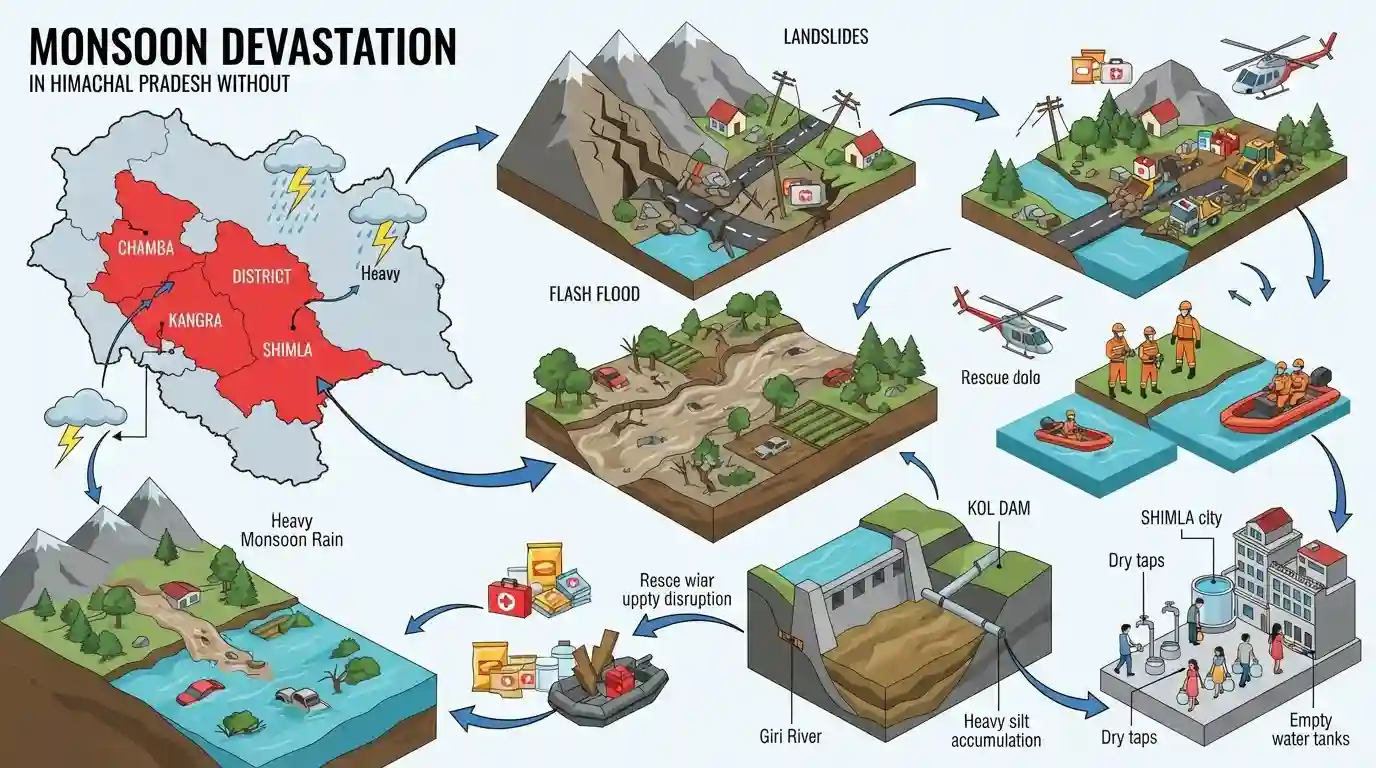
Himachal Pradesh is grappling with severe devastation caused by heavy monsoon rains, leading to landslides and flash floods across multiple districts. The India Meteorological Department (IMD) has issued high alerts for areas including Chamba, Kangra, and Shimla. The extreme weather has extensively damaged local infrastructure, blocked crucial highways, and washed away agricultural lands. Furthermore, massive silt accumulation in the Giri River and Kol Dam has disrupted the Satluj Water Supply Project, causing severe drinking water shortages in Shimla.
Key Points
- Heavy monsoon rains caused widespread devastation in Himachal Pradesh, prompting the IMD to issue flash flood warnings for seven districts.
- Landslides severely disrupted connectivity, blocking National Highway 154A in Chamba and vital circular roads in Shimla.
- Agricultural lands, water mills, and local infrastructure in Chamba suffered extensive damage from cloudbursts and flooding.
- High silt levels in the Giri River and Kol Dam hampered the Satluj Water Supply Project, creating acute drinking water shortages in Shimla.
Important Terms
Satluj Water Supply Project

A critical infrastructure initiative lifting water from the Kol Dam on the Satluj River to meet the drinking water demands of Shimla. Heavy siltation from floods frequently disrupts its operations.
UPSC context
Relevant for GS-1 and GS-3. Highlights the vulnerability of urban water security and infrastructure to extreme climate events and disasters.
India Meteorological Department (IMD)
The principal government agency under the Ministry of Earth Sciences responsible for meteorological observations, weather forecasting, and issuing disaster warnings like flash flood and cyclone alerts.
UPSC context
Crucial for GS-3 (Disaster Management). Tests institutional frameworks for early warning systems, climate resilience, and meteorological forecasting in India.
State Disaster Management Authority (SDMA)
A statutory body established under the Disaster Management Act, 2005. Chaired by the Chief Minister, it coordinates disaster preparedness, mitigation policies, and localized response efforts at the state level.
UPSC context
Important for GS-3 (Disaster Management). Evaluates knowledge of India's decentralized statutory framework for executing localized disaster mitigation and response.
Prelims Trap
"The Giri River, which supplies water to Shimla, is a major tributary of the Satluj river."
The Giri River is a tributary of the Yamuna, not the Satluj. They are often conflated in news because both are vital to Shimla's water supply.
Static Concepts Connected
What is the geographical profile of the Giri and Satluj rivers?
- Giri River: Originates at Kupar Peak in Shimla, divides the Sirmaur district into Cis-Giri and Trans-Giri regions, and serves as a major tributary of the Yamuna River.
- Satluj River: The longest river in Himachal (Vedic name: Sutudri); enters India near Shipki La and hosts the 800 MW Kol Dam hydroelectric project.
How does the IMD formally define a cloudburst?
- Rainfall criteria: Rainfall of 100 mm or more per hour over a localized geographical region of approximately 20 to 30 square kilometers.
- Topographical trigger: Steep hilly terrain forces warm, moist monsoon winds upwards rapidly (orographic lift), creating massive cumulonimbus clouds that dump massive amounts of water suddenly.
Cross-Topic Patterns
Flood-induced urban water scarcity
High siltation from landslides chokes hydro and water-lifting projects (like Kol Dam), creating a paradox where heavy flooding directly causes acute drinking water shortages in hill stations like Shimla.
Himalayan dams and climate risk
Increased frequency of cloudbursts heightens silt accumulation and structural risks for Himalayan dams. This links physical geography directly to infrastructure vulnerability in Mains GS-3 Disaster Management.

Expect a Prelims matching question pairing Himalayan tributaries (like Giri) with their parent rivers, alongside Kol Dam's location in 2026.
Linked PYQs · 5
Linked PYQs · 5
- 2024HPAS_PRELIMSGS1
Arrange the following states of India from highest to lowest flood prone area : (1) Bihar (2) Punjab (3) Rajasthan (4) Uttar Pradesh Choose the correct answer from the options given below :
- 2024HPAS_PRELIMSGS1
Arrange the following climatic zones of Himachal Pradesh according to rainfall amount from lowest to highest : (1) Frigid aridic zone (2) Wet temperate zone (3) Humid sub-tropical zone (4) Sub-humid sub-tropical zone Choose the correct answer from the options given below :
- 2025HPAS_PRELIMSGS1
Match List I with List II : | List-I (Code) | List-II (District) | |---|---| | (a) Highest Rainfall (2018 Data) | (i) Shimla | | (b) Second Most Incidents Reported (2024 Crime Data) | (ii) Mandi | | (c) Fourth Highest Population (2011 Census) | (iii) Kangra | | (d) Fourth Largest Area | (iv) Solan | Choose the correct answer from the options given below : Code: (a) (b) (c) (d)
- 2023HPAS_PRELIMSGS1
Consider the following statements : (1) The rainiest district in Himachal Pradesh is Kangra. (2) Rainfall in the Alpine region of Himachal Pradesh varies between 300-600 mm. (3) Winter season in Himachal Pradesh extends from October to March. (4) Mandi is the hottest place in Himachal Pradesh. Choose the correct answer from the options given below :
- 2016HPAS_PRELIMSGS1
By what name did the Greek scholars call the Satluj river ?
