Southwest Monsoon Regains Momentum with Heavy Rains Across Rajasthan
Source:dd-news ↗
Why It Matters
Understanding the spatial distribution of the southwest monsoon in Rajasthan is crucial for RPSC exams, particularly the distinction between the arid western regions and the humid southeastern (Hadoti) region which receives heavy rainfall. Additionally, knowledge of river systems like the Kalisindh and Parvan (tributaries of the Chambal) and associated dams is frequently tested in Rajasthan Geography.
Summary
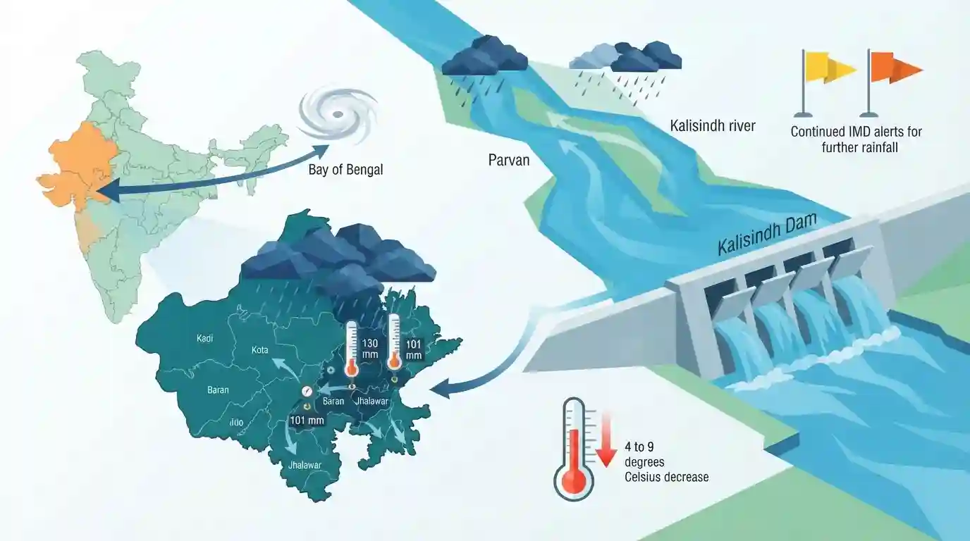
The southwest monsoon has regained momentum in Rajasthan, driven by a new weather system over the Bay of Bengal. This has resulted in heavy to very heavy rainfall across various districts, particularly in the southeastern Hadoti region (Kota, Baran, Jhalawar). Notable precipitation included 130 mm in Baran's Chhipabarod and 101 mm in Kota's Sultanpur. The heavy rains have significantly increased water inflows into the Parvan and Kalisindh rivers, prompting authorities to open gates at the Kalisindh Dam. Consequently, maximum temperatures in the state have plummeted by 4 to 9 degrees Celsius, and the IMD has issued further yellow and orange alerts for continued rainfall.
Key Points
- A new weather system developing over the Bay of Bengal has reinvigorated the southwest monsoon in Rajasthan, causing widespread heavy rainfall.
- The highest rainfall was recorded in Chhipabarod (Baran) at 130 mm and Sultanpur (Kota) at 101 mm, highlighting the heavy precipitation typical of the Hadoti region.
- Due to substantial inflows, gates of the Kalisindh Dam were opened, and water levels surged in the Parvan and Kalisindh rivers.
- The heavy showers led to a significant drop in maximum temperatures across the state, ranging between 4 and 9 degrees Celsius.
Important Terms
India Meteorological Department (IMD)

Established in 1875, it is India's principal agency under the Ministry of Earth Sciences, tasked with meteorological observations, weather forecasting, seismology, and issuing early warnings for hazardous weather.
UPSC context
GS Paper I (Geography) & III (Disaster Management); tests key administrative bodies and monsoon forecasting mechanisms in India.
Hadoti Region
A distinct geographical and cultural region in southeastern Rajasthan, encompassing Kota, Bundi, Baran, and Jhalawar districts, featuring fertile black cotton soil formed from Deccan Trap basaltic rocks.
UPSC context
GS Paper I (Indian Geography); tests regional physiography, soil distribution, and river basins of the southeastern Rajasthan plateau.
Kali Sindh River
A perennial interstate river originating in Madhya Pradesh's Vindhya Range, flowing north into southeastern Rajasthan to join the Chambal River, playing a key role in regional hydrology and water management.
UPSC context
GS Paper I (Drainage Systems); tests knowledge of the Chambal river basin, major tributaries, and water-sharing projects.
Parwan River
A seasonal tributary of the Kali Sindh River that originates in Madhya Pradesh and flows through Rajasthan. It supports local agriculture and bisects the ecologically significant Shergarh Wildlife Sanctuary.
UPSC context
GS Paper I (Rivers) & III (Biodiversity/Projects); tests irrigation projects, regional rivers, and sanctuary locations.
Meteorological Centre (Jaipur)
Established in October 1972 as a state-level unit of the IMD, this facility records weather observations and disseminates meteorological forecasts, agro-advisories, and early severe-weather warnings for Rajasthan.
UPSC context
GS Paper I (Physical Geography/Climatology); tests state-specific weather forecasting setups and local disaster alert systems.
Prelims Trap
All four major dams under the Chambal Valley Project serve the dual purpose of power generation and irrigation.
Only Gandhi Sagar, Rana Pratap Sagar, and Jawahar Sagar generate power. The Kota Barrage is designed exclusively for agricultural irrigation through canals.
Static Concepts Connected
What is the hydrological trajectory of the Kalisindh River?
- Origin and Course: Rises in MP's Vindhya Range, enters Rajasthan's Jhalawar, and joins the Chambal River at Nonera.
- Cultural Landmark: Confluences with the Ahu River at the base of the UNESCO World Heritage Gagron Fort.
- Key Tributary: Fed by the Parvan River, which flows past the historic Shergarh Wildlife Sanctuary in Baran.
What are the core features of the Chambal Valley Project?
- Joint Venture: A collaborative irrigation and power scheme executed equally by Rajasthan and Madhya Pradesh.
- Dam Cascade: Comprises Gandhi Sagar (MP), Rana Pratap Sagar, Jawahar Sagar, and Kota Barrage (Rajasthan).
- Functional Split: Three upstream dams generate hydroelectricity, whereas the downstream Kota Barrage functions solely for canal irrigation.
Cross-Topic Patterns
Hydrology and Heritage Confluences
Water fort (Jal Durg) architecture, like Gagron Fort, relies on strategic river confluences (Ahu and Kalisindh), linking medieval military defense to regional hydrology.
River Corridors and Wildlife Conservation
The Parvan River's flow pattern sustains the Shergarh Wildlife Sanctuary, demonstrating the critical link between river basin management and riparian ecological preservation.

Chambal basin tributaries like Kalisindh and Parvan are likely to be matched with UNESCO sites (Gagron) or sanctuaries (Shergarh) in 2026.
Linked PYQs · 2
Linked PYQs · 2
- 2025RPSC_PRELIMSGS1
What is the correct ascending order of the following group of districts of Rajasthan based on average rainfall in the southwest monsoon?
- 2007RPSC_PRELIMSGS1
The following two dams in the Chambal Valley Project are located in Rajasthan:
