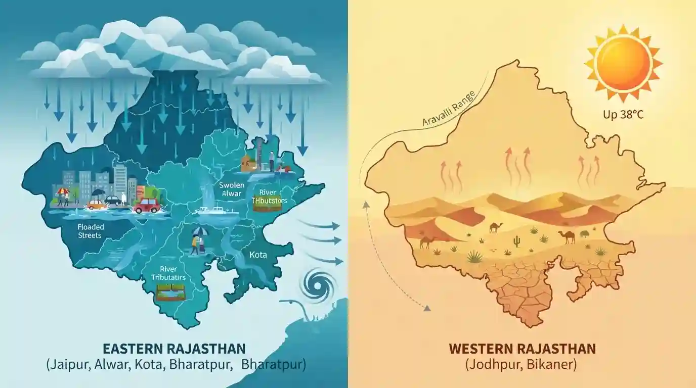
Heavy monsoon rains trigger waterlogging across eastern Rajasthan
Source:dd-india ↗
Why It Matters
Demonstrates the spatial variation of the Southwest Monsoon in Rajasthan, a fundamental geographic concept frequently tested in the RPSC RAS Prelims (e.g., contrasting the humid southeast with the arid west).
Summary
Heavy rains have triggered significant waterlogging in eastern Rajasthan, particularly in Jaipur and Alwar, driven by an active monsoon trough and a low-pressure system over Odisha and West Bengal. While eastern and southeastern divisions like Kota and Bharatpur face continued heavy rainfall, western Rajasthan (Jodhpur, Bikaner) is experiencing weak monsoon conditions with temperatures soaring up to 38°C. This stark regional contrast highlights the distinct rainfall distribution patterns across the state during the southwest monsoon season.
Key Points
- Heavy rainfall caused severe waterlogging in eastern Rajasthan districts, including Jaipur, Alwar, Dholpur, and Karauli.
- The precipitation is driven by an active monsoon trough passing through Amritsar and Nizamabad and connecting to a low-pressure area over northern Odisha and West Bengal.
- Eastern divisions like Kota, Bharatpur, and Jaipur are expected to see continued increased rainfall activity in the coming days.
- In sharp contrast, western Rajasthan districts such as Jodhpur and Bikaner are experiencing weak monsoon conditions, resulting in dry weather and elevated temperatures (36-38°C).
Important Terms
India Meteorological Department (IMD)

The principal government agency under the Ministry of Earth Sciences responsible for meteorological observations, weather forecasting, and tracking monsoon dynamics in India.
UPSC context
Relevant for GS Paper 2 (Institutions) and Geography; tests knowledge of agencies managing weather and disaster warnings.
Monsoon Trough
An extended low-pressure belt formed over the Indian subcontinent during summer. It acts as a major driver for the southwest monsoon, pulling moist ocean winds inland to produce heavy rainfall.
UPSC context
Crucial for RPSC Physical Geography (GS Paper 1); tests understanding of the core mechanisms driving India's monsoon rainfall.
Southwest Monsoon
The primary rain-bearing wind system in India spanning June to September. Originating from the Indian Ocean due to differential heating, it provides over 90% of Rajasthan's annual rainfall.
UPSC context
Vital for Rajasthan Geography and Economy; tests knowledge of seasonal climate patterns and their profound agricultural impact.
Low-Pressure System
An atmospheric zone where warm air rises, drawing in surrounding moist air. During summer, these systems frequently form over the Bay of Bengal, moving inland to trigger and sustain heavy showers.
UPSC context
Essential for Climatology (GS Paper 1); tests candidates' grasp of dynamic weather events that sustain and distribute monsoon rains.
Aravalli Range
A mountain range bisecting Rajasthan that acts as a major climatic divide. Its parallel alignment to the Arabian Sea monsoon winds prevents obstruction, leaving western Rajasthan severely arid.
UPSC context
A core RPSC Rajasthan Geography topic; evaluates understanding of how local physical topography dictates regional rainfall disparities.
Prelims Trap
The Arabian Sea branch is the primary cause of heavy rainfall in eastern Rajasthan.
Eastern Rajasthan receives most of its rainfall from the Bay of Bengal branch moving via the monsoon trough, while the Arabian Sea branch yields minimal rain.
Static Concepts Connected
How does the Aravalli Range dictate Rajasthan's rainfall pattern?
- Parallel alignment: It runs parallel to the Arabian Sea monsoon branch, failing to obstruct the winds, which leaves western Rajasthan largely arid.
- Climatic divide: It acts as a physical barrier, preventing the moisture-laden Bay of Bengal winds from crossing into the western districts.
What are the extreme ends of Rajasthan's climatic classification?
- Arid Zone: Western districts like Bikaner and Jaisalmer fall in the Arid zone (0-20 cm rainfall), experiencing high summer temperatures and low humidity.
- Very Humid Zone: Southeastern districts like Kota and Jhalawar fall in the Very Humid zone (80-100+ cm rainfall), receiving heavy showers from the Bay of Bengal branch.
Cross-Topic Patterns
Urban Flooding + Drainage Systems
Severe waterlogging in Jaipur and Alwar highlights urban planning flaws, linking directly to geography topics covering Rajasthan's internal drainage systems and urban watershed management.
Agro-Climatic Zones + Monsoon Vagaries
The stark eastern-western rainfall divide is the basis for Rajasthan's 10 Agro-Climatic Zones, frequently tested alongside drought-management and dry-land farming schemes.

Expect a multi-statement question contrasting the impact of the Bay of Bengal vs. Arabian Sea monsoon branches on Rajasthan's climate.
Linked PYQs · 2
Linked PYQs · 2
- 2025RPSC_PRELIMSGS1
What is the correct ascending order of the following group of districts of Rajasthan based on average rainfall in the southwest monsoon?
- 2023RPSC_PRELIMSGS1
Which areas of India receive North-East monsoon rainfall? A. Tamil Nadu coast B. Gujarat coast C. Southern Andhra Pradesh D. South-eastern Karnataka Code:
