Monsoon Rains Disrupt Rajasthan Infrastructure and Water Reservoirs
Source:theprint ↗
Why It Matters
Understanding Rajasthan's drainage systems (like the Udai Sagar dam in Udaipur), infrastructure developments (Delhi-Mumbai Expressway), and the district-wise distribution of monsoon rainfall is critical for the RPSC RAS Prelims. Past questions frequently test the spatial variation of monsoon rains and the geographical mapping of rivers and districts.
Summary
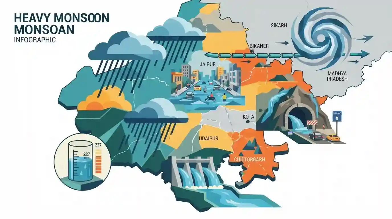
Heavy monsoon rains have severely disrupted life across Rajasthan, with Chittorgarh's Bassi recording the highest rainfall at 227 mm. The deluge caused severe waterlogging in major cities like Jaipur, disrupting traffic. Critical infrastructure was affected, leading to the temporary closure of the Mukundra tunnel on the Delhi-Mumbai Expressway in Kota. In Udaipur, the gates of the Udai Sagar dam were opened as water levels neared capacity. The Meteorological Department attributed the intense rainfall to a low-pressure system over northwest Madhya Pradesh and a monsoon trough extending through Bikaner.
Key Points
- Bassi in Chittorgarh recorded the highest rainfall in Rajasthan at 227 mm, causing widespread disruption.
- The Mukundra tunnel on the Delhi-Mumbai Expressway in Kota was closed due to high water levels.
- Authorities opened the gates of the Udai Sagar dam in Udaipur as water approached full capacity.
- Heavy rains and severe waterlogging impacted Jaipur, disrupting traffic and daily life.
- The heavy precipitation is driven by a low-pressure area over northwest Madhya Pradesh and a monsoon trough passing through Bikaner.
Important Terms
Delhi-Mumbai Expressway

An under-construction, 1,350 km controlled-access highway linking India's national and financial capitals. It traverses multiple states, including Rajasthan, and features advanced wildlife corridors to minimize ecological disruption.
UPSC context
GS Paper 3 (Infrastructure). Tests knowledge of economic corridors, regional connectivity, and sustainable infrastructure development.
India Meteorological Department (IMD)
The principal agency under the Ministry of Earth Sciences responsible for meteorological observations, weather forecasting, and seismology in India. It issues critical early warnings for monsoons and extreme weather events.
UPSC context
GS Paper 1 (Geography) and GS Paper 3 (Disaster Management). Tests understanding of early warning systems and climate monitoring.
Udai Sagar Dam
A historic 16th-century dam built by Maharana Udai Singh II on the Berach River in Udaipur, Rajasthan. It created the Udai Sagar Lake, serving as a crucial reservoir for regional water security and irrigation.
UPSC context
GS Paper 1 (Geography/History). Tests knowledge of traditional water management systems and Rajasthan's river basins.
Monsoon Trough
An elongated low-pressure area extending roughly from the Thar Desert to the Bay of Bengal. Its north-south shift dictates the active and break phases of the southwest monsoon across India.
UPSC context
GS Paper 1 (Physical Geography). Tests understanding of the Indian monsoon mechanism and factors controlling spatial rainfall distribution.
Mukundra Tunnel
An 8.3 km twin-tube highway tunnel on the Delhi-Mumbai Expressway. It passes beneath Rajasthan's ecologically sensitive Mukundra Hills Tiger Reserve, functioning as a critical wildlife mitigation structure to prevent habitat fragmentation.
UPSC context
GS Paper 3 (Environment/Infrastructure). Highlights the balance between rapid infrastructure growth and biodiversity conservation within tiger reserves.
Prelims Trap
Mukundra Hills Tiger Reserve is located within the Aravalli mountain range.
Mukundra Hills is actually in the Hadoti plateau region, associated with the Vindhyan range. UPSC frequently tests the geographical boundaries of the Aravallis.
Static Concepts Connected
How does the Monsoon Trough dictate rainfall distribution in India?
- Nature: It is an elongated low-pressure convergence zone forming part of the ITCZ over the Indian landmass during the southwest monsoon.
- Active Phase: When the trough passes through the plains (e.g., extending through Bikaner), it draws moisture and causes widespread, heavy precipitation.
- Break Phase: When the trough shifts northward to the Himalayan foothills, the plains experience dry spells while the northeast and foothills get torrential rain.
How does the Ayad/Berach river connect to the broader Ganga drainage basin?
- Origin: The Ayad river originates in the Gogunda hills of the Udaipur district.
- Transformation: After draining into and flowing out of the Udai Sagar lake, the river's name changes to the Berach river.
- Basin Integration: The Berach river flows into the Banas river, which then joins the Chambal, ultimately feeding into the Yamuna and the broader Ganga system.
Cross-Topic Patterns
Expressways & Wildlife Corridors
The Mukundra tunnel on the Delhi-Mumbai Expressway exemplifies eco-friendly infrastructure under PM Gati Shakti, designed specifically to prevent the fragmentation of tiger habitats in sensitive ecological zones.
Arid Region Urban Flooding
Extreme precipitation in historically dry areas like Rajasthan reflects shifting climate patterns, severely stressing legacy urban drainage systems in cities like Jaipur and highlighting the need for climate-resilient urban planning.

Expect a 2026 Prelims geography question mapping Rajasthan's wildlife reserves (Mukundra, Bassi) to their intersecting rivers and ranges.
Linked PYQs · 4
Linked PYQs · 4
- 2025RPSC_PRELIMSGS1
Match List-I with List-II and select the correct answer from the code given below: List-I (District) – List -II (River) A. Udaipur i. Sabai and Ruparil B. Bundi ii. Gambhiri and Parwati C. Bharatpur iii. Som and Jakham D. Alwar iv. Kural Code: A, B, C, D
- 2025RPSC_PRELIMSGS1
What is the correct ascending order of the following group of districts of Rajasthan based on average rainfall in the southwest monsoon?
- 2023RPSC_PRELIMSGS1
Which of the following groups of districts is correctly arranged in descending order according to the amount of received monsoon rainfall?
- 2025RPSC_PRELIMSGS1
General Knowledge & General Studies 1. The four segments of the Golden Quadrilateral connect which cities? A. Delhi – Mumbai B. Mumbai – Chennai C. Chennai – Kolkata D. Kolkata – Delhi Choose the correct answer from the options below, considering the ascending order of length of these four segments: Code:
