Monsoon Rains Disrupt Char Dham Yatra and Pilgrimage Routes
Source:new-indian-express ↗
Why It Matters
This article highlights the climate and geographical vulnerabilities of Uttarakhand, showcasing the recurring impact of landslides on critical transport routes (NH-58) and religious circuits (Char Dham, Adi Kailash, and Om Parvat). This context is vital for understanding disaster management, physical geography, river valleys (Alaknanda and Mandakini), and border administrative permits (ILP) in the Himalayan state.
Summary
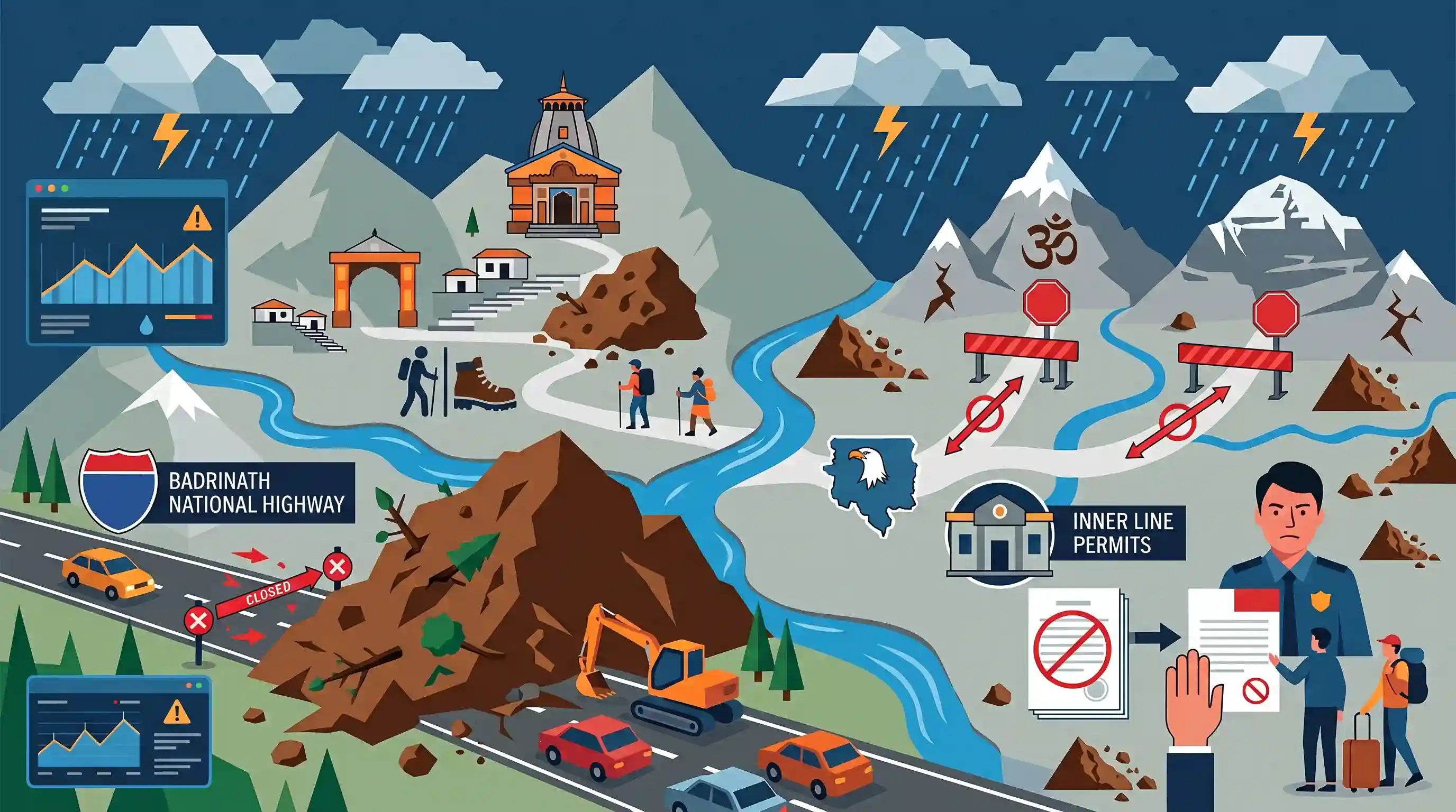
Relentless monsoon rains in Uttarakhand have disrupted the state's major pilgrimage circuits. The Badrinath National Highway is blocked by landslide debris at the chronic Sirobagad slide zone on the Srinagar-Rudraprayag highway. Debris also blocked the pedestrian route at Gaurikund (the gateway to Kedarnath). In Kumaon's Pithoragarh district, authorities have suspended the Adi Kailash and Om Parvat journeys and paused the issuance of Inner Line Permits (ILPs) due to landslide risks in high Himalayan terrains. Heavy rainfall alerts remain active across multiple districts.
Key Points
- Relentless monsoon rainfall in Uttarakhand has severely disrupted the prestigious Char Dham Yatra and high-altitude pilgrimages.
- The Badrinath National Highway (NH-58) is blocked at Sirobagad, a chronic landslide zone that has plagued the Srinagar-Rudraprayag stretch for nearly three decades.
- Debris and rockfall hit the pedestrian route at Gaurikund, the official gateway and trekking base camp to the Kedarnath shrine in Rudraprayag district.
- In the Kumaon division, pilgrimages to Adi Kailash and Om Parvat in Pithoragarh district have been suspended, and the issuance of Inner Line Permits (ILPs) has been temporarily halted due to severe landslide risks.
- The IMD has issued yellow and orange alerts for heavy rain across several districts of Uttarakhand, prompting disaster management teams to be placed on high alert.
Important Terms
Inner Line Permit (ILP) System

A travel document issued by state governments under British-era regulations to restrict and monitor the entry and stay of non-domicile Indian citizens in sensitive border or tribal regions.
UPSC context
GS Paper II (Polity - Federal Structure & Tribal Safeguards) and GS Paper III (Border Management - National Security).
Char Dham Yatra
A major Himalayan pilgrimage circuit in Uttarakhand that visits four sacred Hindu shrines located near river origins: Yamunotri (Yamuna), Gangotri (Ganga), Kedarnath (Mandakini), and Badrinath (Alaknanda).
UPSC context
GS Paper I (Art & Culture - Pilgrimage Tourism; Geography - Himalayan Rivers) and GS Paper III (Disaster Management).
India Meteorological Department (IMD)
The chief scientific agency of the Ministry of Earth Sciences responsible for weather monitoring, monsoon tracking, seismological observations, and issuing severe weather disaster warnings.
UPSC context
GS Paper I (Physical Geography - Monsoon and Weather Phenomena) and GS Paper III (Disaster Management and Early Warning Systems).
Landslide Hazard Zonation (LHZ)
A spatial mapping technique that divides terrains into homogeneous zones categorized by their susceptibility to slope failure and landslide risk based on geologic, tectonic, and rainfall factors.
UPSC context
GS Paper I (Geography - Geomorphology) and GS Paper III (Disaster Management - Mitigation of natural hazards in Himalayan ecosystems).
Adi Kailash
A sacred Himalayan mountain in Uttarakhand's Pithoragarh district, revered as "Chota Kailash" and situated in a sensitive border region near the Indo-China boundary.
UPSC context
GS Paper I (Culture - Sacred Geography) and GS Paper III (Border Security - Infrastructure and Tourism in sensitive areas).
Prelims Trap
The Inner Line Permit (ILP) system is a regulatory mechanism unique only to the North-Eastern states of India.
While the historical BEFR-based ILP operates in the Northeast, Uttarakhand’s border districts (like Pithoragarh) also enforce an Inner Line Permit system under security regulations for accessing strategic high-altitude zones.
Static Concepts Connected
What are the major confluences (Panch Prayag) of the Alaknanda River system?
- Vishnuprayag: The first major confluence where the Alaknanda meets the Dhauliganga River.
- Rudraprayag: The confluence of the Alaknanda and Mandakini (originating from the Chorabari Glacier near Kedarnath).
- Devprayag: The final confluence where Alaknanda merges with Bhagirathi to officially form the Ganga River.
Why is the Lesser/Greater Himalayan boundary geologically prone to chronic landslides?
- Tectonic shear: Proximity to active fault lines (like the Main Central Thrust) fractures and severely weakens the bedrock.
- Chemical weathering: Monsoonal hydration converts feldspar-rich rocks into weak kaolin clay, dramatically reducing slope shear strength.
- Pore-water pressure: Heavy seasonal rainfall saturates slope material, increasing pore-water pressure and triggering gravity-driven failures.
Cross-Topic Patterns
Strategic infrastructure vs. Ecological stability
Balancing dual goals of border road construction for national security (near the LAC) with severe ecological fragility and frequent landslides in the Main Central Thrust zone.
Inner Line Permits beyond Northeast India
Examines how security-based travel restrictions (ILP) apply to strategic Himalayan borders in Uttarakhand and Himachal, linking internal security with tourism administration.

UPSC may test the physical geography of Kumaon/Garhwal, matching shrines like Adi Kailash or Kedarnath to their respective river basins.
Linked PYQs · 4
Linked PYQs · 4
- 2025UKPSC_PRELIMSGS1
Which of the following is the correct order of rivers from west to east in Uttarakhand?
- 2024UKPSC_PRELIMSGS1
Select the correct pair of the river basins separated by Dudhatoli Mt. Range.
- 2012UKPSC_PRELIMSGS1
In which of the following rivers' confluence is Gobindghat located?
- 2025UKPSC_PRELIMSGS1
Which of the following pairs is not correctly matched ? Name of Airport District
