Rajasthan Heavy Rainfall Red Warning and Urban Disruptions
Source:sangritoday ↗
Why It Matters
Understanding monsoon patterns, low-pressure system tracks, and the spatial distribution of rainfall in Rajasthan is a core topic in the RPSC RAS Prelims syllabus. Questions frequently test the ascending or descending order of rainfall among different districts of Rajasthan (e.g., in RAS Prelims 2023 and 2025). Urban drainage and disaster management issues also remain vital for regional planning topics.
Summary
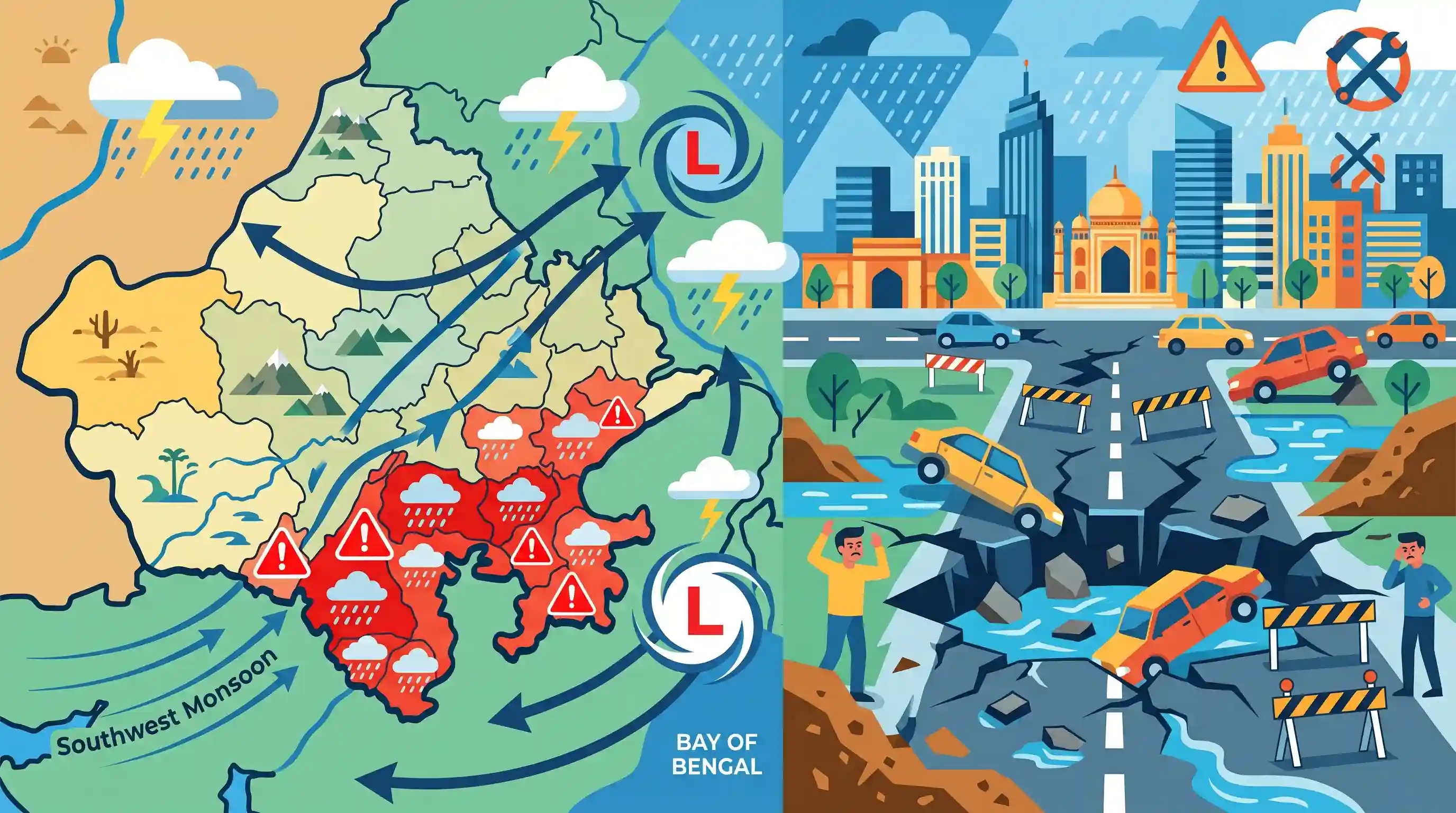
The article details a severe weather event in Rajasthan during July 2026, wherein the India Meteorological Department (IMD) issued a red warning for eight southern and southeastern districts. The intense rainfall is driven by a west-northwesterly moving low-pressure system originating from the Bay of Bengal. Additionally, the initial monsoon showers have exposed infrastructure vulnerabilities in the state capital of Jaipur, where major road cave-ins and massive potholes disrupted traffic, underscoring urban planning and disaster management challenges.
Key Points
- The India Meteorological Department (IMD) issued a 'Red Alert' for extremely heavy rainfall from July 7–10 in eight districts of Rajasthan, including Banswara, Baran, Chittorgarh, Dungarpur, Jhalawar, Pratapgarh, Salumbar, and Udaipur.
- The meteorological mechanism behind this heavy downpour is a low-pressure area originally formed over the Bay of Bengal and Odisha coast, which subsequently shifted west-northwesterly towards southeastern Jharkhand and northern Odisha, bringing intense precipitation to Eastern Rajasthan.
- Eastern and Southeastern regions of Rajasthan are experiencing severe weather, while Western Rajasthan (Jodhpur and Bikaner divisions) expects lighter to moderate precipitation, illustrating the state's typical spatial gradient where rainfall increases from the northwest towards the southeast.
- Heavy monsoon downpours led to major urban infrastructure failures in the capital city of Jaipur, where multiple roads caved in (forming 8 to 10-feet deep potholes at Gopalpura bypass and Tonk Road), highlighting gaps in urban drainage, quality of road construction, and municipal disaster preparedness.
Important Terms
India Meteorological Department (IMD)

India's principal agency under the Ministry of Earth Sciences, responsible for meteorological observations, weather forecasting, and early warnings for natural disasters like cyclones, heavy rains, and heatwaves.
UPSC context
Essential for GS Paper 1 (Geography: Climate) and GS Paper 3 (Disaster Management: early warning systems).
Urban Flooding
The inundation of built-up urban areas caused by heavy rainfall overwhelming municipal drainage systems, worsened by concretisation, unplanned construction, and encroachment of natural water bodies.
UPSC context
Relevant for GS Paper 1 (Urbanization challenges) and GS Paper 3 (Disaster Management and NDMA guidelines).
Southwest Monsoon
A massive seasonal wind system blowing from the southwest across the warm Indian Ocean to the Indian subcontinent from June to September, delivering nearly 75% of India's annual rainfall.
UPSC context
Vital for GS Paper 1 (Physical Geography: mechanism of Indian monsoon and spatial rainfall distribution).
IMD Color-Coded Warnings
A hazard alert framework (Green, Yellow, Orange, Red) used by the IMD to communicate the intensity of severe weather events and the required level of preparedness.
UPSC context
Important for GS Paper 3 (Disaster Management: disaster risk reduction and emergency communication).
Low-Pressure System
An atmospheric region where air pressure is lower than the surrounding area, driving rising air currents, cloud formation, and heavy precipitation like monsoon depressions.
UPSC context
Core topic for GS Paper 1 (Geography: atmospheric circulation, cyclogenesis, and precipitation mechanisms).
Prelims Trap
Monsoon rainfall in Rajasthan increases from the southeast towards the northwest, following the path of the Bay of Bengal branch.
In reality, rainfall decreases steadily from the southeast and east towards the northwest and west, with Jhalawar receiving high rainfall and Jaisalmer the lowest.
Static Concepts Connected
What causes the sharp Southeast-to-Northwest rainfall gradient in Rajasthan?
- Aravalli Alignment: The range runs parallel to the Arabian Sea monsoon branch, failing to intercept its moisture and leaving western Rajasthan in a rain shadow.
- Moisture Depletion: The Bay of Bengal branch enters from the east, steadily losing its moisture payload as it travels westward across the state.
- Spatial Contrast: Southeastern districts like Jhalawar receive high rainfall (>900mm), whereas western desert districts like Jaisalmer receive very low rainfall (<150mm).
How does rapid urban concretization modify hydrology and cause flash floods?
- Infiltration Loss: Impervious concrete surfaces prevent natural ground infiltration, forcing up to 90% of rainfall to become immediate surface runoff.
- Peak Discharge: Concreted catchments increase peak flood discharge by 1.8 to 8 times and expand total runoff volumes by up to 6 times.
- Hydrograph Compression: The lag time between maximum rainfall intensity and peak runoff is severely shortened, overwhelming stormwater drainage systems instantly.
Cross-Topic Patterns
Urban Hydrology + Municipal Finance
Rising urban runoff requires costly drainage overhauls; however, financially weak Urban Local Bodies struggle to fund climate-resilient drainage infrastructure under modern master plans.
IMD Warnings + Federal Disaster Relief
IMD color-coded alerts trigger immediate local emergency protocols, but the systemic coordination between state SDRFs and federal NDRF resources remains a critical administrative hurdle.

Mains 2026 is likely to link urban infrastructure vulnerability (like road cave-ins) directly with changing thermodynamic monsoon patterns.
Linked PYQs · 2
Linked PYQs · 2
- 2025RPSC_PRELIMSGS1
What is the correct ascending order of the following group of districts of Rajasthan based on average rainfall in the southwest monsoon?
- 2023RPSC_PRELIMSGS1
Which of the following groups of districts is correctly arranged in descending order according to the amount of received monsoon rainfall?
