Kathua Cloudburst and Landslides Raise Himalayan Risks
Source:The Hindu ↗
Why It Matters
Provides a real-world case study on the increasing frequency of extreme weather events (cloudbursts and landslides) in the fragile Himalayan ecosystem. It highlights the critical role of coordinated, multi-agency disaster response (SDRF, Military, Paramilitary) in remote terrains, which is a key focus area in UPSC GS3 Disaster Management.
Summary
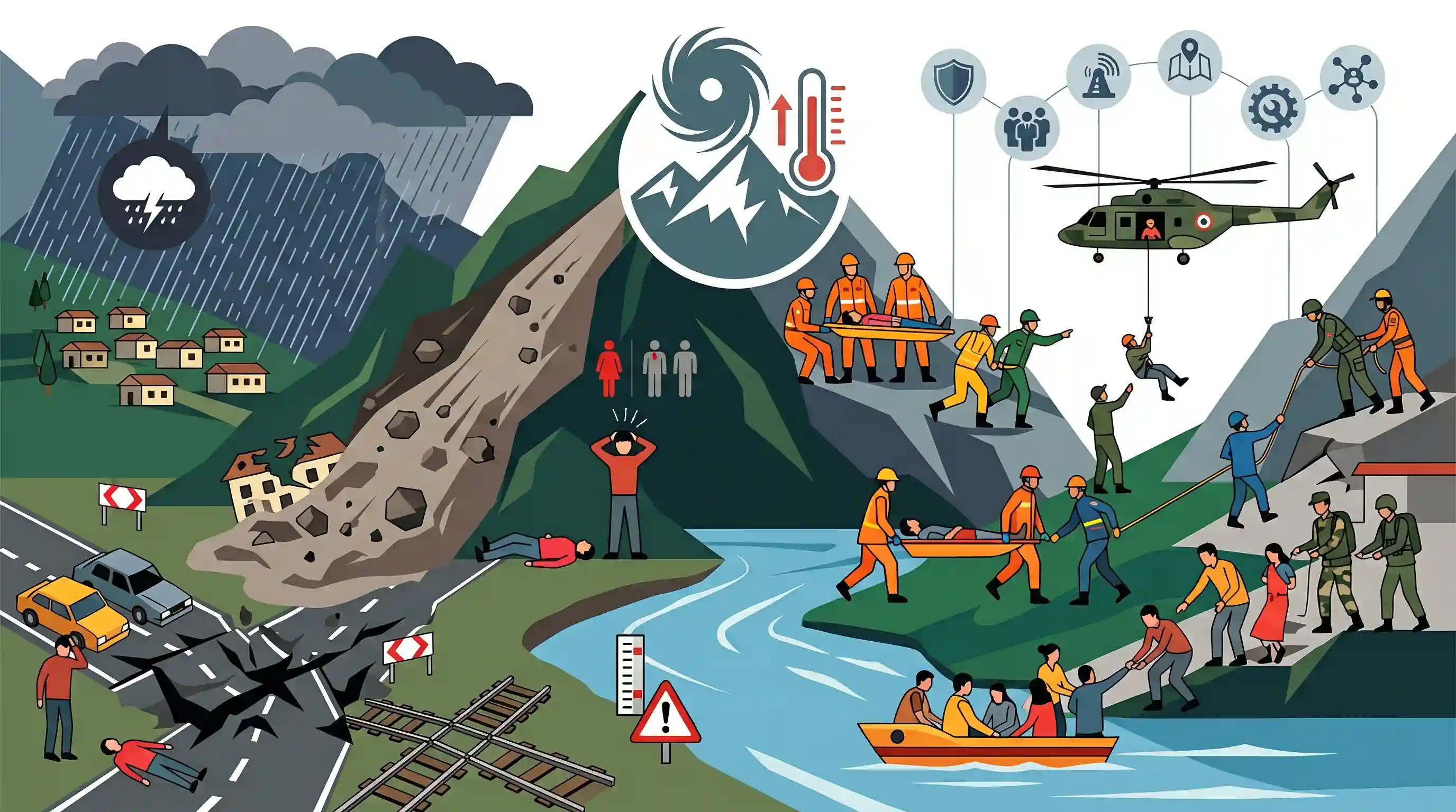
Heavy overnight rains in Jammu and Kashmir's Kathua district triggered a devastating cloudburst in Jodh Ghati village and a landslide in the Janglote area, resulting in at least seven deaths and five injuries. The extreme weather damaged critical infrastructure, including national highways and railway tracks, while causing water levels in the Ujh river to rise near the danger mark. A coordinated rescue operation was quickly mobilized, utilizing the SDRF, military, paramilitary forces, and helicopters to evacuate the injured. The recurring nature of such events highlights the extreme vulnerability of the Himalayan region to climate-induced disasters and underscores the necessity of robust, multi-agency disaster response and mitigation strategies.
Key Points
- At least seven fatalities and five injuries were reported in Kathua district, J&K, following a cloudburst in Jodh Ghati and a landslide in Janglote.
- Heavy overnight rains triggered the calamities, causing damage to a national highway, railway tracks, and residential areas.
- The Ujh river's water level rose sharply near the danger mark, prompting advisories for residents to stay away from water bodies.
- A joint rescue and relief operation was mobilized involving the SDRF, police, military, and paramilitary forces.
- Helicopters were deployed to airlift critically injured individuals to medical facilities in Pathankot.
Important Terms
Cloudburst

Localized extreme rainfall exceeding 100 mm per hour over a ~20–30 sq km area, typically occurring in hilly regions due to orographic lifting and cumulonimbus cloud formation.
UPSC context
GS Paper I: Physical Geography; tests understanding of localized atmospheric phenomena and the impact of climate change on rainfall patterns.
State Disaster Response Force (SDRF)
Specialized state-level units mandated under the Disaster Management Act, 2005, for immediate rescue operations. They are modeled after the NDRF and funded primarily through the State Disaster Response Fund.
UPSC context
GS Paper III: Disaster Management; tests knowledge of the institutional framework for sub-national disaster preparedness and response.
Central Armed Police Forces (CAPFs)
Security forces under the Ministry of Home Affairs (including BSF, CRPF, ITBP) that serve as first responders during disasters, providing specialized search, rescue, and medical aid.
UPSC context
GS Paper III: Internal Security/Disaster Management; evaluates the role of central agencies in supporting civil authorities during national emergencies.
National Disaster Management Act, 2005
The legal framework governing India's disaster response, establishing the NDMA (National), SDMA (State), and DDMA (District) to shift focus from reactive relief to proactive mitigation and preparedness.
UPSC context
GS Paper II/III: Governance and Disaster Management; fundamental for questions on statutory bodies and the evolution of India's disaster policy.
Himalayan Vulnerability
The inherent susceptibility of the Himalayas to disasters like landslides and flash floods due to their status as young fold mountains, steep topography, and high seismic sensitivity.
UPSC context
GS Paper III: Environment and Disaster Management; focuses on ecological fragility versus developmental pressures in the Himalayan ecosystem.
Prelims Trap
A cloudburst is defined as any sudden, devastating heavy rainfall that leads to flash floods in mountainous regions.
IMD strictly defines a cloudburst quantitatively: rainfall exceeding 100 mm per hour over a concentrated geographical area of 10-30 sq km. Mere devastation or flash flooding does not classify it as a cloudburst.
Static Concepts Connected
Why are the Himalayas more susceptible to landslides than the Western Ghats?
- Tectonic activity: The Himalayas are young, seismically active fold mountains, causing constant instability compared to the older, relatively stable block structure of the Western Ghats.
- Geological composition: Himalayan slopes consist largely of unconsolidated sedimentary rocks and loose soil, which are easily sheared and eroded by heavy rainfall.
- Steep topography: The rugged, steep gradients of the Himalayas amplify gravity-driven mass movement when the slopes are lubricated by intense precipitation.
How is the State Disaster Response Fund (SDRF) constituted and funded?
- Statutory backing: Created under Section 48(1)(a) of the Disaster Management Act, 2005 as the primary fund available to State Governments for immediate disaster relief.
- Funding pattern: The Center contributes 75% for general category states and 90% for special category states and UTs (like Jammu and Kashmir).
- Nodal authority: The Ministry of Home Affairs oversees the release of the central share, guided by the recommendations of the Finance Commission.
Cross-Topic Patterns
Ujh River & Indus Water Treaty
Ujh is a right-bank tributary of the Ravi. The flooding here intersects with India's strategic push (like the Ujh Multipurpose Project) to fully utilize its water share of eastern rivers under the IWT.
LHZ Mapping & GSI mandate
Landslide Hazard Zonation mapping by the Geological Survey of India is a core national strategy. Prelims frequently tests which nodal scientific agencies are responsible for mapping specific natural disasters.

Ujh/Ravi tributaries mapped against Indus Water Treaty projects, combined with IMD's strict cloudburst criteria, is prime 2026 Prelims material.
Linked PYQs · 4
Linked PYQs · 4
- 2022MainsGS3
Explain the mechanism and occurrence of cloudburst in the context of the Indian subcontinent. Discuss two recent examples.
- 2016MainsGS3
Rehabilitation of human settlements is one of the important environmental impacts which always attracts controversy while planning major projects. Discuss the measures to be adopted to mitigate the impact of the recent incidents of cloudbursts in many places of Uttarakhand.
- 2016MainsGS1
The Himalayas are highly prone to landslides. Discuss the causes and suggest suitable measures of mitigation.
- 2021MainsGS3
Describe the various causes and the effects of landslides. Mention the important components of the National Landslide Risk Management Strategy.
