Rajasthan Heatwave And Western Disturbance Rainfall Forecast
Source:times-of-india ↗
Why It Matters
Understanding the regional climate variations of Rajasthan, the meteorological processes behind intense heatwaves, the generation of dust storms via local convective currents, and the impact of Western Disturbances is essential for the RPSC RAS Geography syllabus.
Summary
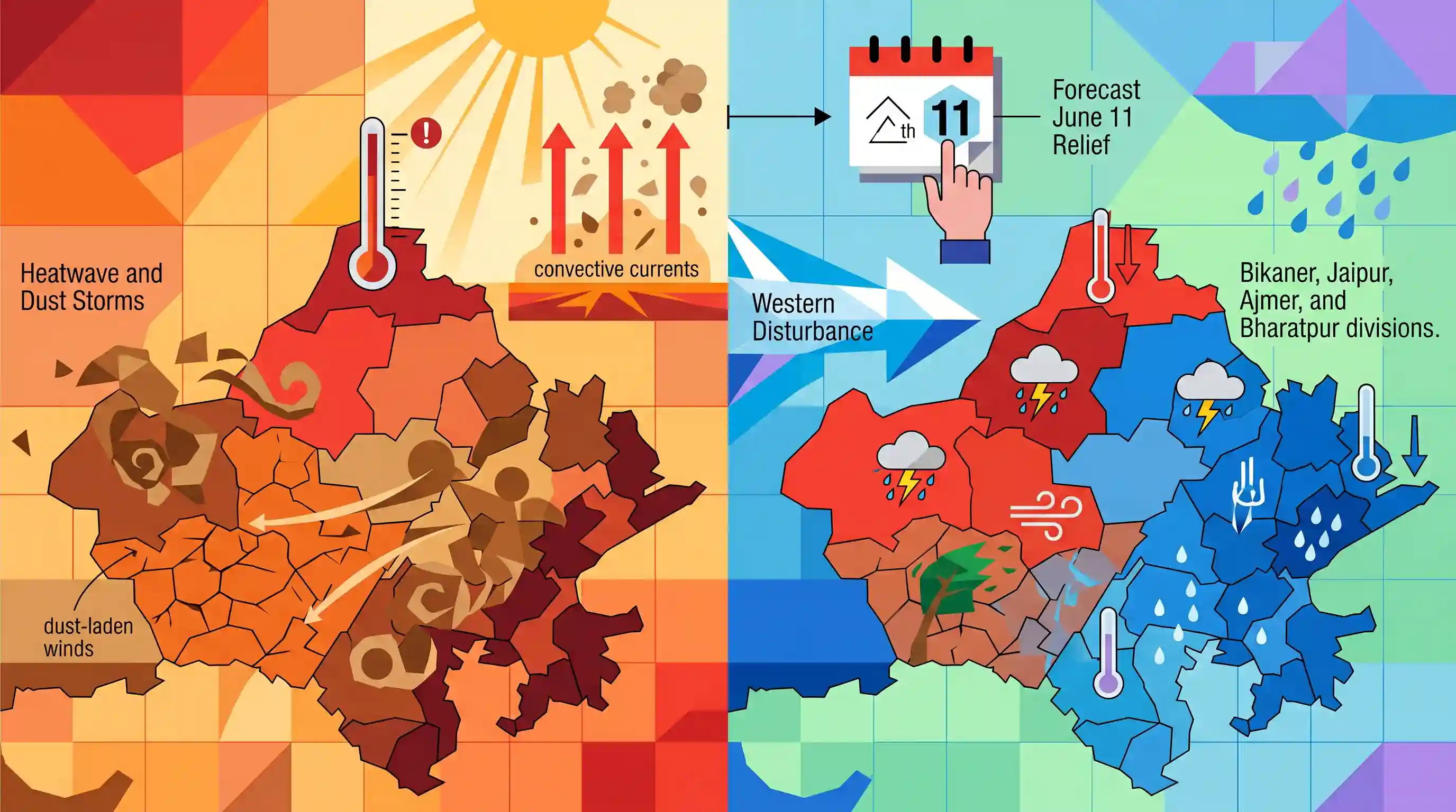
The article highlights severe heatwave conditions across several districts in Rajasthan, with temperatures soaring up to 46.4°C in Sri Ganganagar. It reports on prevailing dry conditions and dust-laden winds in the Jodhpur and Bikaner divisions. However, relief is expected starting June 11 as a fresh Western Disturbance is forecast to bring thunderstorms, strong winds, and light-to-moderate rainfall to Bikaner, Jaipur, Ajmer, and Bharatpur divisions.
Key Points
- Severe heatwave conditions gripped several parts of Rajasthan, with Sri Ganganagar recording the state's highest maximum temperature of 46.4 degrees Celsius, followed by Churu (44.6°C), Pilani (44.5°C), Phalodi (43.8°C), and Jaisalmer and Bikaner (both 43.6°C).
- Western Rajasthan (primarily Jodhpur and Bikaner divisions) is experiencing extremely dry conditions with strong dust-laden winds blowing at speeds of 20-30 kmph.
- Localised intense heating of the desert soil during May and June causes the development of vertical convective currents, which are responsible for generating regional dust storms (Andhi) in Rajasthan.
- An active Western Disturbance (which originates from the Mediterranean Sea) is predicted to trigger a shift in weather from June 11 to June 14, bringing thunderstorms, high-speed winds (50-60 kmph), and light to moderate rainfall across Bikaner, Jaipur, Ajmer, and Bharatpur divisions.
Important Terms
India Meteorological Department (IMD)

The principal government agency under the Ministry of Earth Sciences responsible for meteorological observations, weather forecasting, and early warning systems for natural hazards in India.
UPSC context
GS Paper I (Geography) and GS Paper III (Disaster Management); tests administrative agencies and weather monitoring.
Western Disturbance
An extra-tropical storm originating in the Mediterranean region that travels eastward via the westerly jet stream, bringing non-monsoonal winter rain and snow to northwestern India.
UPSC context
GS Paper I (Climatology/Geography); tests non-monsoonal weather patterns and their impact on Rabi agriculture.
Heatwave
A period of abnormally high temperatures declared by the IMD when maximum temperatures cross 40°C in plains, 37°C on coasts, or 30°C in hills, with specified departures from normal.
UPSC context
GS Paper I (Climatology) and GS Paper III (Disaster Management); tests criteria for extreme climate events.
Convective Currents
Vertical air flows driven by thermal gradients where heated, less dense air rises and cooler, denser air sinks, leading to atmospheric instability, cloud formation, and thunderstorms.
UPSC context
GS Paper I (Physical Geography - Climatology); tests atmospheric thermodynamics and local weather dynamics.
Dust Storm
A meteorological hazard in arid regions where strong winds lift fine particles from dry, bare soil into the atmosphere, significantly reducing visibility and causing soil erosion.
UPSC context
GS Paper I (Geography) and GS Paper III (Disaster Management); tests wind-driven hazards and dryland ecosystem vulnerabilities.
Prelims Trap
Western Disturbances are strictly winter phenomena and cannot occur during the hot weather season.
WDs are not restricted to winter; they can persist into May-June, interacting with local convective systems to cause severe pre-monsoon thunderstorms and dust storms (Andhi).
Static Concepts Connected
What is the meteorological mechanism behind Western Disturbances (WDs)?
- Origin & Path: They are extra-tropical cyclonic storms originating over the Mediterranean, Caspian, and Black seas.
- Driving Force: They are carried eastward towards India by the high-altitude Subtropical Westerly Jet Stream.
- Agricultural Impact: They bring crucial winter precipitation (called 'Mawat' in Rajasthan) essential for Rabi crops like wheat.
Why does Western Rajasthan remain highly arid despite proximity to the Arabian Sea?
- Aravalli Alignment: The Aravalli Range lies parallel to the southwest monsoon's Arabian Sea branch, failing to intercept moisture.
- No Orographic Lift: Lack of physical barriers prevents adiabatic cooling and condensation, leaving the western plains arid.
- Atmospheric Aridity: Extreme dry heat from the desert soil evaporates any high-altitude moisture before it precipitates.
Cross-Topic Patterns
Urban heat islands & district heat action plans
Rising temperatures in Rajasthan highlight the need to integrate urban microclimate mapping with NDMA’s Heat Action Plans to protect vulnerable informal-sector workers.
Westerly jet weakening & climate change
Arctic warming triggers jet stream stalling, leading to erratic pre-monsoon Western Disturbances that cause crop damage and alter regional dust-storm frequencies.

Expect a conceptual question linking the weakening of the Westerly Jet Stream to erratic pre-monsoon Western Disturbances and heatwave frequency.
Linked PYQs · 4
Linked PYQs · 4
- 2018RPSC_PRELIMSGS1
The dust storms occurring in Rajasthan during May-June months are responsible for: (a) Origin of convective currents at some places (b) Aravalli hills are parallel to the southwest winds. (c) Origin of very intense easterly winds
- 2025RPSC_PRELIMSGS1
What is the correct ascending order of the following group of districts of Rajasthan based on average rainfall in the southwest monsoon?
- 2024RPSC_PRELIMSGS1
Which one of the following statements is not correct?
- 2025RPSC_PRELIMSGS1
Which of the following statements is NOT correct?
