Chhatrapati Sambhajinagar Gas Pipeline Leak and Disaster Management
Source:The Hindu ↗
Why It Matters
For MPSC Combined Prelims, infrastructure projects in Maharashtra (like the 701-km Samruddhi Expressway), major national highways (such as the Dhule-Solapur NH-52), and PSU-led energy infrastructure (GAIL pipelines) are frequent areas of questioning in Geography and Economy. This incident highlights the intersection of public transport corridors and critical industrial assets, which is crucial for disaster management and regional planning.
Summary
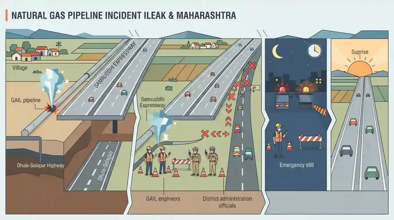
A gas pipeline leak occurred from a GAIL pipeline near Takliwadi in Gangapur taluka of Maharashtra's Chhatrapati Sambhajinagar district, adjacent to the Samruddhi Expressway. Prompt intervention by the district administration, led by District Collector Vinay Gowda and GAIL engineers, led to the temporary diversion of traffic via the Dhule-Solapur Highway. Precautionary measures were quickly implemented, and normal traffic on the expressway resumed early the next morning.
Key Points
- A major gas leak occurred on August 29, 2026, from a GAIL pipeline near Takliwadi in Gangapur taluka, Chhatrapati Sambhajinagar district, along a 24-km stretch of the Samruddhi Expressway.
- As a precautionary measure, the local administration diverted expressway traffic between the Hadas Pimpalgaon and Maliwada interchanges.
- Vehicles heading towards Nagpur were routed to exit at Maliwada, travel via the Dhule-Solapur highway (NH-52), and re-enter the expressway at Hadas Pimpalgaon.
- District Collector Vinay Gowda confirmed that the local administration, along with GAIL officials and fire-fighting teams, successfully managed the containment of the leak.
- Normal traffic operations along the affected stretch of the Samruddhi Highway were restored by 4:00 AM on August 30, 2026.
Important Terms
Hindu Hrudaysamrat Balasaheb Thackeray Maharashtra Samruddhi Mahamarg

A 701-km, 6-lane access-controlled expressway connecting Mumbai and Nagpur. It is Maharashtra's longest expressway, passing through 10 districts, developed to boost regional economic growth.
UPSC context
GS-1 Geography & GS-4 Economy: Tests major state infrastructure, connectivity corridors, and regional development projects.
GAIL (India) Limited
A Maharatna central public sector undertaking under the Ministry of Petroleum and Natural Gas, responsible for natural gas processing, transmission, and national gas pipeline grids.
UPSC context
GS-4 Economy: Tests energy infrastructure, public sector undertakings, and resource distribution networks in Maharashtra.
District Disaster Management Authority (DDMA)
A statutory body established under the Disaster Management Act, 2005, chaired by the District Collector, responsible for local-level disaster planning, coordination, and emergency response.
UPSC context
GS-3 Disaster Management: Tests district administrative roles, crisis coordination, and local emergency response mechanisms.
Maharashtra State Road Development Corporation (MSRDC)
A public corporation under the Government of Maharashtra established in 1996, mandated to construct, operate, and maintain road infrastructure, expressways, and bridges in the state.
UPSC context
GS-1 Geography & GS-4 Economy: Tests state-led infrastructure agencies, road networks, and regional development initiatives.
Prelims Trap
The Samruddhi Mahamarg directly passes through Vidarbha's major industrial hubs, including Akola and Chandrapur.
Samruddhi Mahamarg directly touches 10 districts but bypasses Akola and Chandrapur. Candidates often confuse feeder network districts with direct alignment districts.
Static Concepts Connected
Which districts does the Samruddhi Mahamarg directly pass through?
- Direct alignment: Passes through 10 districts: Nagpur, Wardha, Amravati, Washim, Buldhana, Jalna, Chhatrapati Sambhajinagar, Ahmednagar, Nashik, and Thane.
- Key specifications: A 701-km long, 6-lane access-controlled greenfield expressway designed to connect Nagpur and Mumbai.
- Feeder network: Bypasses Akola and Chandrapur directly, but integrates them via feeder highways, connecting 24 districts total.
What is the PM GatiShakti National Master Plan for infrastructure?
- Core objective: A digital platform coordinating 16 ministries for integrated planning and coordinated execution of infrastructure connectivity projects.
- Utility integration: Promotes laying gas pipelines and optical fibers along highway Right of Way (RoW) to prevent repeated road-cutting.
Cross-Topic Patterns
Expressway integration + GatiShakti model
Integrating GAIL's gas pipeline inside Samruddhi's RoW exemplifies PM GatiShakti, but links transport infrastructure directly to industrial hazards.
Disaster management + Highway protocols
Pipeline leaks near major expressways test coordination between local district administration (Collector), NHAI/MSRDC, and central PSUs like GAIL.

MPSC may ask a multi-statement question on Samruddhi Mahamarg’s district coverage, length, and its integration with PM GatiShakti.
Linked PYQs · 2
Linked PYQs · 2
- 2025MPSC_PRELIMSGS1
Which of the following is an example of a renewable energy resource ?
- 2026MPSC_PRELIMSGS1
Match the following forest circles with their share in percentage to total forest area of Maharashtra. | (Forest circles of Maharashtra) | (Percentage to total forest area Economic survey of Maharashtra (2024)) | |---|---| | (a) Gadchiroli | (1) 12.5 | | (b) Nagpur | (2) 20.8 | | (c) Dhule | (3) 9.5 | | (d) Thane | (4) 10.4 | Code: (a) (b) (c) (d)
