Mission Drishti: Private Space Sector and Earth Observation
Source:The Hindu ↗
Why It Matters
This development marks a watershed moment in India's space privatization push, directly relevant to the GS-3 syllabus on indigenization of technology and space awareness. The integration of EO and SAR technologies is a global first by an Indian startup, making it highly pertinent for questions on applications of remote sensing (agriculture, disaster management) and the role of private players in accelerating India's space economy.
Summary
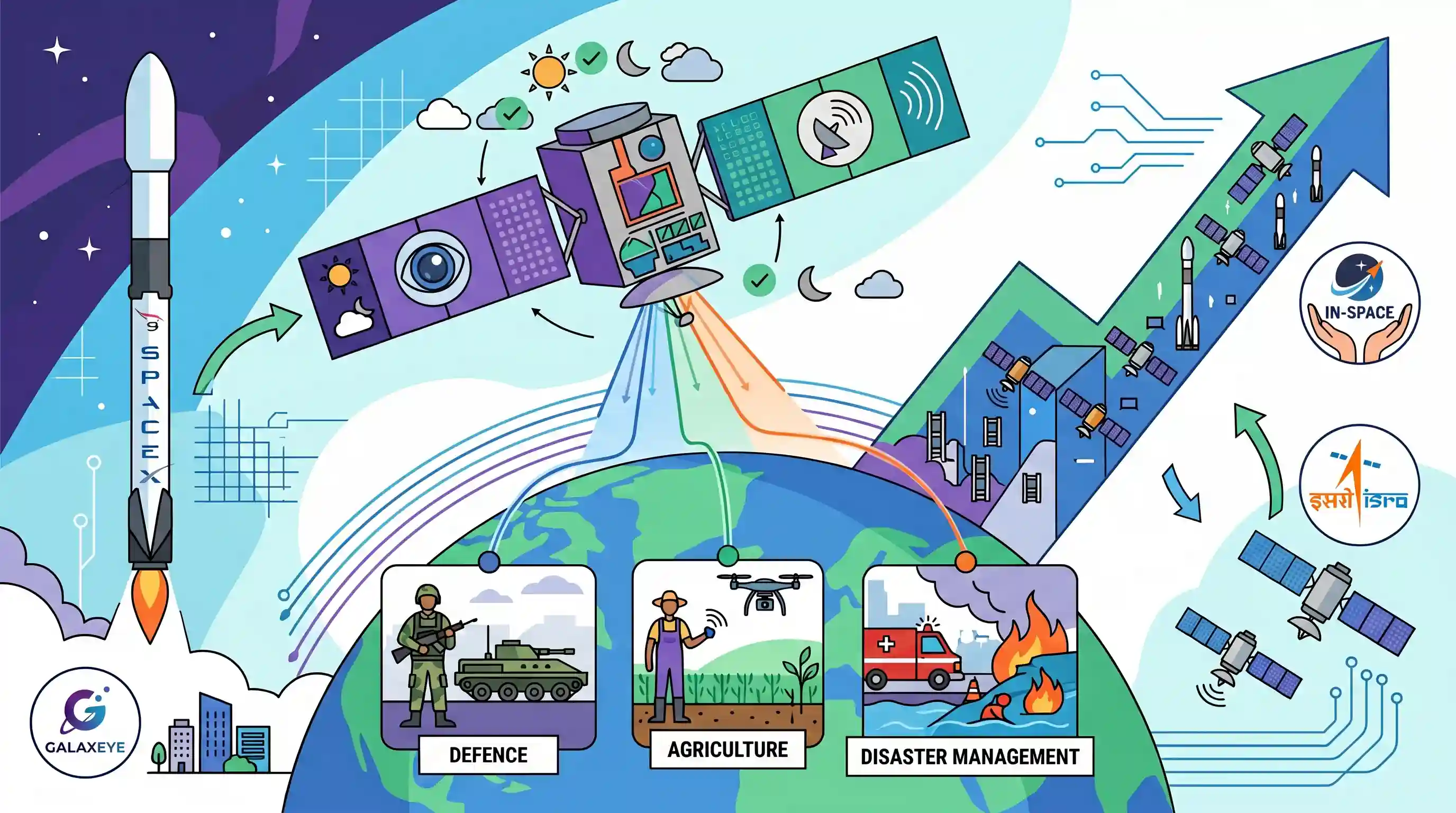
Bengaluru-based space startup GalaxEye successfully launched Mission Drishti, a 190 kg dual-use Earth observation satellite, aboard a SpaceX Falcon 9 rocket. Billed as India's largest privately developed Earth observation satellite, it is also the world's first to integrate both Electro-Optical (EO) and Synthetic Aperture Radar (SAR) sensors on a single platform, enabling all-weather, day-and-night imaging. The high-frequency data generated will serve critical sectors like defence, agriculture, and disaster management. The successful mission highlights the maturing of India's private space tech ecosystem under the aegis of IN-SPACe and will complement ISRO's existing fleet of Earth observation satellites.
Key Points
- GalaxEye successfully launched Mission Drishti, India's largest privately developed Earth observation satellite (190 kg), aboard a SpaceX Falcon 9 rocket.
- Mission Drishti is the world's first OptoSAR satellite, integrating Electro-Optical (EO) and Synthetic Aperture Radar (SAR) sensors into a single platform for all-weather, day-and-night imaging.
- The dual-use satellite supports multiple use cases, including defence, agriculture, disaster management, maritime monitoring, and infrastructure planning.
- The launch represents a significant milestone in the commercialization of India's private space technology ecosystem and is supported by confidence-building efforts from IN-SPACe.
- The satellite is expected to complement India's broader space initiatives, augmenting the active 29 Earth Observation satellites outlined in ISRO's recent annual report.
Important Terms
IN-SPACe

A single-window nodal agency under the Department of Space that regulates and facilitates private sector participation in India’s space industry, allowing access to ISRO’s infrastructure.
UPSC context
GS-III (Space Technology); critical for understanding India’s Space Policy 2023 and the privatization of the space sector.
Mission Drishti
India's largest privately developed Earth observation satellite mission (by GalaxEye), distinguished as the first globally to integrate both Electro-Optical (EO) and Synthetic Aperture Radar (SAR) sensors.
UPSC context
GS-III (Indigenization of Tech); tests knowledge of private sector milestones and advanced multi-sensor satellite capabilities.
Synthetic Aperture Radar (SAR)
An active remote sensing technology using microwave pulses to create high-resolution imagery. It provides all-weather, day-and-night observation as it can penetrate clouds, darkness, and smoke.
UPSC context
GS-III (Science & Tech); relevant for disaster management, defense surveillance, and environmental monitoring.
Earth Observation (EO)
The use of remote sensing satellites to monitor the Earth’s surface and atmosphere for applications such as agriculture, disaster management, and urban planning.
UPSC context
GS-III (Space Applications); key for resource management, climate change, and national security.
GalaxEye
An IIT-Madras incubated space-tech startup specializing in multi-sensor satellites; represents India's growing "NewSpace" ecosystem and the shift toward IP-led private space innovation.
UPSC context
GS-III (Economy/S&T); highlights the role of indigenous startups in achieving self-reliance (Atmanirbharta) in high-tech sectors.
Prelims Trap
"Launched by ISRO, Mission Drishti is India's first Earth Observation satellite."
Drishti is privately developed by GalaxEye and launched via SpaceX Falcon 9. ISRO already operates numerous EO satellites; this is merely the largest private Indian one.
Static Concepts Connected
How does Synthetic Aperture Radar (SAR) differ from Optical sensing?
- Energy source: SAR is an active sensor emitting its own microwave pulses, whereas optical sensors are passive and rely on reflected sunlight.
- Weather resilience: SAR microwaves easily penetrate clouds, fog, and smoke, offering all-weather capabilities, unlike optical sensors which are blocked by cloud cover.
- Operational timing: Because SAR provides its own illumination, it can seamlessly capture high-resolution imagery day and night.
What distinguishes IN-SPACe from NSIL in India's space architecture?
- IN-SPACe role: Acts as an autonomous nodal agency under the Department of Space to promote, authorize, and regulate private sector space activities.
- NSIL role: Serves as the commercial arm of ISRO, primarily responsible for transferring ISRO technologies to industry and commercializing launch services.
Cross-Topic Patterns
FDI in Space + Startup Ecosystem
The success of private entities like GalaxEye validates the 2024 policy amendment permitting up to 100% FDI in the space sector (up to 74% under the automatic route for satellite manufacturing).
OptoSAR + Disaster and Border Management
Combining EO and SAR tackles the 'Himalayan cloud cover' challenge, enabling uninterrupted tactical surveillance for border security and real-time mapping during monsoon floods or GLOFs.

Expect a 2026 prelims question contrasting SAR vs Optical remote sensing paired with India's new FDI space policy thresholds.
Linked PYQs · 4
Linked PYQs · 4
- 2016MainsGS3
Discuss India's achievements in the field of Space Science and Technology. How the application of this technology has helped India in its socio-economic development?
- 2019PrelimsGS1
For the measurement/estimation of which of the following are satellite images/remote sensing data used? 1. Chlorophyll content in the vegetation of a specific location 2. Greenhouse gas emissions from rice paddies of a specific location 3. Land surface temperatures of a specific location Select the correct answer using the code given below.
- 2015PrelimsGS1
In which of the following activities are Indian Remote Sensing (IRS) satellites used? 1. Assessment of crop productivity 2. Locating groundwater resources 3. Mineral exploration 4. Telecommunications 5. Traffic studies Select the correct answer using the code given below.
- 2024PrelimsGS1
Consider the following activities : 1. Identification of narcotics on passengers at airports or in aircraft 2. Monitoring of precipitation 3. Tracking the migration of animals In how many of the above activities can the radars be used?
