Gaganyaan Mission: ISRO Advances Towards Human Spaceflight
Source:The Hindu ↗
Why It Matters
This article provides crucial updates on India's most ambitious space endeavor, the Gaganyaan mission, highlighting domestic technological advancements in human spaceflight. It also underscores international cooperation in space through NISAR and tracks challenges in satellite deployment (NVS-02), all of which are highly relevant for the Science and Technology section of GS Paper 3.
Summary
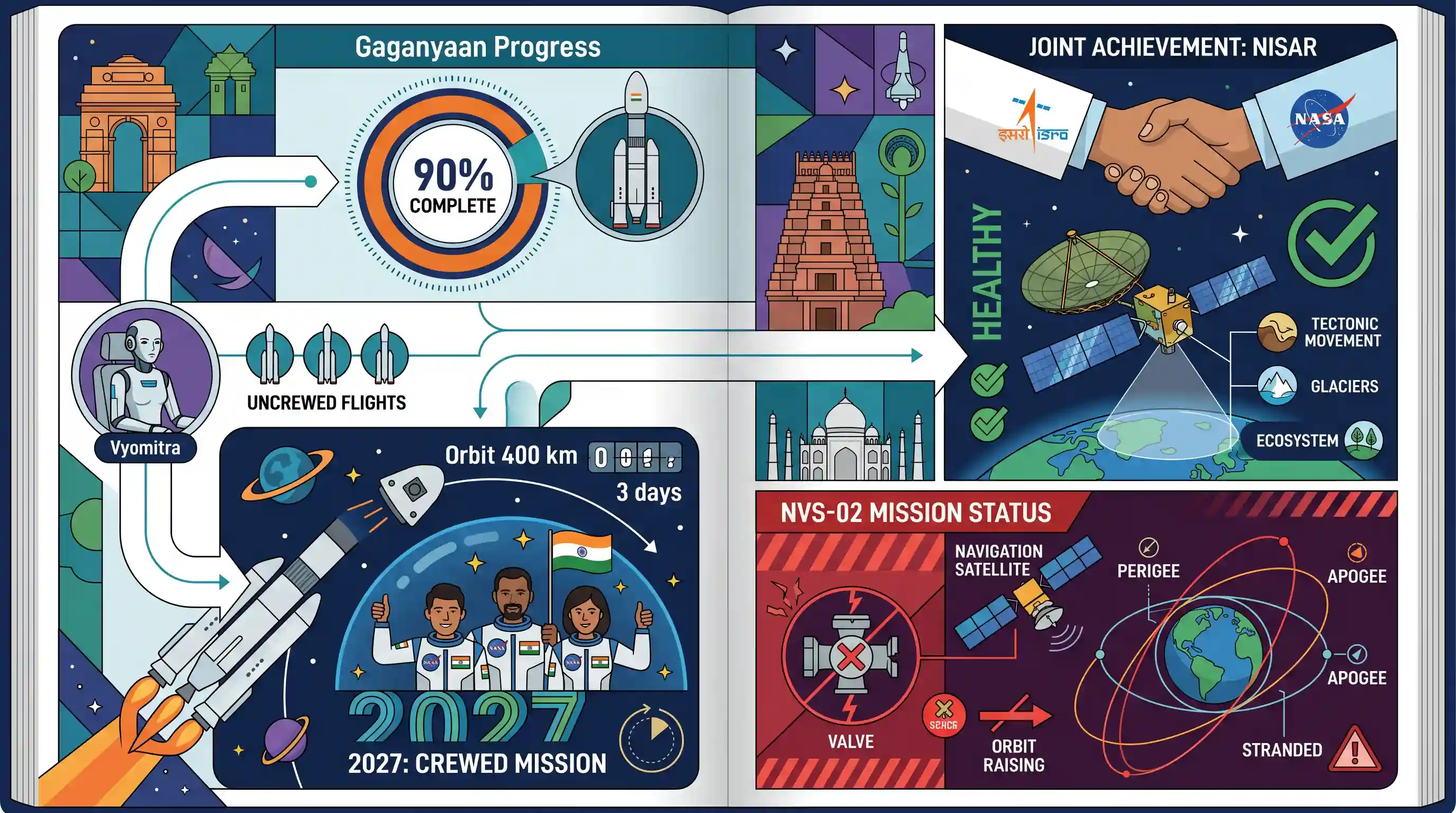
ISRO Chairman V. Narayanan has announced that 90% of the technological development for India's Gaganyaan human spaceflight mission is complete, with the final crewed launch scheduled for 2027. The project will see three uncrewed preparatory flights, starting with the humanoid Vyomitra later this year. The mission intends to safely launch three astronauts into a 400 km orbit for three days. Concurrently, ISRO confirmed that the NISAR Earth-observation satellite, a joint venture with NASA, is healthy and nearing operational status. However, the NVS-02 navigation satellite suffered a valve malfunction, leaving it stranded in an elliptical orbit.
Key Points
- ISRO has completed 90% of the development work for the Gaganyaan mission, focusing on human-rating the rocket, life support, and crew escape systems.
- The crewed Gaganyaan mission is targeted for 2027, which will follow three uncrewed test flights, the first of which will feature the humanoid Vyomitra.
- Gaganyaan aims to launch a three-member crew to a 400 km orbit for a three-day mission before a safe return to Indian sea waters.
- The NASA-ISRO Synthetic Aperture Radar (NISAR) satellite, launched in July 2025, is healthy and expected to be fully operational within weeks to provide dual-frequency Earth observation data.
- The NVS-02 navigation satellite experienced a valve malfunction preventing it from reaching a circular orbit; an investigative committee has identified the fault for government review.
Important Terms
Gaganyaan mission

India's premier human spaceflight mission aiming to send a three-member crew to a 400 km Low Earth Orbit (LEO) for three days and return them safely to Earth.
UPSC context
GS Paper 3: Science & Tech; tests knowledge of India's indigenous human spaceflight capabilities and strategic space milestones.
NISAR (NASA-ISRO Synthetic Aperture Radar)
A joint Earth-observation mission between NASA and ISRO using dual-frequency (L and S-band) Synthetic Aperture Radar to monitor global environmental changes and natural hazards.
UPSC context
GS Paper 3: S&T; highlights advanced remote sensing technology and international collaboration in space.
NVS-02 satellite
A second-generation navigation satellite for India's NavIC constellation; it recently faced an orbit-raising issue due to a valve malfunction in its liquid engine.
UPSC context
GS Paper 3: S&T; relevant for understanding India's regional navigation system (NavIC) and technical challenges in satellite deployment.
Vyomitra
A female-looking humanoid robot (half-humanoid) developed by ISRO to fly on uncrewed Gaganyaan missions to simulate human functions and test life-support systems.
UPSC context
GS Paper 3: S&T/Robotics; tests awareness of mission safety protocols and humanoid applications in space exploration.
Vikram Sarabhai Space Centre (VSSC)
ISRO's lead center in Thiruvananthapuram, Kerala, responsible for the design and development of launch vehicle technology, including the human-rated LVM3 for Gaganyaan.
UPSC context
GS Paper 3: S&T; tests knowledge of India's space infrastructure and the roles of key institutional centers.
Prelims Trap
"Gaganyaan is India's first mission to place a three-member crew in a Geosynchronous orbit (GEO)."
Gaganyaan targets a Low Earth Orbit (LEO) at roughly 400 km altitude, not a Geosynchronous Orbit (~35,786 km), which is primarily used for communication and navigation.
Static Concepts Connected
What distinguishes second-generation NavIC satellites (NVS series) from the earlier IRNSS constellation?
- Indigenous clocks: Employs locally developed Rubidium atomic clocks to overcome the high failure rate of the imported atomic clocks used in the first generation.
- L1 frequency integration: Introduces the civilian L1 band, widely used in standard GPS devices, significantly enhancing NavIC's compatibility with commercial smartphones and wearables.
What are the operational differences between Low Earth Orbit (LEO) and Geosynchronous Orbit (GEO)?
- Altitude range: LEO sits between 160-2000 km (Gaganyaan targets 400 km), whereas GEO operates exactly at 35,786 km above Earth's equator.
- Primary applications: LEO is preferred for Earth observation (like NISAR) and human spaceflight due to proximity; GEO is optimized for continuous telecommunications and regional navigation.
Cross-Topic Patterns
Space situational awareness & Gaganyaan
Placing astronauts in LEO necessitates strict space debris tracking. Expect linkages between Gaganyaan's crew module safety protocols and ISRO's Project NETRA (Network for space object Tracking and Analysis) in GS-3.
NISAR & Himalayan hazard mapping
NISAR’s dual-band SAR can penetrate forest cover to detect millimeter-scale crustal deformations, directly tying into GS-3 disaster management topics regarding earthquake and landslide vulnerability in the Himalayas.

Expect a 2026 multi-statement question merging Gaganyaan's 400km LEO, Vyomitra's role, and NavIC's civilian L1 band interoperability.
Linked PYQs · 3
Linked PYQs · 3
- 2017MainsGS3
India has achieved remarkable successes in unmanned space missions including the Chandrayaan and Mars Orbitter Mission, but has not ventured into manned space missions. What are the main obstacles to launching a manned space mission, both in terms of technology and logistics? Examine critically.
- 2025PrelimsGS1
Consider the following space missions : I. Axiom-4 II. SpaDeX III. Gaganyaan How many of the space missions given above encourage and support micro-gravity research?
- 2018PrelimsGS1
With reference to the Indian Regional Navigation Satellite System (IRNSS), consider the following statements: 1. IRNSS has three satellites in geostationary and four satellites in geosynchronous orbits. 2. IRNSS covers entire India and about 5500 sq. km beyond its borders. 3. India will have its own satellite navigation system with full global coverage by the middle of 2019. Which of the statements given above is/are correct?
