Eastern Himalayas monsoon landslides and North Bengal connectivity
Source:the-statesman ↗
Why It Matters
The geography of North Bengal, specifically the Teesta river valley and its surrounding plains (Terai and Dooars), is a high-yield topic for WBCS Prelims. Understanding the region's vulnerability to landslides during the monsoon is essential for both physical geography and disaster management sections.
Summary
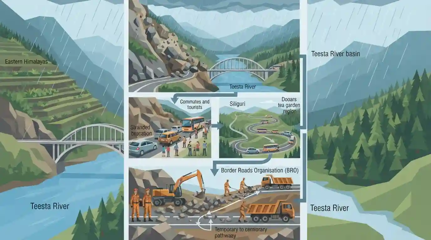
Incessant monsoon rainfall in North Bengal triggered a significant landslide on National Highway-10 near the Sevoke coronation bridge, disrupting direct vehicular connectivity between Siliguri and the Dooars region. The blockage severely affected local commuters and tourists, necessitating long traffic diversions. The Border Roads Organisation (BRO) was actively engaged in clearing the debris to restore communication. This recurring issue highlights the environmental fragility of the Eastern Himalayas and the Teesta river valley, which are highly susceptible to rain-induced landslides.
Key Points
- A fresh landslide near the Sevoke coronation bridge on National Highway-10 completely blocked the direct road link between Siliguri and the Dooars region in North Bengal.
- The landslide was triggered by continuous heavy monsoon rains, underscoring the vulnerability of the region's hilly terrain to natural disasters.
- The disruption caused significant hardship for commuters, tourists, and freight transport, forcing the administration to route traffic through alternative, longer diversions.
- The Border Roads Organisation (BRO) was deployed to clear the debris and restore the crucial connectivity along NH-10, which also serves as a vital lifeline to Sikkim.
Important Terms
Border Roads Organisation (BRO)

A statutory body under the Ministry of Defence that develops and maintains strategic road networks in India's border areas. It handles critical infrastructure, emergency debris clearance, and connectivity in challenging terrains like the Himalayas.
UPSC context
Relevant for GS Paper 3 (Security/Infrastructure). Tests knowledge of border management, strategic assets, and disaster response.
Dooars Region
The alluvial floodplains in North Bengal and Assam lying south of the outer Himalayan foothills. Meaning "doors," it serves as the gateway to Bhutan and is renowned for tea estates, dense forests, and wildlife.
UPSC context
Crucial for WBCS Paper 4 (Geography of West Bengal). Tests physical divisions, economy (tea industry), and biodiversity.
Sevoke Coronation Bridge
A historic arched bridge built in 1941 spanning the Teesta River in Darjeeling district. It is a critical transportation link in North Bengal, connecting Siliguri with Kalimpong, the Dooars, and neighboring northeastern states.
UPSC context
Important for WBCS Paper 4 (Geography/Transport). Tests knowledge of historical transport landmarks and river crossings in West Bengal.
National Highway 10 (NH-10)
A 174-km highway connecting Siliguri (West Bengal) to Gangtok (Sikkim). Running mostly parallel to the Teesta River, it is the primary economic and strategic lifeline linking landlocked Sikkim with the rest of India.
UPSC context
Important for WBCS Paper 4 (Transportation). Tests knowledge of regional infrastructure, border state lifelines, and Himalayan highway routes.
Teesta River
A major transboundary Himalayan river flowing through Sikkim and West Bengal before entering Bangladesh. Its steep valleys and rapid currents significantly influence the topography, ecology, and landslide vulnerability of the North Bengal region.
UPSC context
High priority for WBCS Paper 4 (Drainage Systems). Tests knowledge of river geography, transboundary water disputes, and natural hazards.
Eastern Himalayas
The eastern segment of the Himalayan range extending across Northeast India. Characterized by heavy monsoon rainfall and deep river valleys, its fragile environmental and geological conditions make it exceptionally vulnerable to rain-induced landslides.
UPSC context
Relevant for WBCS Paper 4 (Physical Geography) and Disaster Management. Tests mountain ecosystems, climate impacts, and hazard susceptibility.
Prelims Trap
"The region to the West of the Teesta river in North Bengal is known as the Dooars."
The Teesta river divides the plains. West of Teesta is Terai; East of Teesta is Dooars. Aspirants frequently reverse these two distinct physiographic zones.
Static Concepts Connected
What are the key geographical features of the Teesta River system?
- Origin: Arises from the Tso Lhamo Lake (Chho Lhamo) in North Sikkim at an elevation of roughly 5,280 meters.
- Physiographic Divider: Acts as the primary geomorphological boundary separating the Terai plains (west) and the Dooars plains (east) in North Bengal.
- Major Tributary: The Rangeet river, originating in Sikkim, is the most significant right-bank tributary of the Teesta.
Why is the Darjeeling-Sikkim Himalayan region highly prone to landslides?
- Geological fragility: The Eastern Himalayas feature steep gradients, deep gorges, and young, unconsolidated sedimentary rock formations that are inherently unstable.
- Climatic triggers: The region receives intense and continuous rainfall during the southwest monsoon, which saturates and destabilizes the topsoil.
- Anthropogenic stress: Deforestation and heavy infrastructure projects, such as widening highways (NH-10) along river valleys, exacerbate slope instability.
Cross-Topic Patterns
Infrastructure vs Himalayan Ecology
The recurring blockage of NH-10 bridges Physical Geography with Strategic Connectivity, as this vulnerable Teesta valley corridor is the sole logistical and military lifeline for landlocked Sikkim.
Teesta Geomorphology + Border Security
The geomorphology of the Teesta dictates both physical divisions (Terai/Dooars) and transport alignments (NH-10). Its maintenance by the BRO highlights civil-military integration in border regions.

Expect a multi-statement question testing the Teesta's origin, its East-West Terai/Dooars division, and its alignment with NH-10.
Linked PYQs · 2
Linked PYQs · 2
- 2022WBCS_PRELIMSGS1
The western part of Teesta river in West Bengal is called
- 2018WBCS_PRELIMSGS1
Geomorphologists opine that change of the course of the Kosi river resulted in
