APCRDA fast tracks four new roads to amaravati capital
Source:The Hindu ↗
Why It Matters
Infrastructure development in Andhra Pradesh, specifically regarding its designated capital region Amaravati, is a crucial topic for APPSC Group 1 Prelims. It highlights the state's urban planning priorities, economic infrastructure policies, and the role of bodies like APCRDA in regional development.
Summary
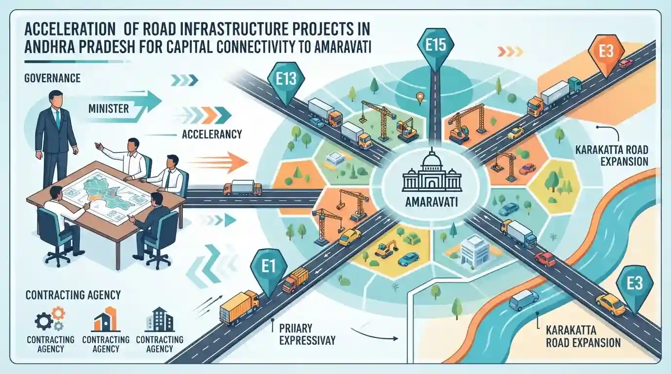
The Andhra Pradesh government is accelerating road infrastructure projects to improve connectivity to its capital region, Amaravati. Municipal Administration and Urban Development Minister P. Narayana, alongside APCRDA officials, announced the fast-tracking of four additional roads (E13, E15, E1, and E3) and the Karakatta road expansion. This move aims to create multiple access points into Amaravati and accommodate future traffic demands by leveraging major contracting agencies to complete the stalled infrastructure projects.
Key Points
- The Andhra Pradesh government has decided to lay four new roads (E13, E15, E1, and E3) to establish multiple entry points and boost connectivity to Amaravati.
- Municipal Administration and Urban Development Minister P. Narayana directed agencies like L&T, NCC, and MEIL to expedite infrastructure works, which had been paused previously.
- In addition to the new roads, ongoing works like the Karakatta road expansion (linking Prakasam Barrage to Rayapudi) are being sped up to handle increased traffic flow to the capital.
- The push for road infrastructure in the capital region forms a core component of the broader Amaravati Capital Region Development plan, executed by APCRDA.
Important Terms
Andhra Pradesh Capital Region Development Authority (APCRDA)

Statutory body formed in 2014, responsible for planning, executing, and regulating the development of Andhra Pradesh's capital region, including land pooling and infrastructure projects.
UPSC context
Crucial for APPSC Paper III (Economy and Development) and AP State Governance, focusing on urban planning and the capital city project.
Karakatta Road
An arterial road infrastructure project in Amaravati that runs alongside the Krishna riverbed, undergoing four-lane expansion to improve capital connectivity.
UPSC context
Relevant to APPSC Paper III (Infrastructure), testing knowledge of specific ongoing transport infrastructure developments in the new capital region.
Larsen & Toubro (L&T)
A major Indian multinational conglomerate involved in engineering, construction, and infrastructure projects, frequently engaged in Amaravati's capital development works.
UPSC context
Useful for APPSC Economy sections as an example of public-private partnerships and major corporate involvement in state infrastructure.
Megha Engineering & Infrastructure Ltd (MEIL)
A prominent Indian infrastructure company undertaking large-scale construction, irrigation, and road projects across Andhra Pradesh, including the Amaravati capital region.
UPSC context
Relevant for APPSC Economy and Infrastructure topics highlighting the execution of state mega-projects by major private contractors.
Prelims Trap
"Amaravati's land was acquired primarily through the Central Land Acquisition Act, 2013."
The AP government predominantly utilized a voluntary Land Pooling Scheme (LPS) under the APCRDA Act, 2014, rather than using traditional eminent domain under the 2013 Central Act.
Static Concepts Connected
What are the key features of the Amaravati Land Pooling Scheme (LPS)?
- Voluntary mechanism: Farmers voluntarily transfer land to the APCRDA in exchange for a designated proportion of fully developed residential and commercial plots.
- Annuity benefits: Landowners receive an annual financial payment (annuity) and agricultural tenant laborers receive monthly pensions for a stipulated 10-year period.
- Statutory basis: It operates under the specific statutory framework of the APCRDA Act, 2014, distinguishing it from conventional and mandatory land acquisition processes.
What is the geographical and historical significance of the Prakasam Barrage?
- River connectivity: It spans the Krishna River, forming a crucial transport and geographic link between the NTR (Vijayawada) and Guntur districts.
- Delta irrigation: Originally conceptualized by Sir Arthur Cotton, it serves as the primary headworks for the extensive Krishna Delta irrigation network.
Cross-Topic Patterns
Amaravati infra and flood plain ecology
The Karakatta road expansion along the Krishna embankment highlights the intersection of urban infrastructure and riverine ecology, a key theme in state disaster management and AP geography.
State reorganization and sole capital legislation
The infrastructural push aligns with the AP Reorganisation (Amendment) Act 2026, which legally cemented Amaravati as the sole capital, permanently overriding the three-capital decentralization debate.

Expect a multi-statement question combining Amaravati's Seed Access Road geography with APCRDA's statutory powers and the Land Pooling Scheme.
Linked PYQs · 1
Linked PYQs · 1
- 2024APPSC_PRELIMSGS1
In connection with transport and infrastructure in Andhra Pradesh, which of the following statement/statements is/are valid? I. Andhra Pradesh's first riverine project has been proposed between Muktayala and Madipadu on Krishna river. II. The Bhogapuram Greenfield International Airport had been started with a corpus fund that is sourced from National Investment and Infrastructure Fund (NIIF). III. Infrastructure investments in Andhra Pradesh are strictly implemented only with reference to strategic investments like ports and industrial corridors, but not with reference to community assets. IV. Rail Over Bridges (ROBs) are being developed in Andhra Pradesh under the Setu Bandhan Scheme. Select the correct answer using the codes given below :
