Bihar Structural Flood Mitigation and Basin Management Needs
Source:civilsdaily ↗
Why It Matters
Floods are an annual socio-economic catastrophe in Bihar, making an understanding of river dynamics, embankment limitations, and transboundary basin management critically important for state-level civil services examinations.
Summary
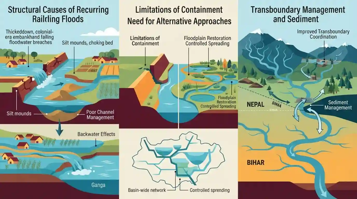
The article analyzes the deep-rooted structural causes of recurring floods in Bihar, which persist even during deficient monsoon seasons due to poor river channel management, siltation, backwater effects from the Ganga, and limitations of the colonial-era embankment containment model. It highlights the need for a basin-wide approach, floodplain restoration, improved transboundary coordination with Nepal, and sediment management provisions in water treaties.
Key Points
- Bihar experienced heavy flooding despite a 27% rainfall deficit during the monsoon season due to high upstream river flows, sediment accumulation, and backwater effects from the Ganga.
- Embankment-based containment separates rivers from floodplains, raising riverbeds through siltation and shrinking safety margins over time.
- Interstate and international coordination (especially with Nepal for Kosi and Gandak, and renegotiation of the Farakka/Ganga Water Sharing Treaty) is vital for regional flood and sediment management.
- Key structural and policy issues include internal waterlogging behind embankments, settlements inside embanked corridors, and lack of dedicated sediment management budgets.
Important Terms
Ganga Basin River Management Plan

A comprehensive framework formulated by a consortium of IITs under the National Mission for Clean Ganga to address river health, sediment dynamics, and sustainable basin-wide management across the Ganga river system.
UPSC context
BPSC Paper II (Geography & Environment) — evaluates holistic river basin planning for Bihar's recurring flood and siltation issues.
India-Bangladesh Ganga Water Sharing Treaty (1996)
A bilateral agreement signed in 1996 governing the sharing of dry-season Ganga waters at Farakka, frequently debated in Bihar for its impact on upstream flow and silt accumulation.
UPSC context
BPSC Paper II (International Relations & Polity) — tests the understanding of transboundary water treaties and their downstream ecological impacts on Bihar.
National Mission for Clean Ganga
The implementation wing of the National Ganga Council, established in 2011, responsible for pollution abatement, conservation, and river rejuvenation projects like Urban River Management Plans in Bihar.
UPSC context
BPSC Paper II (Governance & Environment) — questions focus on institutional frameworks for river conservation and urban river planning in the state.
National Ganga Council
The apex body headed by the Prime Minister of India, created under the River Ganga (Rejuvenation, Protection and Management) Authorities Order, providing overall policy direction for Ganga management.
UPSC context
BPSC Paper II (Polity & Governance) — examines top-level statutory authorities and central coordination mechanisms for inter-state river governance.
Prelims Trap
Heavy flooding in Bihar occurs only during years of excess monsoon rainfall.
Aspirants often believe that heavy monsoon rainfall is the sole cause of Bihar floods, overlooking that severe floods occur even during deficient monsoon seasons due to siltation and backwater effects.
Static Concepts Connected
What are the major structural and non-structural causes of recurring floods in North Bihar?
- Nepal Origin Rivers: Kosi, Gandak, and Bagmati bring massive silt loads from the fragile young Himalayas into the flat Gangetic plains, raising riverbeds.
- Embankment Failure: The colonial-era embankment model traps water behind them, causes siltation inside channels, and prevents natural drainage of floodplains.
- Ganga Backwater Effect: Siltation at Farakka Barrage slows the Ganga's flow, creating a backwater effect that chokes the outfall of Bihar's southern and northern tributaries.
- Basin Siltation: Lack of dedicated sediment management budgets exacerbates aggradation of riverbeds across the Kosi and Gandak basins.
Cross-Topic Patterns
Bihar Floods and India-Bangladesh Water Treaty
Bihar's floods connect interstate riparian water sharing with bilateral treaties like the 1996 Ganga Treaty expiring in 2026, linking domestic river management to foreign policy.
Embankment Model vs Ecological Governance
The rise in flood-prone area from 2.5 million hectares in 1954 to 7.3 million hectares illustrates the failure of hard-engineering paradigms in environmental governance.

Bihar flood management + Farakka barrage backwater effect + 1996 Ganga Treaty renewal likely to be a 2-statement Mains question.
Linked PYQs · 2
Linked PYQs · 2
- 2020BPSC_PRELIMSGS1
Which of the following rivers flowing in Bihar is a north flowing river?
- 2024-IBPSC_PRELIMSGS1
Which river is known as the ‘Sorrow of Bihar’?
