Swelling rivers displace lakhs as severe floods hit Bihar districts
Source:The Hindu ↗
Why It Matters
Provides critical context on annual monsoon flooding patterns, river systems, and disaster management preparedness in Bihar, directly aligning with BPSC syllabus requirements on state geography and administration.
Summary
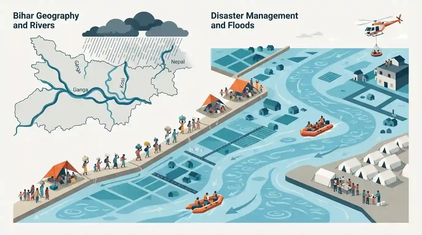
A severe flood situation has emerged across several districts in Bihar as continuous heavy rainfall and swelling rivers, notably the Ganga and Kosi, inundate vast areas, displacing lakhs of people and prompting intensive relief and rescue efforts by state and central disaster response agencies.
Key Points
- Heavy monsoon rains and swelling rivers have caused widespread flooding affecting lakhs of people across multiple districts in Bihar.
- Major rivers including the Ganga and Kosi are flowing above danger marks, leading to inundation of low-lying rural and urban settlements.
- State administration, along with NDRF and SDRF teams, has been deployed for rescue, relief operations, and distribution of essentials to affected populations.
- Flood management and disaster response remain critical governance and geographical challenges for Bihar during the monsoon season.
Important Terms
State Disaster Response Force (SDRF)

A specialized state-level agency in Bihar trained and equipped for rapid response, search, and rescue operations during natural calamities like recurring annual floods.
UPSC context
BPSC General Studies Paper II (Disaster Management, Bihar Geography): tests institutional frameworks for flood mitigation and emergency response in Bihar.
National Disaster Response Force (NDRF)
A specialized federal force established under the Disaster Management Act, 2005, deployed for specialized rescue and relief operations during major disasters and floods across Indian states.
UPSC context
BPSC General Studies Paper II (Disaster Management, Governance): tests center-state coordination and federal emergency response mechanisms during riverine floods.
Prelims Trap
All major flood-causing rivers in Bihar originate from the southern peninsular plateau.
Aspirants often assume all major flood-causing rivers in Bihar originate from the Chotanagpur plateau, whereas the most destructive ones (Kosi, Gandak, Bagmati) originate in the Himalayas/Nepal.
Static Concepts Connected
Why is the Kosi River known as the 'Sorrow of Bihar'?
- Course Shifting: Notorious for frequent and unpredictable changes in its course (avulsion) due to heavy silt load brought down from the Himalayas.
- Himalayan Origin: Originates in Tibet/Nepal, entering North Bihar and causing sudden, catastrophic floods affecting millions of lives and agricultural lands annually.
- Silt Deposition: Carries immense sediment deposition which raises the river bed over time, leading to embankment breaches during peak monsoon months.
Cross-Topic Patterns
Bihar Floods: Geography meets Disaster Governance
Severe monsoon flooding across districts links physical river morphology with rural socio-economic vulnerability, testing state administrative capacity and disaster response fund (SDRF) utilization in governance.
Transboundary Rivers and Indo-Nepal Water Diplomacy
The Kosi and Gandak systems originate in Nepal, tying state-level flood mitigation to bilateral water diplomacy, catchment area treatment, and basin-wide early-warning frameworks.

BPSC frequently combines Kosi river geomorphology, transboundary treaties, and disaster relief mechanisms into analytical 68th-70th Mains questions.
Linked PYQs · 2
Linked PYQs · 2
- 2020BPSC_PRELIMSGS1
Which of the following rivers flowing in Bihar is a north flowing river?
- 2024-IBPSC_PRELIMSGS1
Which river is known as the ‘Sorrow of Bihar’?
