Bihar Flood Alert and River Basin Water Level Management
Source:timesofindia ↗
Why It Matters
Floods are an annual and recurring disaster in Bihar. Understanding the state's drainage system, the origin and flow of its major rivers, and the vulnerability of specific regions is highly relevant for the BPSC Prelims Geography section.
Summary
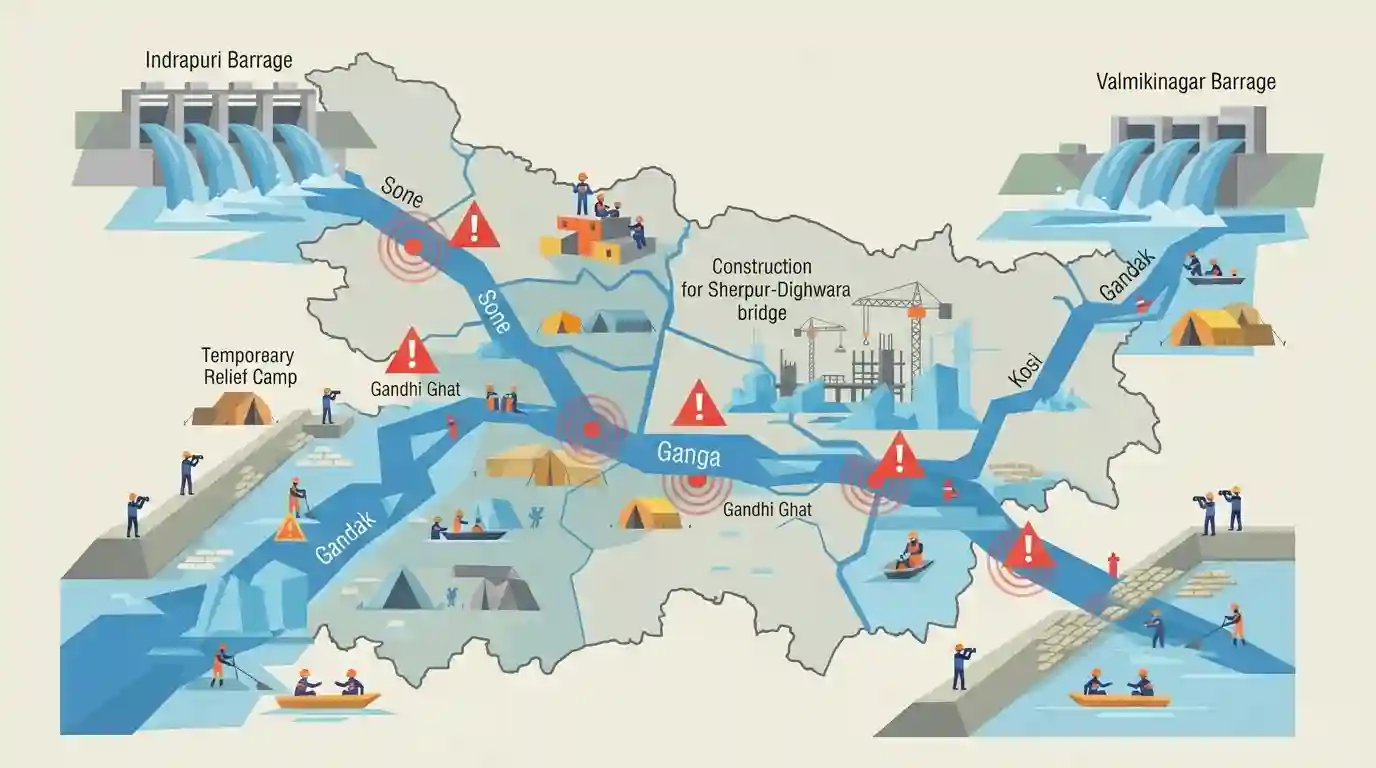
A flood alert has been issued across several low-lying and riverine areas in Bihar as major rivers, including the Ganga, Sone, Kosi, and Gandak, continue to swell. The Ganga is flowing above the danger mark at several locations like Gandhi Ghat and Hathidah. Increasing water discharge from barrages like Indrapuri (Sone river) and Valmikinagar (Gandak river) has exacerbated the situation. The rising waters have also disrupted infrastructure projects, notably the Sherpur-Dighwara bridge. State authorities and the Water Resources Department are on high alert, monitoring embankments and preparing for potential disaster management measures.
Key Points
- Multiple rivers in Bihar, including Ganga, Sone, Kosi, Gandak, Saryu, Bagmati, and Punpun, are in spate following heavy rainfall, posing a flood threat to low-lying areas.
- The rising water level of the Ganga has severely impacted the ongoing construction of the six-lane Sherpur-Dighwara bridge.
- Water discharge from the Indrapuri barrage into the Sone river and the Valmikinagar barrage into the Gandak river has significantly increased.
- The State Water Resources Department (WRD) has issued alerts for riverine areas and is continuously monitoring embankments to prevent breaches.
Important Terms
Bihar Water Resources Department (WRD)

Bihar government's nodal agency responsible for the construction, maintenance, and regulation of flood control structures, major/medium irrigation projects, and river barrages.
UPSC context
BPSC tests disaster management institutions and flood management policies under Bihar Geography and Disaster Management syllabus areas.
Indrapuri Barrage
A major barrage across the Son River in Rohtas district, central to the Sone Canal System. It provides crucial irrigation to south-western Bihar.
UPSC context
BPSC queries irrigation projects, river infrastructure, and geographical features of Bihar under General Studies Paper 1 & 2.
Valmikinagar Barrage
A key barrage on the Gandak River at the Indo-Nepal border in West Champaran, managing flood discharges and supplying irrigation to Bihar and UP.
UPSC context
BPSC extensively covers North Bihar's riverine geography, flood mitigation structures, and transboundary water management issues.
Sherpur-Dighwara Bridge
An under-construction 6-lane extradosed bridge over the Ganga linking Danapur to Saran. It acts as a vital segment of the proposed Patna Ring Road.
UPSC context
Bihar's infrastructure projects and regional connectivity (connecting North and South Bihar) are prominent topics in BPSC GS and Current Affairs.
Prelims Trap
"The Valmikinagar barrage manages floodwaters for the Kosi river."
Aspirants often mix up major barrage locations. Valmikinagar is on the Gandak river (West Champaran), while the Kosi river is managed by the Bhimnagar barrage.
Static Concepts Connected
Which major river barrages manage irrigation and flood control in Bihar?
- Valmikinagar (Gandak): Located in West Champaran, it regulates water from Nepal and feeds the Triveni, Tirhut, and Don canal systems.
- Indrapuri (Sone): Situated in Rohtas district, this barrage sustains the extensive Sone canal system, acting as the agricultural lifeline for South Bihar.
- Bhimnagar (Kosi): Located near the Nepal border in Supaul, it manages the volatile flow and massive sediment load of the 'Sorrow of Bihar'.
What are the primary geographical causes of recurrent floods in North Bihar?
- Topographic Gradient: The sudden topographical drop from the Nepal Himalayas to the flat Bihar plains abruptly slows river velocity, causing water to spill over.
- Heavy Siltation: Rivers originating in young fold mountains carry massive sediment loads, raising riverbeds over time and reducing water-carrying capacity.
- Channel Avulsion: Due to high silt deposition, rivers like the Kosi frequently abandon their channels and carve new paths, breaching established embankments.
Cross-Topic Patterns
River Morphology vs. Mega-Infrastructure
The disruption of the Sherpur-Dighwara bridge highlights the recurring tension between Bihar's aggressive push for mega-bridges (like the Patna Ring Road) and the volatile morphology of its rivers.
Trans-boundary Water Management
Flood severity in North Bihar is heavily dependent on rainfall catchments and barrage discharges from Nepal, making hydro-diplomacy an integral part of Bihar's disaster management strategy.

Expect a match-the-following question pairing Bihar's major barrages (Indrapuri, Valmikinagar) with their respective rivers or districts.
Linked PYQs · 4
Linked PYQs · 4
- 2020BPSC_PRELIMSGS1
Which of the following rivers flowing in Bihar is a north flowing river?
- 2023BPSC_PRELIMSGS1
The other name of river Gandak is
- 2024-IBPSC_PRELIMSGS1
Which river is known as the ‘Sorrow of Bihar’?
- 2024-EBPSC_PRELIMSGS1
Which of the following drainage systems drains the lands of Bihar?
