ISRO Study Highlights Satellite Blind Spots in Stubble Burning Data
Source:Indian Express ↗
Why It Matters
The article bridges Science & Technology (limitations of remote sensing and satellite orbits) with Environment (air pollution management), both core GS3 themes. It demonstrates how behavioral adaptation can bypass technological monitoring, illustrating the complex challenges of policy enforcement in India.
Summary
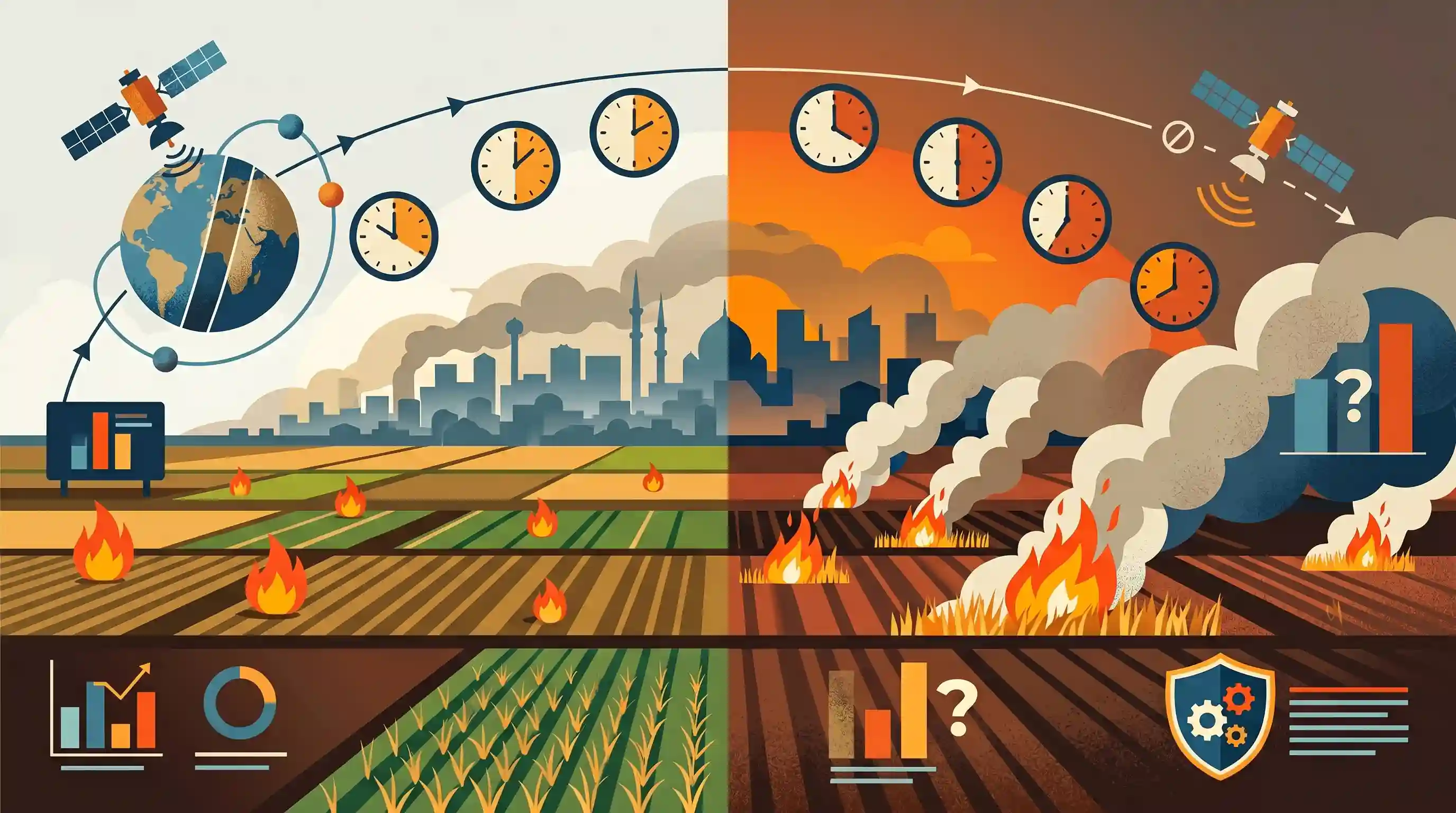
An ISRO study reveals that the reported decline in farm fires across northern India is likely an underestimation. Farmers have reportedly altered their stubble-burning schedules to late afternoon or evening hours to evade detection by monitoring satellites, which typically pass over the region during specific daytime windows. By exploiting these remote sensing blind spots, the true volume of crop residue being burned is masked. This data discrepancy highlights the limitations of current space technology in continuous environmental monitoring and undermines policy efforts to manage severe winter air pollution in the Delhi-NCR region.
Key Points
- An ISRO study suggests the recent official dip in farm fires is an undercount caused by farmers shifting the timing of stubble burning.
- Farmers are increasingly burning crop residue later in the day to exploit temporal blind spots between the scheduled overpass times of monitoring satellites.
- This behavioral shift compromises the accuracy of remote sensing data relied upon by regulatory bodies to track and penalize agricultural emissions.
- The underestimation complicates air quality management and policy enforcement in the Delhi-NCR region, where winter pollution is heavily influenced by farm fires.
Important Terms
ISRO (Indian Space Research Organisation)

India's primary space agency, responsible for satellite-based environmental monitoring, including the 'CREAMS' platform for tracking farm fires and crop residue burning via its Space Applications Centre (SAC).
UPSC context
GS Paper III: Science & Tech; crucial for monitoring environmental degradation and agricultural patterns.
Stubble Burning (Parali Burning)
The practice of setting fire to straw stubble (crop residue) after harvesting grain, primarily paddy, to quickly clear fields for the next sowing cycle, notably in Punjab and Haryana.
UPSC context
GS Paper III: Environmental Pollution; a major seasonal contributor to severe air pollution in Delhi-NCR.
Polar-orbiting Satellites (LEO)
Satellites that circle Earth from pole to pole at low altitudes (~600-800 km). They provide high-resolution data but only during specific daytime 'overpass' windows, creating monitoring gaps.
UPSC context
GS Paper III: Space Technology; tests understanding of satellite orbits and their limitations in continuous monitoring.
Geostationary Satellites
Satellites that remain fixed over one spot on Earth at high altitudes (~36,000 km). They provide continuous, high-frequency (e.g., every 15 mins) observation, essential for tracking shifting 'diurnal' fire patterns.
UPSC context
GS Paper III: Space Technology; relevant for real-time disaster and environmental surveillance.
Commission for Air Quality Management (CAQM)
A statutory body established to coordinate and oversee air quality management in the National Capital Region (NCR) and adjoining areas, including monitoring stubble-burning enforcement.
UPSC context
GS Paper II: Governance/Statutory Bodies; central to administrative efforts in pollution control.
Remote Sensing
The process of detecting and monitoring physical characteristics of an area by measuring reflected and emitted radiation from a distance, typically via satellite sensors like MODIS or VIIRS.
UPSC context
GS Paper III: E-technology in the aid of farmers; tests technological applications in agriculture and ecology.
Space Applications Centre (SAC)
A key ISRO facility in Ahmedabad focused on developing space-borne instruments and applications; it authored the study revealing the temporal shift in farm fire activity.
UPSC context
GS Paper III: Science & Tech; significant for identifying India’s specialized research institutions.
Prelims Trap
Geostationary Earth observation satellites suffer from temporal blind spots, causing the systemic undercounting of farm fires.
False. Sun-synchronous/polar-orbiting satellites (like Terra/Aqua) pass at fixed local times, creating blind spots. Geostationary satellites orbit higher and provide continuous, high-frequency observation.
Static Concepts Connected
What distinguishes Sun-Synchronous from Geostationary orbits for Earth observation?
- Sun-Synchronous (Polar): Passes over the Earth's surface at the same local solar time daily, creating specific observation windows (and blind spots).
- Geostationary: Orbits at ~35,786 km matching Earth's rotation, enabling continuous, real-time temporal monitoring over a fixed geographic area.
Why is stubble burning a structural issue in the Indo-Gangetic plains?
- Narrow Cropping Window: A narrow 15-20 day window between Kharif paddy harvesting and Rabi wheat sowing forces farmers to clear residue rapidly.
- Temperature Inversion: Winter cooling creates an inversion layer, trapping cold air and massive quantities of PM, CO, and CH4 near the surface.
Cross-Topic Patterns
Space Tech + Regulatory Enforcement
Evasion of satellite tracking by altering farm fire timings exposes the limitations of relying solely on remote sensing for environmental compliance without addressing ground-level socio-economic realities.
Crop Economics + Green Farm Tech
Farmers actively evade satellite tracking instead of using mechanical alternatives like Happy Seeders, underscoring the prohibitive upfront costs and viability gaps in current green agricultural tech subsidies.

Expect a 2026 Prelims question mapping satellite orbit types (Sun-synchronous vs. Geostationary) to their Earth observation limitations.
Linked PYQs · 3
Linked PYQs · 3
- 2019PrelimsGS1
Consider the following: 1. Carbon monoxide 2. Methane 3. Ozone 4. Sulphur dioxide Which of the above are released into atmosphere due to the burning of crop/biomass residue?
- 2019PrelimsGS1
For the measurement/estimation of which of the following are satellite images/remote sensing data used? 1. Chlorophyll content in the vegetation of a specific location 2. Greenhouse gas emissions from rice paddies of a specific location 3. Land surface temperatures of a specific location Select the correct answer using the code given below.
- 2015PrelimsGS1
In which of the following activities are Indian Remote Sensing (IRS) satellites used? 1. Assessment of crop productivity 2. Locating groundwater resources 3. Mineral exploration 4. Telecommunications 5. Traffic studies Select the correct answer using the code given below.
