India Heatwave 2026 Causes and Data Driven Heat Mitigation Strategies
Source:Indian Express ↗
Why It Matters
Heatwaves are becoming longer, more frequent, and more intense in India. Understanding the interplay of macro factors like El Niño with micro factors like the Urban Heat Island effect is crucial for UPSC aspirants. It also highlights the growing importance of data, geospatial technologies, and localized early warning systems in effective disaster management and climate adaptation strategies.
Summary
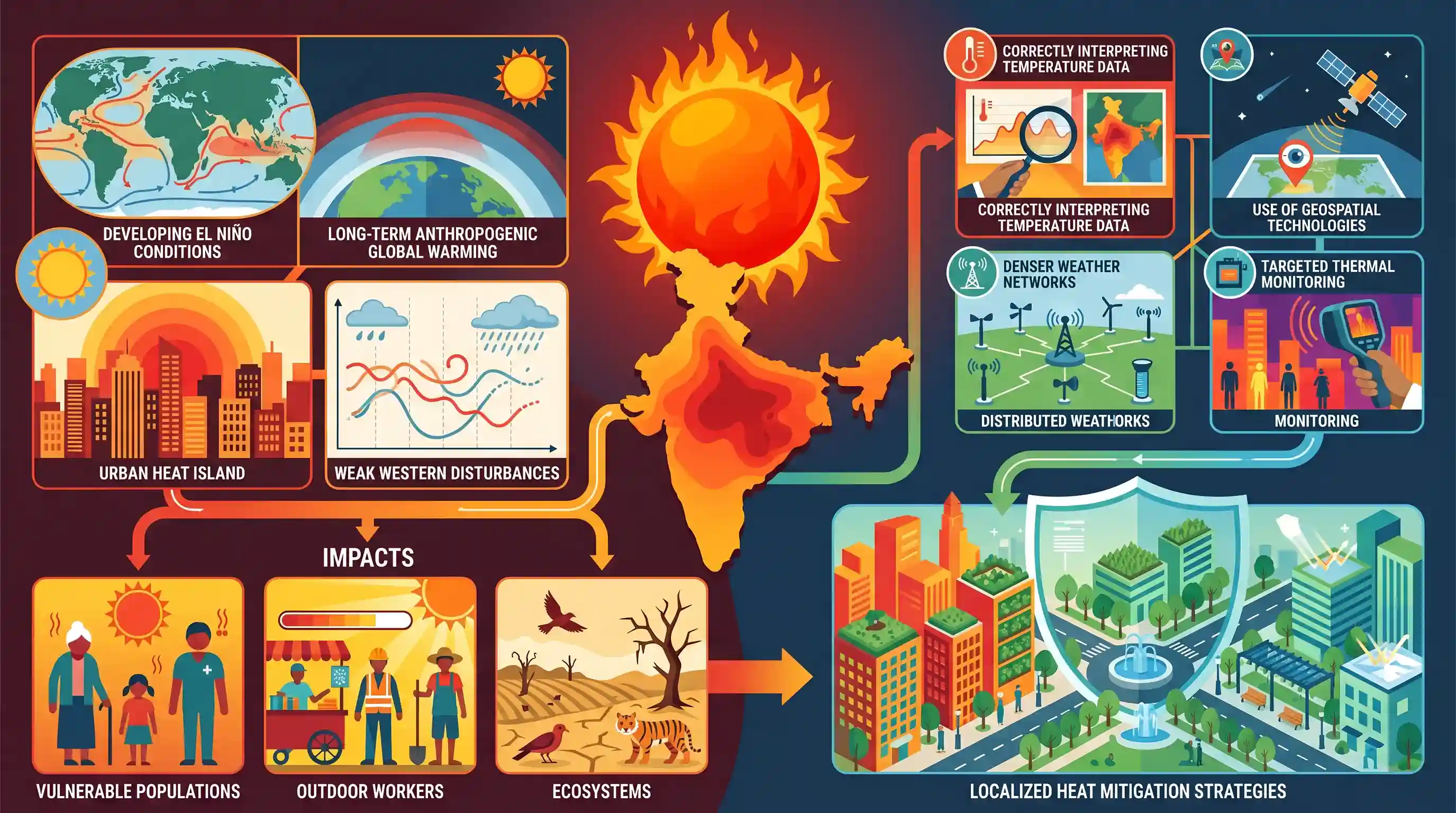
The 2026 summer heatwave across India is exceptionally severe due to a combination of regular pre-monsoon heating, developing El Niño conditions, and long-term anthropogenic global warming. Local factors, such as the Urban Heat Island effect and weak western disturbances, further intensify the heat, severely impacting vulnerable populations, outdoor workers, and ecosystems. The article underscores the importance of interpreting temperature data correctly and advocates for the use of geospatial technologies, denser weather networks, and targeted thermal monitoring to formulate localized and data-driven heat mitigation strategies.
Key Points
- The intense 2026 pre-monsoon heatwave in northwest and central India is a mix of regular seasonal heating amplified by global and local climate factors.
- Temperature maps reflect either air or land surface temperatures, generated using ground stations, remote sensing (MODIS, Landsat), or numerical weather models (ECMWF, GFS).
- Global drivers include developing El Niño conditions (which suppress moisture and negatively impact the southwest monsoon) and anthropogenic global warming raising baseline temperatures.
- Local amplifiers include weak western disturbances, prolonged dry spells, forest fires, and the Urban Heat Island (UHI) effect due to dense infrastructure.
- Vulnerable populations—such as outdoor workers, the elderly, and informal settlement residents—face immense socio-economic and health risks from prolonged heat exposure.
- Effective heat mitigation requires location-specific strategies powered by geospatial technologies, denser weather station networks, and high-resolution thermal remote sensing.
Important Terms
India Meteorological Department (IMD)

India's principal agency under the Ministry of Earth Sciences for meteorological observations, weather forecasting, and seismology. It is responsible for issuing official heatwave warnings and monitoring monsoon patterns.
UPSC context
GS I (Geography) and GS III (Disaster Management); tests institutional frameworks for climate monitoring and warning systems.
El Niño
A climate phenomenon involving warming sea surface temperatures in the central and eastern Pacific. It disrupts the Walker Circulation, typically leading to weak Indian monsoons and intensified pre-monsoon heatwaves.
UPSC context
GS I (Physical Geography); critical for understanding global climatic cycles and their socio-economic impact on Indian agriculture.
Urban Heat Island (UHI) Effect
A micro-climatic phenomenon where urban areas are significantly warmer than surrounding rural regions. It is caused by heat-absorbing concrete, lack of vegetation, and waste heat from vehicles and industries.
UPSC context
GS I (Urbanization) and GS III (Environment); focuses on the health impacts of unplanned urban growth.
Western Disturbances
Extratropical storms originating in the Mediterranean region that bring winter rainfall to Northwest India. Their absence or weakening can cause early temperature spikes and prolonged summer heatwaves.
UPSC context
GS I (Physical Geography); essential for explaining seasonal weather variability and its impact on Rabi crops.
Takshashila Institution
An independent, non-partisan Indian think tank and school of public policy. It conducts research on strategic affairs, economics, and governance to bridge policy-making gaps through data-driven analysis.
UPSC context
GS II (Governance/Public Policy); highlights the role of civil society and think tanks in national policy discourse.
Geospatial Technology
Technology used to collect and analyze location-based data, including GIS, Remote Sensing, and GPS. It is used to map high-risk thermal zones and optimize localized heat-mitigation strategies.
UPSC context
GS III (Science & Tech and Disaster Management); tests applications of space technology in environmental hazard mitigation.
Prelims Trap
"Earth observation satellites directly measure ambient air temperatures to generate heatwave maps."
Satellites measure Land Surface Temperature (LST) via thermal sensors, not air temperature. Air temperature is measured by ground stations ~1.5m above ground. Equating the two leads to incorrect assumptions.
Static Concepts Connected
What are the IMD's official criteria for declaring a heatwave in India?
- Plains threshold: The maximum temperature of a station must reach at least 40°C.
- Hills and coasts: The threshold maximum temperature is 30°C for hilly regions and 37°C for coastal stations.
- Departure from normal: A heatwave requires a temperature departure of 4.5°C to 6.4°C above normal. A severe heatwave is declared when the departure is >6.4°C.
What drives the Urban Heat Island (UHI) effect during summer heatwaves?
- Material heat absorption: Concrete, asphalt, and dense buildings absorb daytime solar radiation and slowly release it, preventing essential nighttime atmospheric cooling.
- Reduced evapotranspiration: Loss of vegetation and green cover in urban areas severely curtails the natural cooling effect provided by moisture evaporation.
- Anthropogenic heat: Waste heat generated by vehicular emissions, industrial processes, and air conditioning units further warms the localized urban microclimate.
Cross-Topic Patterns
Space Tech + Disaster Management
Thermal remote sensing tools like MODIS are increasingly central to NDMA Heat Action Plans (HAPs), mapping vulnerable urban zones for targeted mitigation and early warnings.
Climate Change + Informal Economy
Prolonged heatwaves directly impact outdoor labor productivity, making climate resilience an urgent economic imperative for India's largely informal workforce and agricultural sector.

IMD heatwave criteria combined with UHI mechanisms and satellite LST measurement (MODIS) is a highly probable 2026 Prelims question.
Linked PYQs · 3
Linked PYQs · 3
- 2013MainsGS1
Bring out the causes for the formation of heat islands in the urban habitat of the world.
- 2014MainsGS1
Most of the unusual climatic happenings are explained as an outcome of the El-Nino effect. Do you agree?
- 2017MainsGS3
'Climate change' is a global problem. How India will be affected by climate change? How Himalayan and coastal states of India will be affected by climate change?
