High Altitude Lakes in Uttarakhand Expand Due to Warming
Source:science-iirs ↗
Why It Matters
Directly impacts Uttarakhand's ecological security, vulnerability to climate change, and disaster management preparedness regarding GLOFs.
Summary
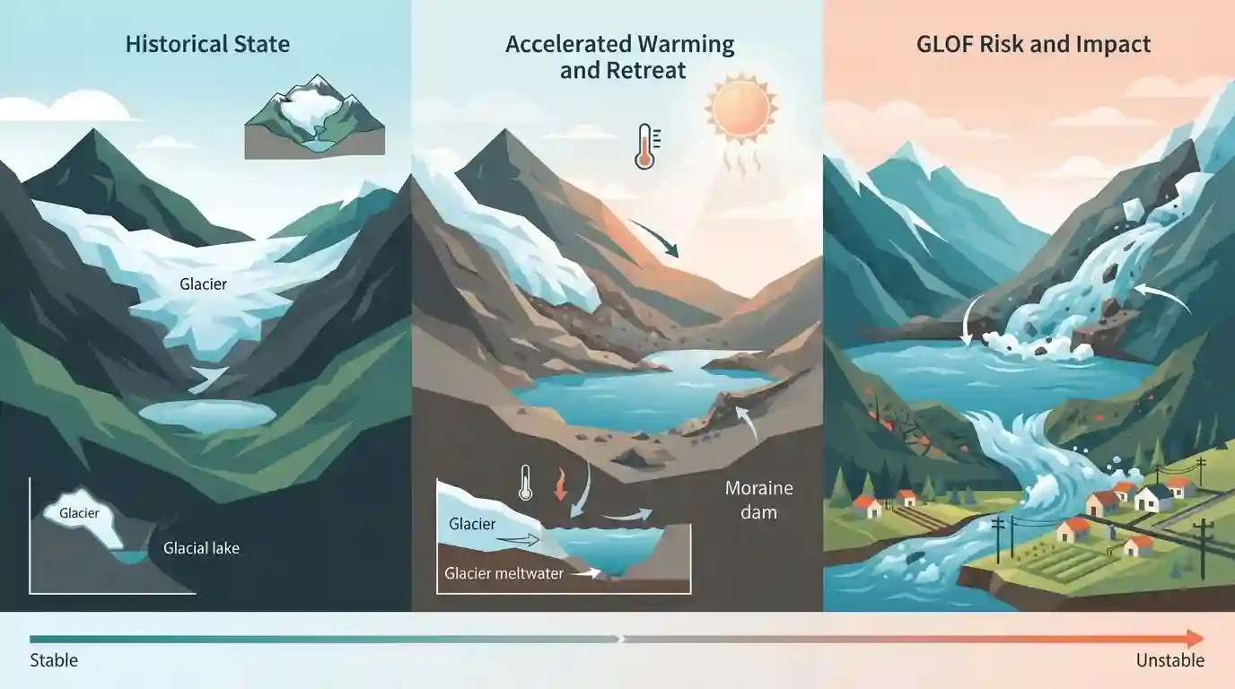
Scientific studies, including those by the Indian Institute of Remote Sensing (IIRS), reveal that high-altitude lakes in the Uttarakhand Himalaya are rapidly growing due to accelerated warming and glacier retreat, raising significant environmental and disaster-management concerns regarding Glacial Lake Outburst Floods (GLOFs) in the fragile mountain ecosystem.
Key Points
- High-altitude lakes in the Uttarakhand Himalayas are showing significant expansion due to enhanced regional warming and glacier retreat.
- Research by institutions like IIRS (Indian Institute of Remote Sensing) highlights climate change indicators such as melting ice masses and expanding glacial lakes.
- Such expansions pose serious threats regarding Glacial Lake Outburst Floods (GLOFs), which can jeopardize downstream infrastructure and human settlements in Uttarakhand.
Important Terms
Elevation Dependent Warming (EDW)

A phenomenon where high-mountain regions warm at a faster rate than lower elevations, driven by snow-albedo feedback, amplifying glacier melt and lake expansion across the Uttarakhand Himalaya.
UPSC context
UKPSC Paper-3 (Environment & Ecology): Tests understanding of regional climate change drivers, mountain ecosystems, and Himalayan cryosphere dynamics.
Indian Institute of Remote Sensing (IIRS)
A premier national remote sensing and geoinformatics training and research institution based in Dehradun, under ISRO, which conducts critical scientific studies on Himalayan glacial dynamics and lake mapping.
UPSC context
UKPSC Prelims/Mains (Science & Tech / Uttarakhand Geography): Tests institutional awareness of key state-based research bodies analyzing environmental hazards.
Glacial Lake Outburst Floods (GLOFs)
Sudden floods caused by the breach of natural dams retaining glacial lakes, posing severe life and property risks in downstream Himalayan river valleys.
UPSC context
UKPSC Paper-5 (Disaster Management): Evaluates knowledge of geological hazards, early warning systems, and vulnerability mitigation strategies in Uttarakhand.
Prelims Trap
High-altitude lakes in the Uttarakhand Himalaya are expanding and inherently stable natural freshwater resources.
Aspirants often assume all high-altitude lakes in Uttarakhand are stable natural reservoirs, overlooking the fact that moraine-dammed lakes are prone to catastrophic GLOFs due to rapid volume expansion.
Static Concepts Connected
What are the key mechanisms and institutional frameworks addressing Glacial Lake Outburst Floods (GLOFs) in India?
- GLOF Mechanism:: Triggered by moraine wall failure due to avalanches, earthquakes, or rapid melting of ice masses.
- Mitigation Framework:: NGRMP implemented by NDMA in coordination with state agencies and research institutions like IIRS Dehradun.
- Early Warning:: Installation of Automated Weather Stations (AWS), siren networks, and real-time monitoring at vulnerable lakes like Vasundhara Tal.
Cross-Topic Patterns
Himalayan Cryosphere & State Disaster Preparedness
Rapid cryospheric changes in Uttarakhand link physical geography with state disaster management frameworks and National Mission on Sustaining the Himalayan Ecosystem (NMSHE) targets.
Remote Sensing & Climate Vulnerability Mapping
Mapping high-altitude lakes via IIRS demonstrates how space technology applications directly aid ground-level climate adaptation and early warning system deployment.

UKPSC frequently tests factual data on glacial lakes alongside institutional bodies like Dehradun-based IIRS and NDMA guidelines. High priority.
Linked PYQs · 3
Linked PYQs · 3
- 2025UKPSC_PRELIMSGS1
Consider the following statements and select the correct answer from the options given below : Statement 1 : Uttarakhand is highly vulnerable to climate change. Statement 2 : Climate change is causing water stress and depleting biodiversity in Uttarakhand.
- 2024UKPSC_PRELIMSGS1
'Untadhura Pass' is situated near which one of the following glaciers of Uttarakhand ?
- 2012UKPSC_PRELIMSGS1
The longest glacier in Uttarakhand is
