Magnitude 57 Earthquake in Bangladesh and Urban Disaster Risks
Source:The Hindu ↗
Why It Matters
The earthquake is a potent reminder of the high seismic risk faced by the Indian subcontinent. For UPSC aspirants, it connects the physical geography of plate tectonics with the practical realities of urban disaster management and structural vulnerability in densely populated South Asian cities.
Summary
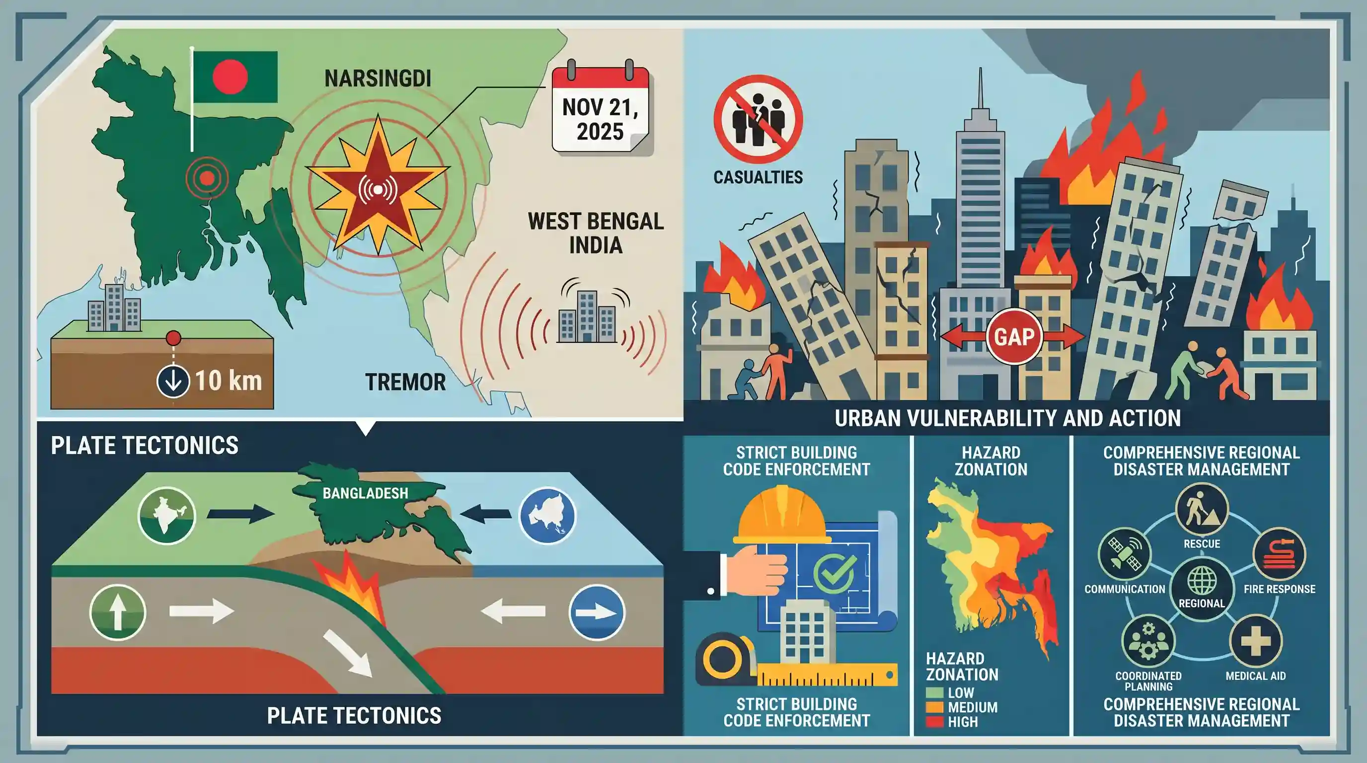
On November 21, 2025, a magnitude 5.7 earthquake struck Bangladesh, causing structural damage, fires, and casualties in Dhaka and surrounding areas. Tremors were also felt in West Bengal, India. The epicentre was located 10 km deep in Narsingdi. Geologically, Bangladesh is situated on active tectonic plate boundaries, making it highly vulnerable to major seismic events. This earthquake exposes significant gaps in urban infrastructure resilience and underscores the critical need for strict enforcement of building safety codes, hazard zonation, and comprehensive regional disaster management to mitigate future catastrophic impacts.
Key Points
- A magnitude 5.7 earthquake struck Bangladesh on November 21, 2025, with an epicentre in Narsingdi near Dhaka at a shallow depth of 10 km.
- The tremors were strongly felt in neighboring regions, including Kolkata and other parts of West Bengal.
- The earthquake caused structural collapses, fires, and casualties in densely populated urban centers, highlighting extreme urban vulnerability.
- Bangladesh and the broader Indian subcontinent sit on active tectonic plate boundaries, putting them at high risk for catastrophic major earthquakes.
- The event serves as a warning call for enforcing building safety codes and comprehensive disaster preparedness in the region.
Prelims Trap
"Deep-focus earthquakes cause significantly more surface destruction than shallow-focus earthquakes."
Shallow-focus earthquakes (<70km deep) are actually more destructive at the surface because seismic waves travel shorter distances, dissipating much less energy.
Static Concepts Connected
Why is the Bangladesh-Northeast India region highly seismically active?
- Triple Plate Junction: It sits at a complex geological triple junction involving the convergence of the Indian, Eurasian, and Burmese tectonic plates.
- Active Thrust Faults: The region features highly active tectonic structures, including the Indo-Burman subduction zone and the Dauki thrust fault.
- Alluvial Amplification: The thick, soft sediments of the Ganga-Brahmaputra delta amplify seismic waves and drastically increase the risk of soil liquefaction during tremors.
What is a 'Seismic Gap' in plate tectonics?
- Definition: It is a segment of an active geological fault that has not experienced a major earthquake in a long time compared to neighboring segments.
- High Strain Accumulation: Tectonic strain continuously accumulates in these unruptured zones, significantly increasing the probability of a catastrophic, high-magnitude earthquake in the future.
Cross-Topic Patterns
Seismic Microzonation in Mega-cities
Connects tectonic hazards to GS3 Disaster Management. Unplanned urbanization on soft deltaic soils (like Dhaka or Kolkata) necessitates seismic microzonation to enforce hyper-local, soil-specific building codes.
Neotectonics and River Avulsion
Earthquakes in the Bengal basin historically cause massive river avulsions (e.g., the 1762 quake shifting the Brahmaputra). This links GS1 geomorphology directly to drainage system evolution.

Expect a 2026 prelims question linking the Indo-Burmese plate boundary dynamics with the highly destructive nature of shallow earthquakes.
Linked PYQs · 5
Linked PYQs · 5
- 2021MainsGS3
Discuss about the vulnerability of India to earthquake related hazards. Give examples including the salient features of major disasters caused by earthquakes in different parts of India during the last three decades.
- 2013MainsGS3
How important are vulnerability and risk assessment for pre-disaster management ? As an administrator, what are key areas that you would focus on in a Disaster Management System.
- 2019MainsGS3
Vulnerability is an essential element for defining disaster impacts and its threat to people. How and in what ways can vulnerability to disasters be characterized? Discuss different types of vulnerability with reference to disasters.
- 2025MainsGS1
Discuss how the changes in shape and sizes of continents and ocean basins of the planet take place due to tectonic movements of the crustal masses.
- 2019MainsGS3
Disaster preparedness is the first step in any disaster management process. Explain how hazard zonation mapping will help disaster mitigation in the case of landslides.
