Monsoon Landslides and Highway Disruptions in Dehradun Region
Source:timesofindia ↗
Why It Matters
The event underscores the high vulnerability of Himalayan towns and critical infrastructure to monsoon-induced disasters. It highlights the urgent need for robust disaster management and climate-resilient urban planning in fragile topographies like structural valleys (Duns) and hill stations.
Summary
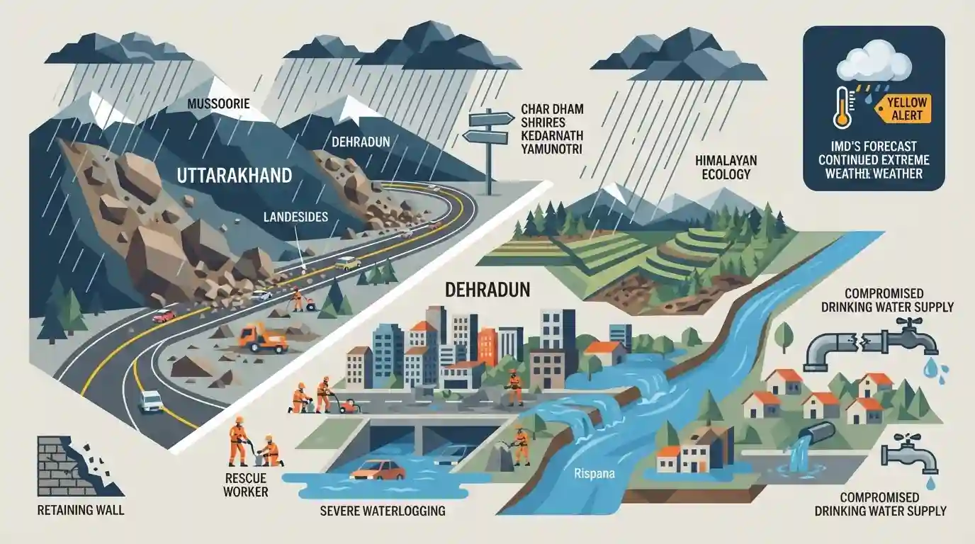
Severe heavy rainfall battered Dehradun and Mussoorie, triggering multiple landslides that blocked crucial highways and disrupted daily life. Debris accumulation halted traffic on major routes, including the national highways leading to the Char Dham shrines of Badrinath, Kedarnath, and Yamunotri. Urban areas like Dehradun experienced severe waterlogging, damage to retaining walls, and a dangerous rise in the Rispana river's water level. Additionally, drinking water supply was heavily compromised due to damaged pipelines. The IMD has maintained a yellow alert for further extreme weather in the region.
Key Points
- Heavy rainfall in Dehradun and Mussoorie triggered landslides, causing widespread disruption to traffic and water supply.
- Key pilgrimage routes, including the Badrinath, Kedarnath, and Yamunotri national highways, were blocked due to landslide debris.
- In Dehradun, the Rispana river swelled, waterlogging streets and damaging retaining walls, severely impacting urban mobility.
- The IMD issued a yellow alert, forecasting continued heavy rainfall, thunderstorms, and lightning across Uttarakhand.
- Essential services were hit, with Jal Sansthan lines damaged, affecting drinking water supply to numerous households.
Important Terms
Char Dham Yatra

A sacred Hindu pilgrimage to four high-altitude shrines—Yamunotri, Gangotri, Kedarnath, and Badrinath—situated in Uttarakhand's Garhwal region, traditionally undertaken clockwise from April/May to October/November.
UPSC context
GS Paper I (Art/Culture) and GS Paper III (Himalayan Ecology/Disaster Management).
State Disaster Response Force (SDRF)
A specialized state-level force trained to conduct search, rescue, and immediate relief operations during natural or man-made disasters, serving as the first organized line of defense.
UPSC context
GS Paper III (Disaster Management); tests state-level crisis response frameworks under the DM Act, 2005.
India Meteorological Department (IMD)
India's principal government agency established in 1875 under the Ministry of Earth Sciences, responsible for meteorological observations, weather forecasting, seismology, and issuing early warning alerts.
UPSC context
GS Paper I (Geography/Climatology) and GS Paper III (Disaster Management); tests early warning systems.
Uttarakhand Jal Sansthan
A state government utility established in 2002 under the Pey Jal Vibhag, responsible for managing water supply, maintaining water pipelines, and handling sewerage systems across Uttarakhand.
UPSC context
GS Paper II (Governance) and GS Paper III (Water Resource Management); tests public utility delivery.
Prelims Trap
A Yellow Alert issued by the IMD signifies extreme danger and mandates immediate evacuation.
A 'Yellow' alert simply means "Be aware/updated". It is the 'Red' alert that mandates "Take action" (like evacuations), and 'Orange' which means "Be prepared".
Static Concepts Connected
What factors make the Himalayan region highly vulnerable to landslides?
- Tectonic activity: The Himalayas are a geologically young fold mountain system with active tectonic faults, making the region seismically unstable.
- Steep gradients: High relief, steep slopes, and fragile, highly fractured rock formations easily give way during heavy precipitation.
- Anthropogenic stress: Deforestation, unscientific road cutting, and heavy dam construction alter natural slope stability and exacerbate landslide risks.
What is the river drainage geography associated with the Char Dham shrines?
- Kedarnath (Mandakini): Kedarnath is situated in the Mandakini River valley.
- Badrinath (Alaknanda): Badrinath is situated along the banks of the Alaknanda River.
- Rudraprayag confluence: The Mandakini and Alaknanda rivers flow southward and merge at Rudraprayag, continuing as the Alaknanda.
Cross-Topic Patterns
Infrastructure vs. Himalayan Ecology
Highway blockages highlight the ongoing conflict between heavy infrastructure initiatives (like the Char Dham Mahamarg Vikas Pariyojana) and the fragile, tectonically active slope stability of the Himalayas.
Urban flooding in hill terrains
The swelling of the Rispana river demonstrates that urban flooding extends beyond metropolitan plains; poor drainage, encroachment, and intense rainfall increasingly paralyze structural 'Dun' valleys.

Expect a multi-statement question mapping Himalayan rivers (Mandakini/Alaknanda) to their shrines alongside IMD color-code meanings.
Linked PYQs · 3
Linked PYQs · 3
- 2025UKPSC_PRELIMSGS1
Which of the following is the correct order of rivers from west to east in Uttarakhand?
- 2012UKPSC_PRELIMSGS1
Which are called 'Duns' in Uttarakhand?
- 2024UKPSC_PRELIMSGS1
Which drainage pattern is commonly found in Ganga plains and Assam Valley, characterized by wide plains, gentle slopes, heavy rains and large number of tributaries ?
